MyTopo
Walnut Springs West Texas US Topo Map
Couldn't load pickup availability
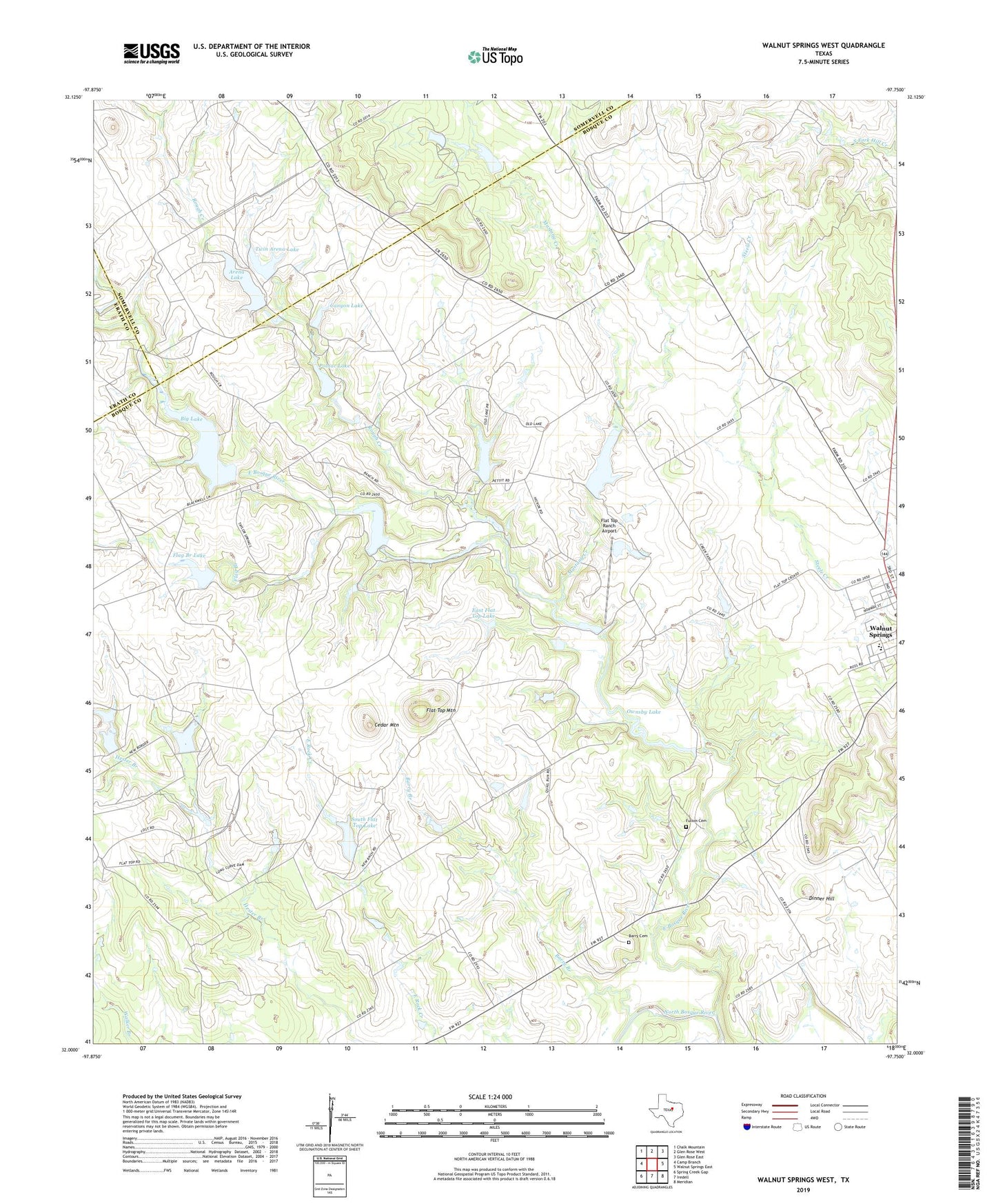
2022 topographic map quadrangle Walnut Springs West in the state of Texas. Scale: 1:24000. Based on the newly updated USGS 7.5' US Topo map series, this map is in the following counties: Bosque, Somervell, Erath. The map contains contour data, water features, and other items you are used to seeing on USGS maps, but also has updated roads and other features. This is the next generation of topographic maps. Printed on high-quality waterproof paper with UV fade-resistant inks.
Quads adjacent to this one:
West: Camp Branch
Northwest: Chalk Mountain
North: Glen Rose West
Northeast: Glen Rose East
East: Walnut Springs East
Southeast: Meridian
South: Iredell
Southwest: Spring Creek Gap
This map covers the same area as the classic USGS quad with code o32097a7.
Contains the following named places: Arena Lake, Arena Lake Dam, Barry Branch, Barry Cemetery, Beecherl Dam, Beecherl Lake, Big Lake, Big Lake Dam, Canyon Lake, Canyon Lake Dam, Cedar Mountain, City of Walnut Springs, Dinner Hill, Drechsel Lake, Drechsel Lake Dam, East Bosque River, East Flat Top Lake, Flag Branch, Flag Branch Dam, Flag Branch Lake, Flat Top Mountain, Flat Top Ranch, Flat Top Ranch Airport, Fulton Cemetery, Irrigation Dam, Irrigation Lake, Mustang Creek, Mustang Lake, Mustang Lake Dam, Old Lake, Old Lake Dam, Ownsby Lake, Polnac Dam, Polnac Lake, Rough Creek, South Flat Top Dam, South Flat Top Lake, Twin Arena Lake, Twin Arena Lake Dam