MyTopo
Camp Creek Lake Texas US Topo Map
Couldn't load pickup availability
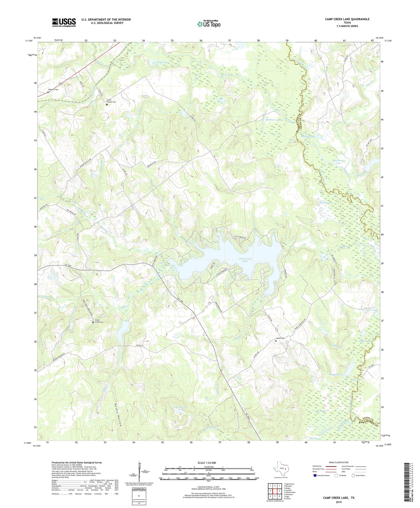
2019 topographic map quadrangle Camp Creek Lake in the state of Texas. Scale: 1:24000. Based on the newly updated USGS 7.5' US Topo map series, this map is in the following counties: Robertson, Leon. The map contains contour data, water features, and other items you are used to seeing on USGS maps, but also has updated roads and other features. This is the next generation of topographic maps. Printed on high-quality waterproof paper with UV fade-resistant inks.
Quads adjacent to this one:
West: Franklin
Northwest: Bald Prairie
North: Marquez
Northeast: Margie
East: Hilltop Lakes
Southeast: Canary
South: Edge
Southwest: Wheelock
Contains the following named places: Big Marsh, Black Bay, Blue Lake, Boggy Branch, Brushy Lake, Busby Hollow, Camp Creek Cemetery, Camp Creek Lake, Camp Creek Lake Dam, Clear Creek, Cobb Branch, Davis Lake, Deep Branch, Devils Jump Creek, Devils Lake, Duck Creek, Easterly Cemetery, Elbow Pond, Elm Grove Church, Flag Branch, Goathouse Branch, Hoxie Chapel Cemetery, Hudson Branch, James Cemetery, Kury Lake, Little Elbow Pond, Malochomy Lake, Mill Creek, Miller Branch, Mitchell Lake, Morton Branch, Ned Branch, Pepper Branch, Reiss Creek, Sandy Branch, Sulphur Lake, W D Kury Dam, Wilburn Lake, Wyach Lake