MyTopo
Franklin Texas US Topo Map
Couldn't load pickup availability
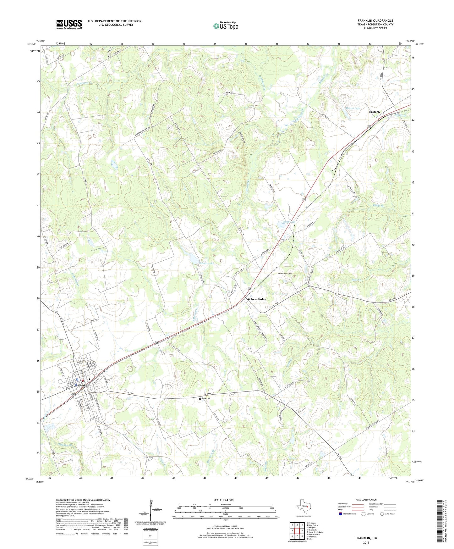
2022 topographic map quadrangle Franklin in the state of Texas. Scale: 1:24000. Based on the newly updated USGS 7.5' US Topo map series, this map is in the following counties: Robertson. The map contains contour data, water features, and other items you are used to seeing on USGS maps, but also has updated roads and other features. This is the next generation of topographic maps. Printed on high-quality waterproof paper with UV fade-resistant inks.
Quads adjacent to this one:
West: Owensville
Northwest: Petteway
North: Bald Prairie
Northeast: Marquez
East: Camp Creek Lake
Southeast: Edge
South: Wheelock
Southwest: Hearne North
This map covers the same area as the classic USGS quad with code o31096a4.
Contains the following named places: Casey Lake, Casey Lake Dam, City of Franklin, Easterly, Franklin, Franklin City Hall, Franklin Division, Franklin Police Department, Franklin Post Office, Franklin Volunteer Fire Department, Hale Cemetery, Martin Lake, Martin Lake Dam, Mount Pleasant Church, New Baden, New Baden Cemetery, New Baden Post Office, North Mineral Creek, Reynolds Elementary School, Robertson County Constable's Office Precinct 1, Robertson County Emergency Medical Services, Robertson County Jail, Robertson County Sheriff's Office, Schultz Lake, Schultz Lake Dam, South Mineral Creek, ZIP Code: 77856