MyTopo
Chandler Texas US Topo Map
Couldn't load pickup availability
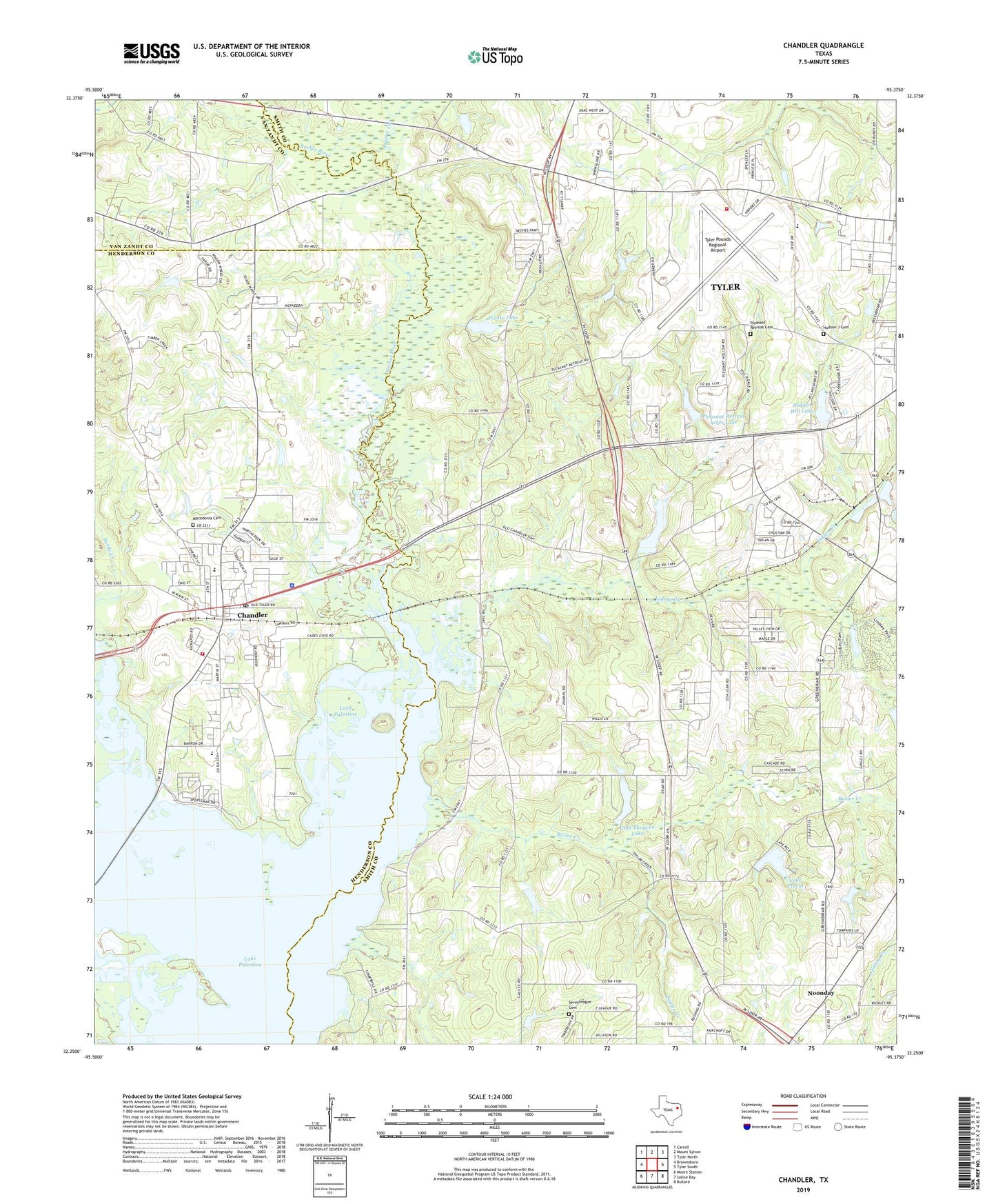
2019 topographic map quadrangle Chandler in the state of Texas. Scale: 1:24000. Based on the newly updated USGS 7.5' US Topo map series, this map is in the following counties: Smith, Henderson, Van Zandt. The map contains contour data, water features, and other items you are used to seeing on USGS maps, but also has updated roads and other features. This is the next generation of topographic maps. Printed on high-quality waterproof paper with UV fade-resistant inks.
Quads adjacent to this one:
West: Brownsboro
Northwest: Carroll
North: Mount Sylvan
Northeast: Tyler North
East: Tyler South
Southeast: Bullard
South: Saline Bay
Southwest: Moore Station
Contains the following named places: Butler Creek, Chandler, Chandler City Hall, Chandler Elementary School, Chandler Memorial Cemetery, Chandler Police Department, Chandler Post Office, Chandler Volunteer Fire Department, Church of Christ, City of Chandler, Club Thirteen Dam, Club Thirteen Lake, Concord Church, County-Line Church, Dean Church, Dixie Church, Dixie School, Faith Baptist Church, Faith Church, Galilee, Greenbriar Lake Dam, Henderson County Constable's Office Precinct 3, Hidden Hill Dam, Hidden Hill Lake, Hill Lake, Holiness Church, Hudson J Cemetery, Indian Creek, Kickapoo Creek, Lake Placid, Lake Placid Dam, Lost Pine Lake, Lost Pine Lake Dam, Macedonia Cemetery, Martin Spring Branch, Noonday Assembly of God Church, Noonday Baptist Church, Peveto Dam, Peveto Lake, Pleasant Retreat Acres Dam, Pleasant Retreat Acres Lake, Pleasant Retreat Cemetery, Pleasant Retreat United Methodist Church, Prairie Creek, Sevenleague Cemetery, Smith County Constable - Precinct 2, Spring Hill Church, Taylor Creek, Tyler Army Air Field, Tyler Fire Department Station 3, Tyler Pounds Regional Airport, Tyler Sports Complex, ZIP Code: 75709