MyTopo
Moore Station Texas US Topo Map
Couldn't load pickup availability
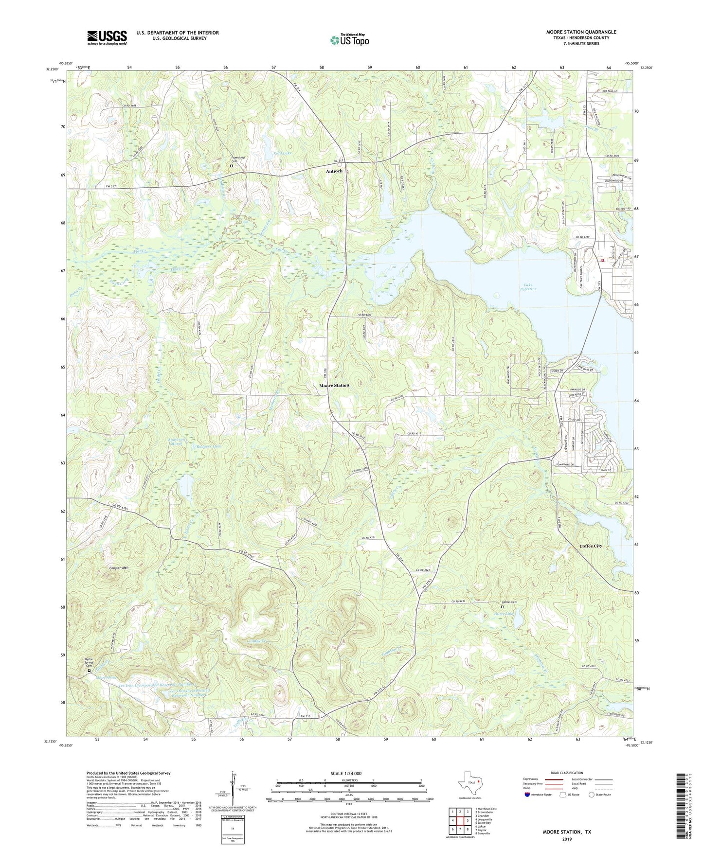
2022 topographic map quadrangle Moore Station in the state of Texas. Scale: 1:24000. Based on the newly updated USGS 7.5' US Topo map series, this map is in the following counties: Henderson. The map contains contour data, water features, and other items you are used to seeing on USGS maps, but also has updated roads and other features. This is the next generation of topographic maps. Printed on high-quality waterproof paper with UV fade-resistant inks.
Quads adjacent to this one:
West: Leagueville
Northwest: Murchison East
North: Brownsboro
Northeast: Chandler
East: Saline Bay
Southeast: Berryville
South: Poynor
Southwest: LaRue
This map covers the same area as the classic USGS quad with code o32095b5.
Contains the following named places: Anderson Marsh, Antioch, Bagley Lake, Bagley Lake Dam, Bethel Cemetery, Bethel Church, Boggy Creek, Central Community Center, Central High School, City of Moore Station, Cooper Mountain, Dunn Creek, Fincastle, Friendship Branch, Friendship Cemetery, Frontier City Lake, Frontier City Lake Dam, Gum Branch, Highsaw Creek, Hurts Lake, Kidd Lake, Kidd Lake Dam, LaRue-Poynor Division, Lone Star Church, Lonestar Baptist Church, Moore Spring, Moore Station, Moore Station City Hall, Mulberry Branch, Myrtle Springs Cemetery, Panther Creek, Putegnat School, Rodgers Lake, Rodgers Lake Dam, Sunrise Shores, Sunrise Shores Census Designated Place, Tex Iron Incorporated Dam Number 1, Tex Iron Incorporated Dam Number 2, Tex Iron Incorporated Reservoir Number 1, Tex Iron Incorporated Reservoir Number 2, Tindel Creek, Tonyard Creek, Union Station African Methodist Episcopal Church, Westside Volunteer Fire Department