MyTopo
Mount Sylvan Texas US Topo Map
Couldn't load pickup availability
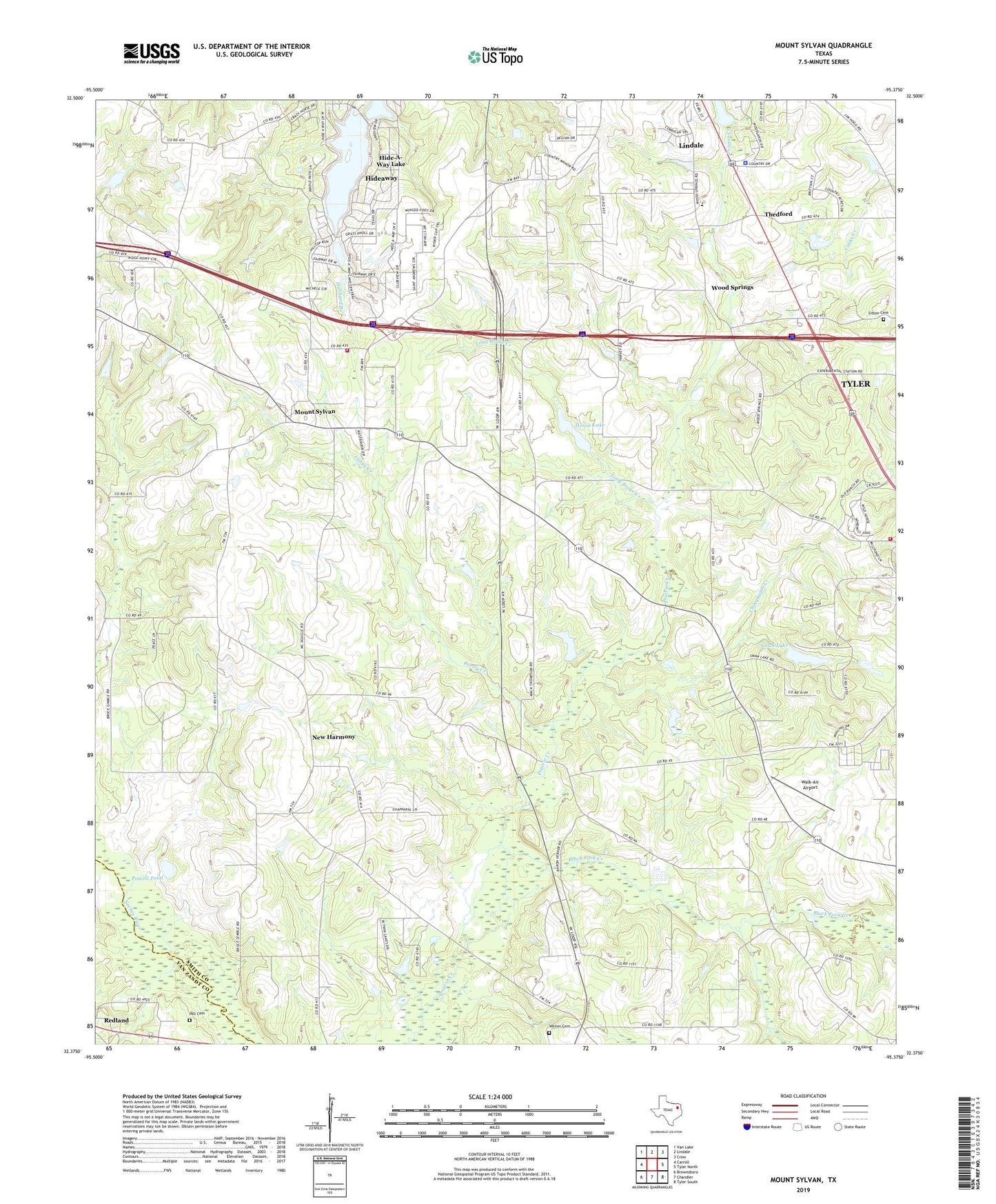
2022 topographic map quadrangle Mount Sylvan in the state of Texas. Scale: 1:24000. Based on the newly updated USGS 7.5' US Topo map series, this map is in the following counties: Smith, Van Zandt. The map contains contour data, water features, and other items you are used to seeing on USGS maps, but also has updated roads and other features. This is the next generation of topographic maps. Printed on high-quality waterproof paper with UV fade-resistant inks.
Quads adjacent to this one:
West: Carroll
Northwest: Van Lake
North: Lindale
Northeast: Crow
East: Tyler North
Southeast: Tyler South
South: Chandler
Southwest: Brownsboro
This map covers the same area as the classic USGS quad with code o32095d4.
Contains the following named places: Acres Homes Branch Library, Aldine Branch Library, Baldwin Boettcher Branch Library, Bellaire City Library, Black Fork Creek, Caney Creek, Chinquapin Creek, City of Hideaway, City of Lindale, Clayton Library, Collier Regional Library, Dixie School, Fairview Church, Hide A Way Lake Community Church, Hideaway, Hide-A-Way Lake, Hide-A-Way Lake Airport, Hide-A-Way Lake Number 1 Dam, Hide-A-Way Lake Number One, Hill Cemetery, House Lake, House Lake Dam, Jones Lake, Jones Lake Dam, KTMJ-FM (Tyler), Lindale City Hall, Lindale Fire Department Station 2, Lindale Fire Department Station 3, Lindale Police Department, Long Brake Creek, Mount Olive Church, Mount Sylvan, New Harmony, Powell Lake Dam, Powell Pond, Redland, Saint Lukes Church, Sitton Cemetery, Smith County Constable's Office Precinct 5, Spring Creek, Swan Lake, Swan Lake Dam, Thedford, Verner Cemetery, Walk-Air Airport, Wood Springs, ZIP Code: 75704