MyTopo
Christmas Point Texas US Topo Map
Couldn't load pickup availability
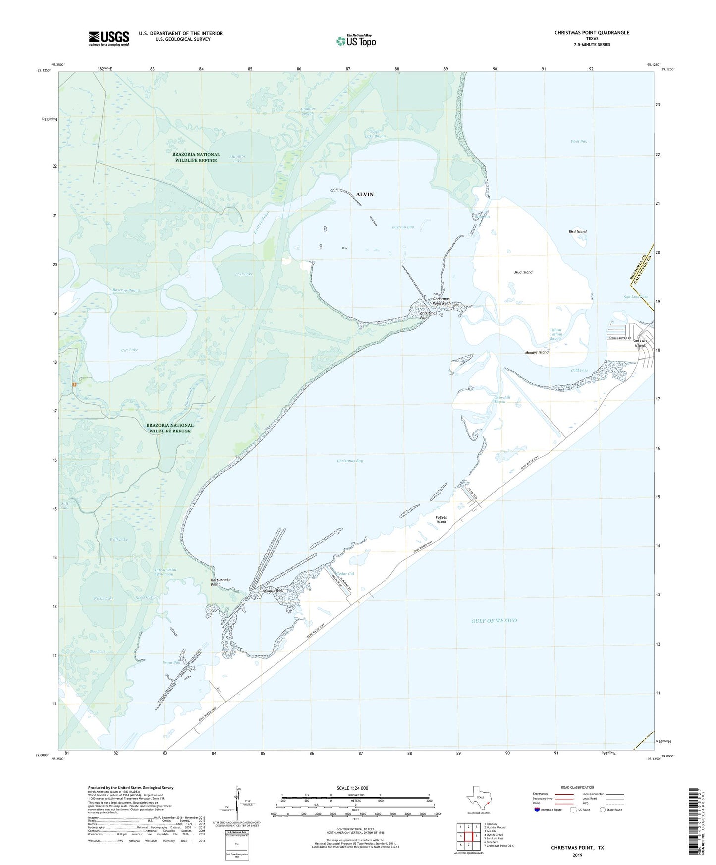
2025 topographic map quadrangle Christmas Point in the state of Texas. Scale: 1:24000. Based on the newly updated USGS 7.5' US Topo map series, this map is in the following counties: Brazoria, Galveston. The map contains contour data, water features, and other items you are used to seeing on USGS maps, but also has updated roads and other features. This is the next generation of topographic maps. Printed on high-quality waterproof paper with UV fade-resistant inks.
Quads adjacent to this one:
West: Oyster Creek
Northwest: Danbury
North: Hoskins Mound
Northeast: Sea Isle
East: San Luis Pass
South: Christmas Point OE S
Southwest: Freeport
This map covers the same area as the classic USGS quad with code o29095a2.
Contains the following named places: Alligator Lake, Alligator Slough, Alvin Branch Library, Arcadia Reef, Bastrop Bay, Bastrop Bayou, Big Slough, Bird Island, Brazoria National Wildlife Refuge, Cedar Cut, Christmas Bay, Christmas Point, Christmas Point Reef, Churchill Bayou, Cold Pass, Cox Lake, Drum Bay, Follets Island, Lost Lake, Moodys Island, Mud Cut, Mud Island, Nicks Cut, Nicks Lake, Oyster Lake, Oyster Lake Bayou, Port Morris, Rattlesnake Point, San Luis Island, Titlum-Tatlum Bayou, Wolf Lake