MyTopo
Hoskins Mound Texas US Topo Map
Couldn't load pickup availability
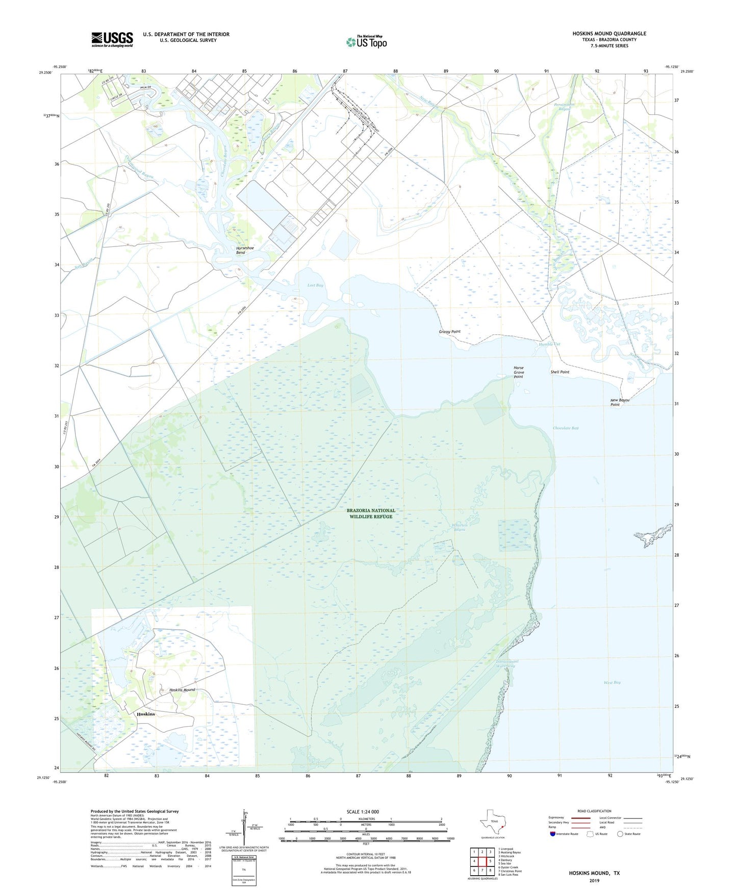
2022 topographic map quadrangle Hoskins Mound in the state of Texas. Scale: 1:24000. Based on the newly updated USGS 7.5' US Topo map series, this map is in the following counties: Brazoria. The map contains contour data, water features, and other items you are used to seeing on USGS maps, but also has updated roads and other features. This is the next generation of topographic maps. Printed on high-quality waterproof paper with UV fade-resistant inks.
Quads adjacent to this one:
West: Danbury
Northwest: Liverpool
North: Mustang Bayou
Northeast: Hitchcock
East: Sea Isle
Southeast: San Luis Pass
South: Christmas Point
Southwest: Oyster Creek
This map covers the same area as the classic USGS quad with code o29095b2.
Contains the following named places: Amoco Chemicals Reservoir, Amoco Chemicals Reservoir Levee, Amoco Heliport, Amsterdam Volunteer Fire Department, Chocolate Bay, Chocolate Bayou, Cottonwood Bayou, Grassy Point, Horse Grove Point, Horseshoe Bend, Horseshoe Bend Marina, Hoskins, Hoskins Mound, Humble Cut, Lost Bay, Mustang Bayou, New Bayou, New Bayou Point, Perry Bayou, Peterson Landing, Salt Bayou, Shell Point, Wharton Bayou