MyTopo
Oyster Creek Texas US Topo Map
Couldn't load pickup availability
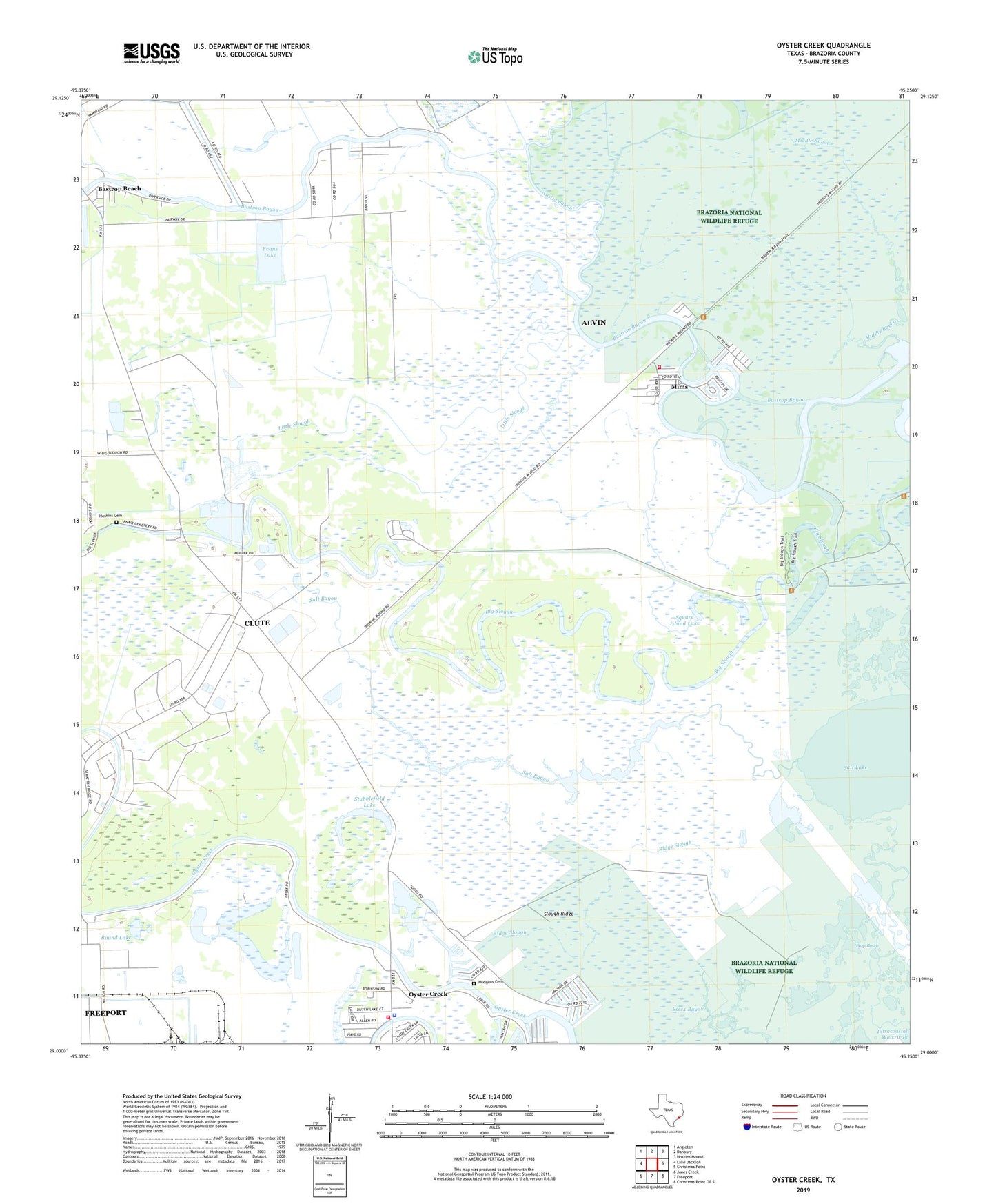
2022 topographic map quadrangle Oyster Creek in the state of Texas. Scale: 1:24000. Based on the newly updated USGS 7.5' US Topo map series, this map is in the following counties: Brazoria. The map contains contour data, water features, and other items you are used to seeing on USGS maps, but also has updated roads and other features. This is the next generation of topographic maps. Printed on high-quality waterproof paper with UV fade-resistant inks.
Quads adjacent to this one:
West: Lake Jackson
Northwest: Angleton
North: Danbury
Northeast: Hoskins Mound
East: Christmas Point
Southeast: Christmas Point OE S
South: Freeport
Southwest: Jones Creek
This map covers the same area as the classic USGS quad with code o29095a3.
Contains the following named places: Air Logistics-Freeport Heliport, Austin Bayou, Bastrop Beach, Bastrop Marina, Bethel Church, Brazos Heritage Museum, Brazosport Division, Chubb Lake, Demi - John Volunteer Fire Department, Dutch Lake, Essex Bayou, Evans Lake, Evans Lake Dam, Evergreen Church, Hoskins Cemetery, Hudgens Cemetery, Little Slough, McCormack Reservoir Number 4 Levee, Middle Bayou, Mims, Oyster Creek, Oyster Creek Police Department, Oyster Creek Volunteer Fire Department, Ridge Slough, Round Lake, Salt Bayou, Salt Lake, Shank Lake, Slop Bowl, Slough Ridge, Square Island Lake, Stratton Ridge, Stratton Ridge Oil Field, Stubblefield Lake, ZIP Code: 77541