MyTopo
Coffeeville Texas US Topo Map
Couldn't load pickup availability
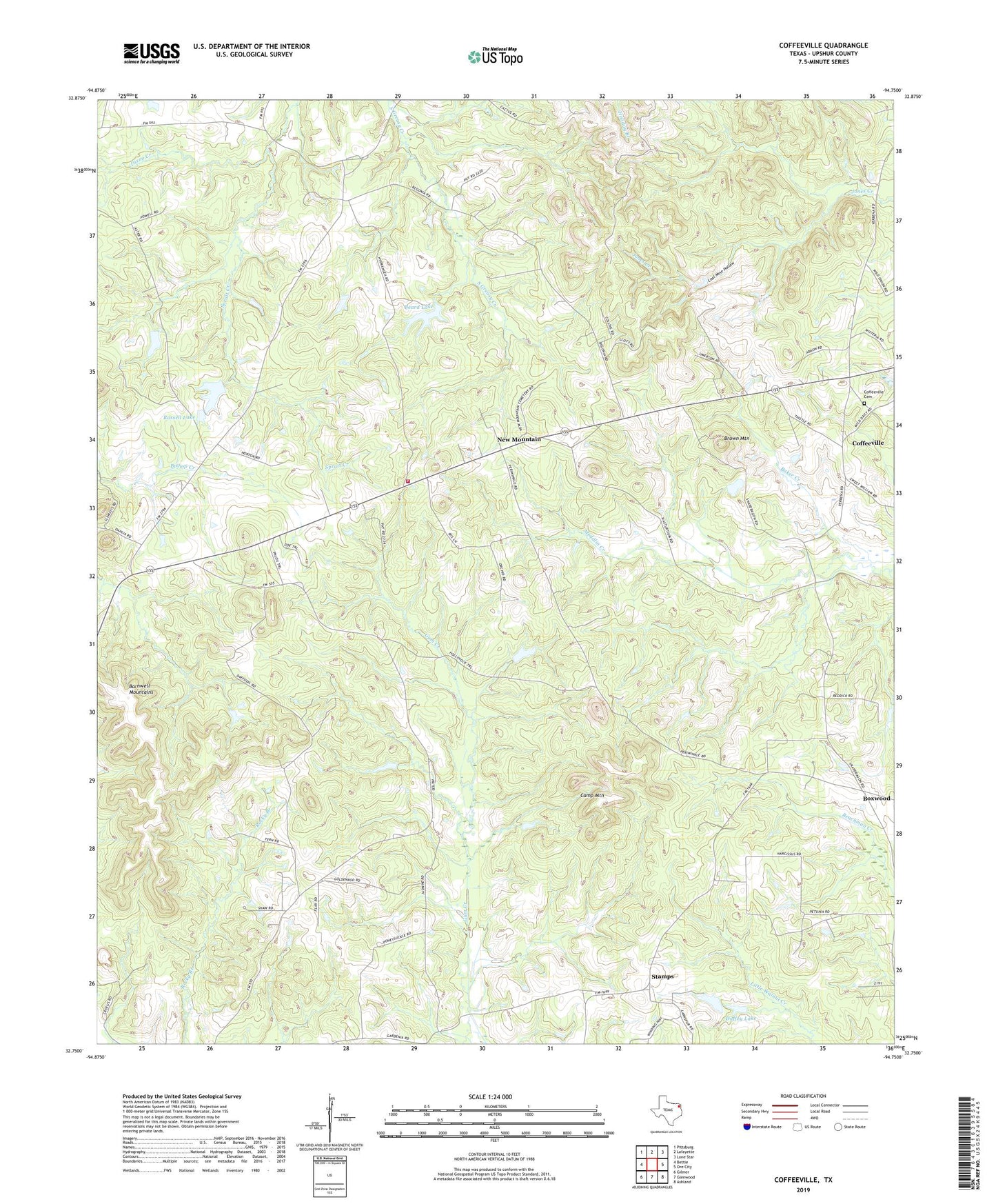
2019 topographic map quadrangle Coffeeville in the state of Texas. Scale: 1:24000. Based on the newly updated USGS 7.5' US Topo map series, this map is in the following counties: Upshur. The map contains contour data, water features, and other items you are used to seeing on USGS maps, but also has updated roads and other features. This is the next generation of topographic maps. Printed on high-quality waterproof paper with UV fade-resistant inks.
Quads adjacent to this one:
West: Bettie
Northwest: Pittsburg
North: Lafayette
Northeast: Lone Star
East: Ore City
Southeast: Ashland
South: Glenwood
Southwest: Gilmer
Contains the following named places: Barnwell Mountains, Beard Lake, Beard Lake Dam, Boxwood, Brown Mountain, Camp Mountain, Coal Mine Hollow, Coffeeville, Coffeeville Cemetery, Cox, Duffey Lake, Duffey Lake Dam, Holly Springs Church, New Mountain, New Mountain Volunteer Fire Department, Ore City Division, Paradise Church, Prince Chapel, Russell Lake, Russell Lake Dam, Sand Hill, Snow Hill, Snow Hill Church, Spratt Creek, Stamps