MyTopo
Pittsburg Texas US Topo Map
Couldn't load pickup availability
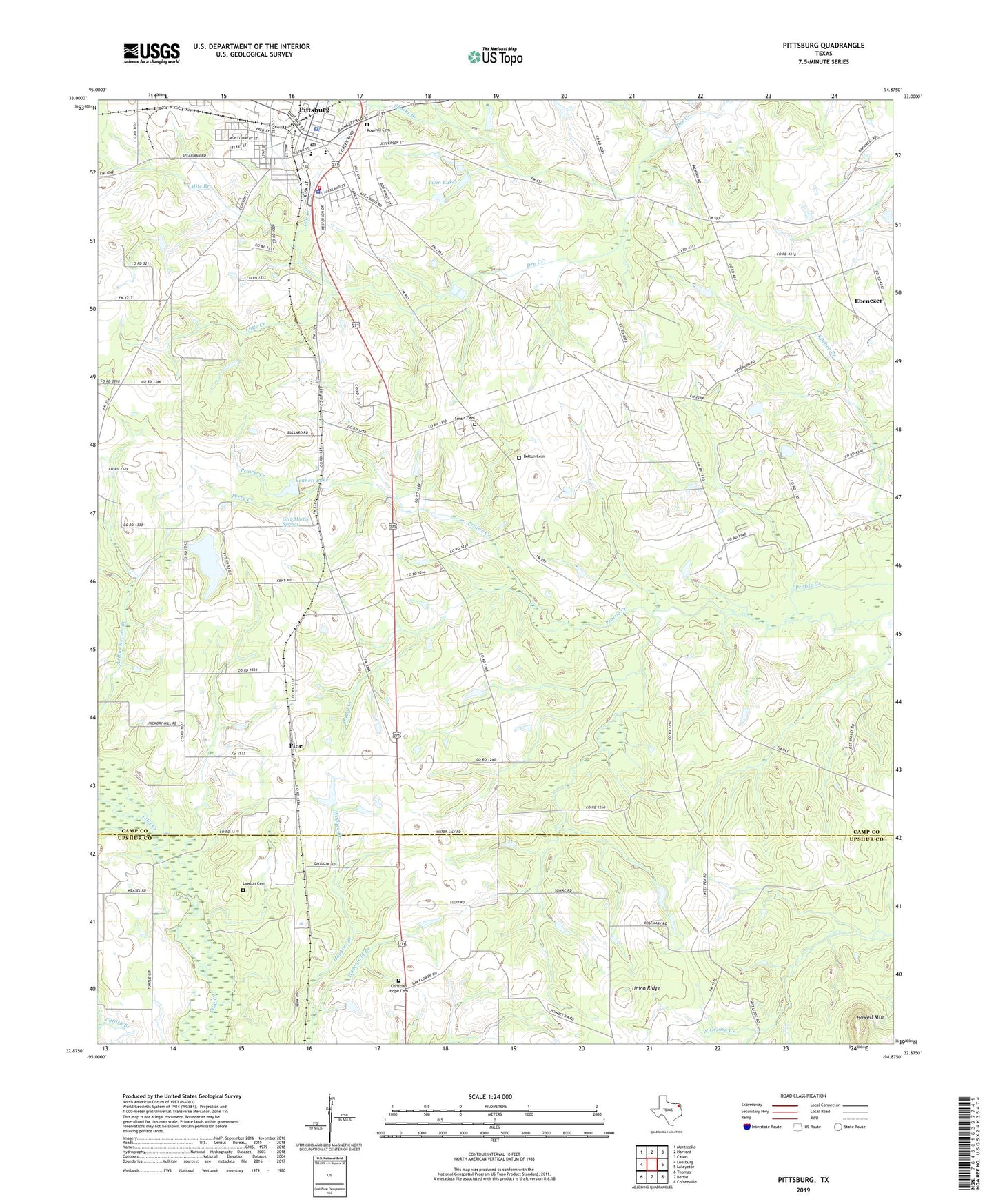
2022 topographic map quadrangle Pittsburg in the state of Texas. Scale: 1:24000. Based on the newly updated USGS 7.5' US Topo map series, this map is in the following counties: Camp, Upshur. The map contains contour data, water features, and other items you are used to seeing on USGS maps, but also has updated roads and other features. This is the next generation of topographic maps. Printed on high-quality waterproof paper with UV fade-resistant inks.
Quads adjacent to this one:
West: Leesburg
Northwest: Monticello
North: Harvard
Northeast: Cason
East: Lafayette
Southeast: Coffeeville
South: Bettie
Southwest: Thomas
This map covers the same area as the classic USGS quad with code o32094h8.
Contains the following named places: Bennett Dam, Bennett Lake, Bolton Cemetery, Bolton Church, Camp County, Camp County Constable's Office, Camp County Emergency Medical Service, Camp County Jail, Camp County Sheriff's Office, Cary Martin Springs, Christian Hope Cemetery, City of Pittsburg, Crossroads, Crossroads Church, Darby Creek, Douglas High School, Ebenezer, Faith Baptist Church, First Baptist Church, First Presbyterian Church, Franklin Street Church of Christ, Hadenfield Branch, Highland Club Dam, Highland Club Lake, Howell Mountain, Independent Hope Church, Lawton Cemetery, Little Creek, Metropolitian Baptist Church, Mile Branch, Perry Creek, Pine, Pine Bluff Baptist Church, Pine Church, Pittsburg, Pittsburg Central Fire Department, Pittsburg City Hall, Pittsburg Division, Pittsburg High School, Pittsburg Intermediate School, Pittsburg Police Department, Pittsburg Post Office, Pittsburg-Camp County Museum, Rosehill Cemetery, Saint Merner Church, Smart Cemetery, Sparks Branch, Texas Forest Service Pittsburg Office, Twin Lakes, Union Chapel, United Pentecostal Church, Wallace Branch, Wallace Chapel, Willow Oak Church, ZIP Code: 75686