MyTopo
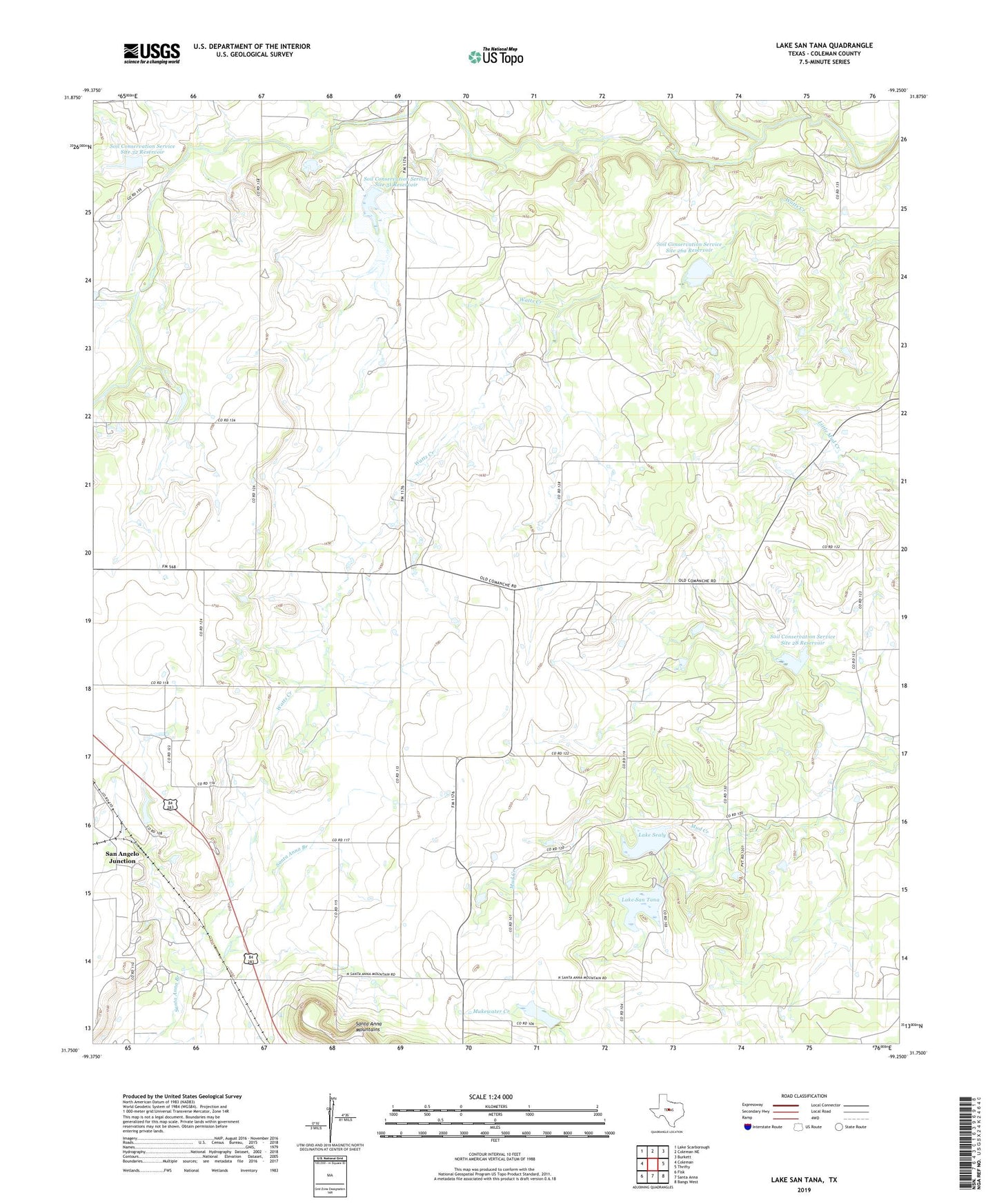
Lake San Tana Texas US Topo Map
Couldn't load pickup availability
2022 topographic map quadrangle Lake San Tana in the state of Texas. Scale: 1:24000. Based on the newly updated USGS 7.5' US Topo map series, this map is in the following counties: Coleman. The map contains contour data, water features, and other items you are used to seeing on USGS maps, but also has updated roads and other features. This is the next generation of topographic maps. Printed on high-quality waterproof paper with UV fade-resistant inks.
Quads adjacent to this one:
West: Coleman
Northwest: Lake Scarborough
North: Coleman NE
Northeast: Burkett
East: Thrifty
Southeast: Bangs West
South: Santa Anna
Southwest: Fisk
This map covers the same area as the classic USGS quad with code o31099g3.
Contains the following named places: Coleman Junction North Oil Field, Hagler Oil Field, Hords Creek, Lake San Tana, Lake Sealy, Lake Sealy Dam, San Angelo Junction, San Tana Dam, Soil Conservation Service Site 26a Dam, Soil Conservation Service Site 26a Reservoir, Soil Conservation Service Site 28 Dam, Soil Conservation Service Site 28 Reservoir, Soil Conservation Service Site 31 Dam, Soil Conservation Service Site 31 Reservoir, Soil Conservation Service Site 32 Dam, Soil Conservation Service Site 32 Reservoir