MyTopo
Purdon Texas US Topo Map
Couldn't load pickup availability
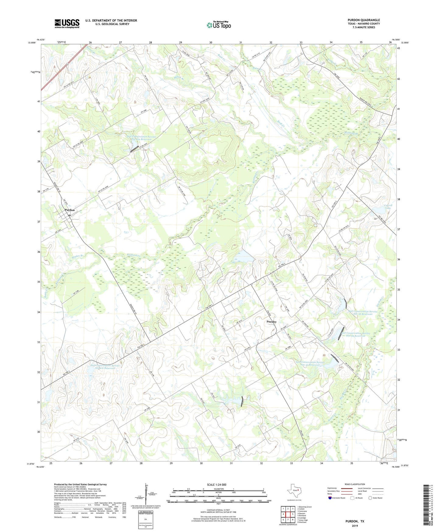
2022 topographic map quadrangle Purdon in the state of Texas. Scale: 1:24000. Based on the newly updated USGS 7.5' US Topo map series, this map is in the following counties: Navarro. The map contains contour data, water features, and other items you are used to seeing on USGS maps, but also has updated roads and other features. This is the next generation of topographic maps. Printed on high-quality waterproof paper with UV fade-resistant inks.
Quads adjacent to this one:
West: Dawson
Northwest: Blooming Grove
North: Corbet
Northeast: Corsicana
East: Richland
Southeast: Wortham
South: Union High
Southwest: Coolidge
This map covers the same area as the classic USGS quad with code o31096h5.
Contains the following named places: Battle Creek, Board Creek, Briar Creek, Carroll Lake, Carroll Lake Dam, Cedar Creek, Dam Number 129, Dam Number 32, Dam Number 33, Dam Number 34, Dam Number 35, Dawson Division, Hughes Branch, KAND-FM (Corsicana), Melton Branch, Purdon, Purdon Post Office, Pursley, Rainbow Field, Rush Creek, Soil Conservation Service Site 115 Dam, Soil Conservation Service Site 115 Reservoir, Soil Conservation Service Site 116 Dam, Soil Conservation Service Site 116 Reservoir, Soil Conservation Service Site 118 Dam, Soil Conservation Service Site 118 Reservoir, Soil Conservation Service Site 129 Dam, Soil Conservation Service Site 129 Reservoir, Soil Conservation Service Site 32 Dam, Soil Conservation Service Site 32 Reservoir, Soil Conservation Service Site 33 Dam, Soil Conservation Service Site 33 Reservoir, Soil Conservation Service Site 34 Dam, Soil Conservation Service Site 34 Reservoir, Soil Conservation Service Site 35 Dam, Soil Conservation Service Site 35 Reservoir, ZIP Code: 76679