MyTopo
Cottonwood Camp Texas US Topo Map
Couldn't load pickup availability
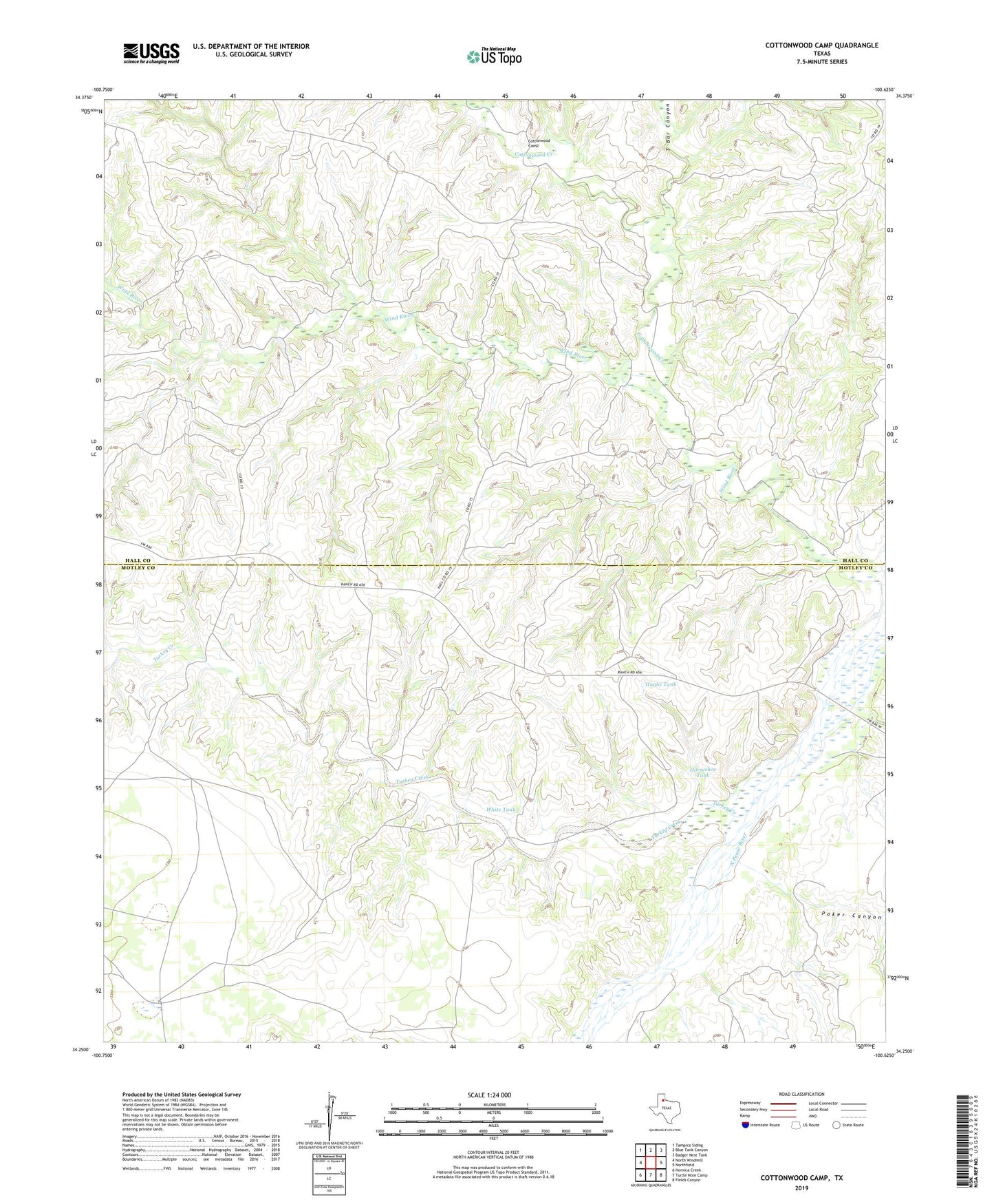
2022 topographic map quadrangle Cottonwood Camp in the state of Texas. Scale: 1:24000. Based on the newly updated USGS 7.5' US Topo map series, this map is in the following counties: Motley, Hall. The map contains contour data, water features, and other items you are used to seeing on USGS maps, but also has updated roads and other features. This is the next generation of topographic maps. Printed on high-quality waterproof paper with UV fade-resistant inks.
Quads adjacent to this one:
West: North Windmill
Northwest: Tampico Siding
North: Blue Tank Canyon
Northeast: Badger Nest Tank
East: Northfield
Southeast: Fields Canyon
South: Turtle Hole Camp
Southwest: Hornica Creek
This map covers the same area as the classic USGS quad with code o34100c6.
Contains the following named places: Alto Vista Camp, Bridlebit Camp, Cedar Top Camp, Cid Gitus Windmill, Cottonwood Camp, Cottonwood Creek, Dry Lake Windmill, Green Windmill, Horseshoe Tank, Hughs Tank, Johnson Windmill, Poker Canyon, T Bar Canyon, Turkey Creek, Turkey Creek Ranch, White Tank, White Windmill, Wind River, Wind River Camp