MyTopo
Council Creek Texas US Topo Map
Couldn't load pickup availability
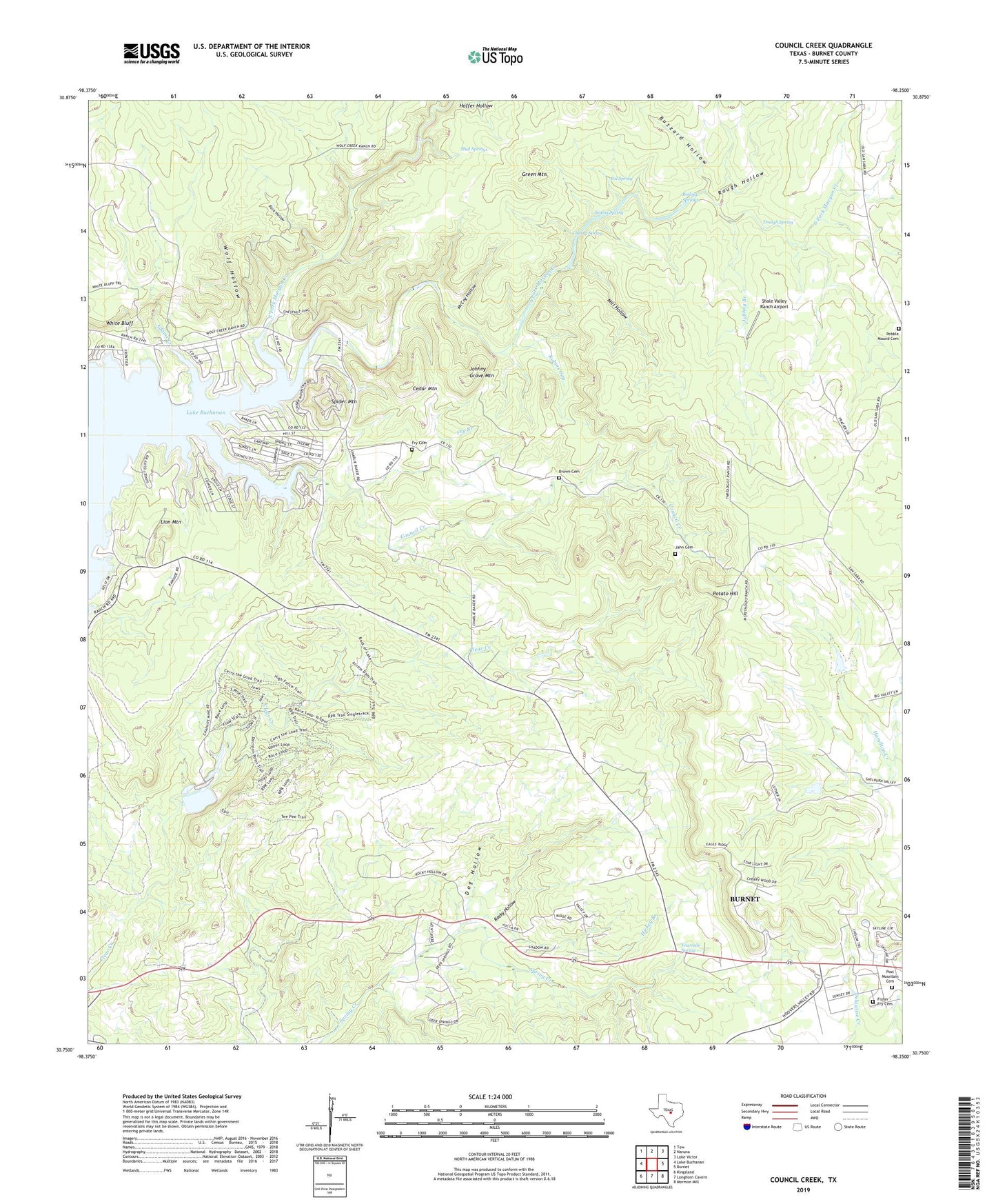
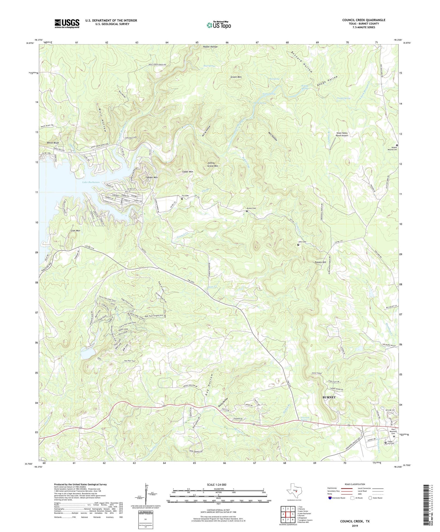
2019 topographic map quadrangle Council Creek in the state of Texas. Scale: 1:24000. Based on the newly updated USGS 7.5' US Topo map series, this map is in the following counties: Burnet. The map contains contour data, water features, and other items you are used to seeing on USGS maps, but also has updated roads and other features. This is the next generation of topographic maps. Printed on high-quality waterproof paper with UV fade-resistant inks.
Quads adjacent to this one:
West: Lake Buchanan
Northwest: Tow
North: Naruna
Northeast: Lake Victor
East: Burnet
Southeast: Mormon Mill
South: Longhorn Cavern
Southwest: Kingsland
Contains the following named places: Adams Creek, Boiling Springs, Brown Cemetery, Burnet Division, Buzzard Hollow, Cedar Mountain, Cherry Spring, Council Creek, Dog Hollow, Dublin Public Library, Fisher - Fry Cemetery, Fourmile Spring, Fry Branch, Fry Cemetery, Green Mountain, Hickey Branch, Jahn Cemetery, Johhny Branch, Johhny Grave Mountain, KGZG-FM (Burnet), Lion Mountain, McCoy Hollow, Mill Hollow, Mud Springs, North Fork Morgan Creek, Pal Spring, Pebble Mound Cemetery, Post Mountain Cemetery, Potato Hill, Robins Gap, Rock Hollow, Rocky Hollow, Rough Hollow, Shale Valley Ranch Airport, Simms Spring, South Fork Morgan Creek, Spider Mountain, Trough Spring, Wolf Hollow, ZIP Code: 78611