MyTopo
Longhorn Cavern Texas US Topo Map
Couldn't load pickup availability
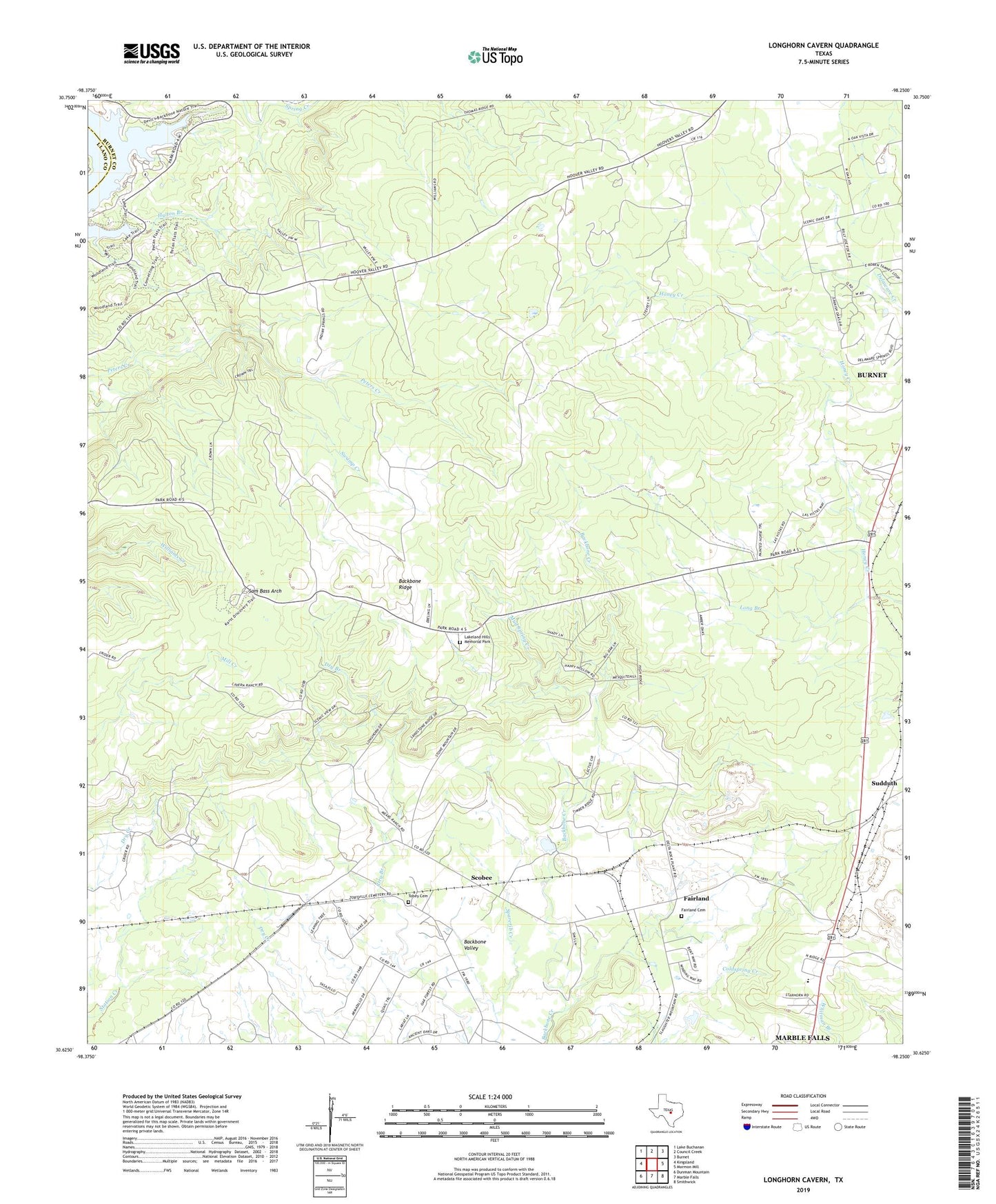
2022 topographic map quadrangle Longhorn Cavern in the state of Texas. Scale: 1:24000. Based on the newly updated USGS 7.5' US Topo map series, this map is in the following counties: Burnet, Llano. The map contains contour data, water features, and other items you are used to seeing on USGS maps, but also has updated roads and other features. This is the next generation of topographic maps. Printed on high-quality waterproof paper with UV fade-resistant inks.
Quads adjacent to this one:
West: Kingsland
Northwest: Lake Buchanan
North: Council Creek
Northeast: Burnet
East: Mormon Mill
Southeast: Smithwick
South: Marble Falls
Southwest: Dunman Mountain
This map covers the same area as the classic USGS quad with code o30098f3.
Contains the following named places: Austin and Northwestern Railroad Historic District, Backbone Ridge, Backbone Valley, Demarco, Fairland, Fairland Cemetery, Hylton Branch, Inks Lake State Park, Inks Lake State Park Trail, KHLB-FM (Burnet), Lakeland Hills Memorial Park, Long Branch, Longhorn Cavern State Park, Longhorn Cavern State Park Trail, Mud Spring Creek, Sam Bass Arch, Scobee, Spring Creek, Sudduth, Swamp Creek, Tobey Cemetery