MyTopo
Burnet Texas US Topo Map
Couldn't load pickup availability
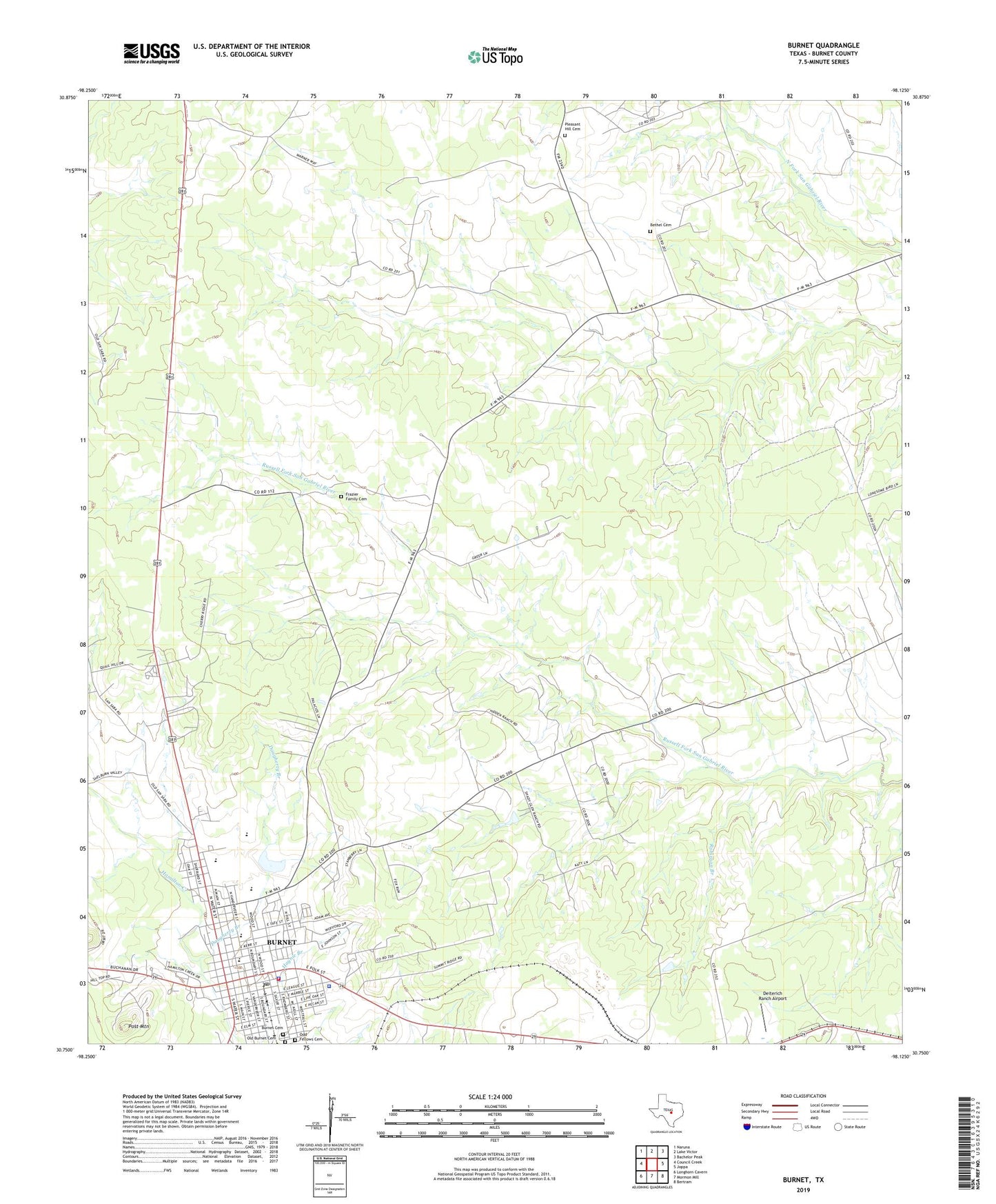
2022 topographic map quadrangle Burnet in the state of Texas. Scale: 1:24000. Based on the newly updated USGS 7.5' US Topo map series, this map is in the following counties: Burnet. The map contains contour data, water features, and other items you are used to seeing on USGS maps, but also has updated roads and other features. This is the next generation of topographic maps. Printed on high-quality waterproof paper with UV fade-resistant inks.
Quads adjacent to this one:
West: Council Creek
Northwest: Naruna
North: Lake Victor
Northeast: Bachelor Peak
East: Joppa
Southeast: Bertram
South: Mormon Mill
Southwest: Longhorn Cavern
This map covers the same area as the classic USGS quad with code o30098g2.
Contains the following named places: Allen Hospital, Bethel Cemetery, Bethel Community Center, Burent Middle School, Burnet, Burnet Cemetery, Burnet City Hall, Burnet County, Burnet County Constable's Office Precinct 1, Burnet County Constable's Office Precinct 2, Burnet County Courthouse, Burnet County Sheriff's Office, Burnet Elementary School, Burnet Fire Department, Burnet High School, Burnet Police Department, Burnet Post Office, Church of Christ, Daugherty Branch, Deiterich Ranch Airport, First Baptist Church, Fort Croghan Historical Site, Fort Croghan Museum, Frazier Ranch Cemetery, KHLB-AM (Burnet), Mandaean Cemetery, Odd Fellows Cemetery, Old Burnet Cemetery, Parsonage Baptist Church, Pleasant Hill Cemetery, Post Mountain, QUEST High School, Robinson Branch, Saint Matthew African Methodist Episcopal Church, Stephenville Public Library, Summit, Temple Baptist Church, Tommy White Park, Wallace Riddell Park