MyTopo
Davis Hill Texas US Topo Map
Couldn't load pickup availability
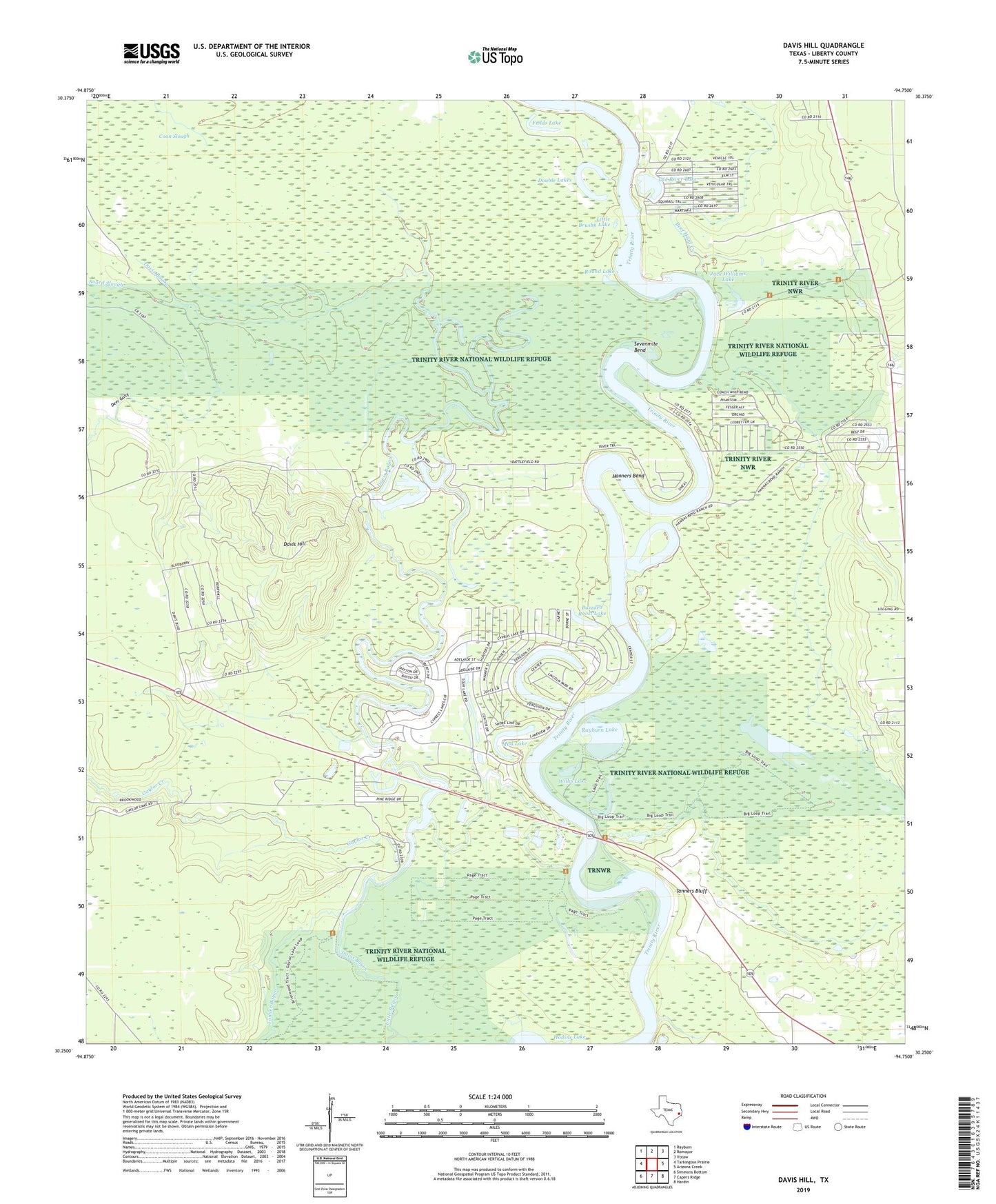
2019 topographic map quadrangle Davis Hill in the state of Texas. Scale: 1:24000. Based on the newly updated USGS 7.5' US Topo map series, this map is in the following counties: Liberty. The map contains contour data, water features, and other items you are used to seeing on USGS maps, but also has updated roads and other features. This is the next generation of topographic maps. Printed on high-quality waterproof paper with UV fade-resistant inks.
Quads adjacent to this one:
West: Tarkington Prairie
Northwest: Rayburn
North: Romayor
Northeast: Votaw
East: Arizona Creek
Southeast: Hardin
South: Capers Ridge
Southwest: Simmons Bottom
Contains the following named places: Beef Head Creek, Bledsoe Creek, Board Slough, Buzzard Roost Lake, Cade Lake, Coushatta Village, Cypress Lake, Cypress Lake Dam, Davis Bayou, Davis Hill, Davis Hill State Park, Deer Gully, Double Lakes, Fields Lake, Franklin, Gaylor Creek, Gaylor Lake, Grand Cane, Hanners Bend, Hanners Bend Lake, Hardin-Rye Division, Hollins Lake, Horseshoe Lake, Jack Williams Lake, Jacob Settlement, Lake Bowie, Lake Sam, Little Brushy Lake, Mud Lake, Old River Lake, Rayburn Lake, Round Lake, Sam Houston, Sevenmile Bend, Tanners Bluff, Trinity River Lake Estates, Trinity River National Wildlife Refuge, Willis Lake