MyTopo
Deanville Texas US Topo Map
Couldn't load pickup availability
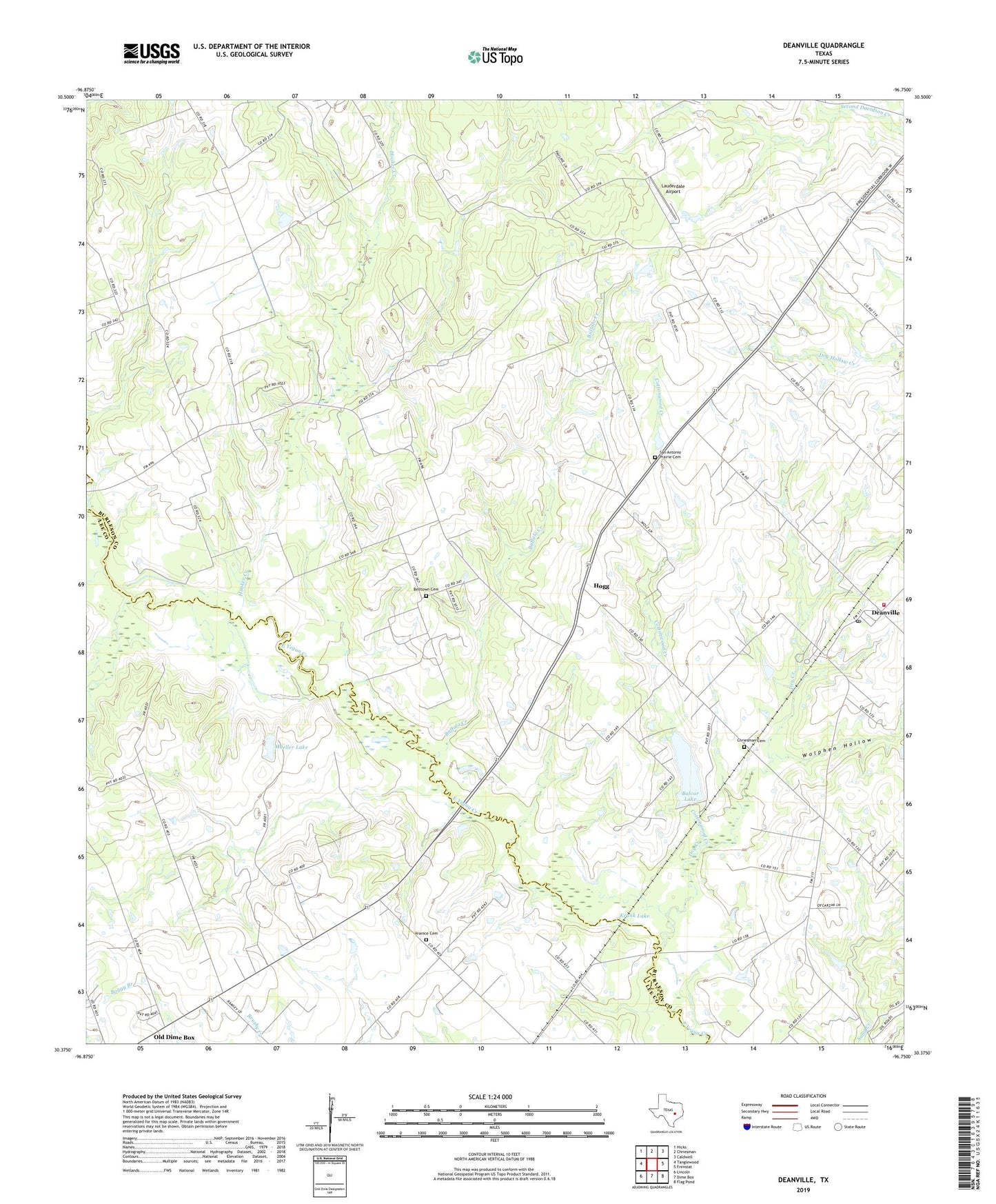
2019 topographic map quadrangle Deanville in the state of Texas. Scale: 1:24000. Based on the newly updated USGS 7.5' US Topo map series, this map is in the following counties: Burleson, Lee. The map contains contour data, water features, and other items you are used to seeing on USGS maps, but also has updated roads and other features. This is the next generation of topographic maps. Printed on high-quality waterproof paper with UV fade-resistant inks.
Quads adjacent to this one:
West: Tanglewood
Northwest: Hicks
North: Chriesman
Northeast: Caldwell
East: Frenstat
Southeast: Flag Pond
South: Dime Box
Southwest: Lincoln
Contains the following named places: Balcar Lake, Balcar Lake Dam, Belltown Cemetery, Buffalo Creek, Chriesman Cemetery, Cottonwood Creek, Deanville, Deanville Census Designated Place, Deanville Post Office, Deanville Volunteer Fire Department, Dry Creek, Gus, Hogg, Hooker Creek, Hranice Cemetery, Krunk Lake, Lauderdale Airport, Mueller Lake, Mueller Lake Dam, Old Dime Box, Porter Branch, Porters Chapel, Providence Church, San Antonio Prairie, San Antonio Prairie Cemetery, Sulphur Spring School, Wolphen Hollow