MyTopo
Dike Texas US Topo Map
Couldn't load pickup availability
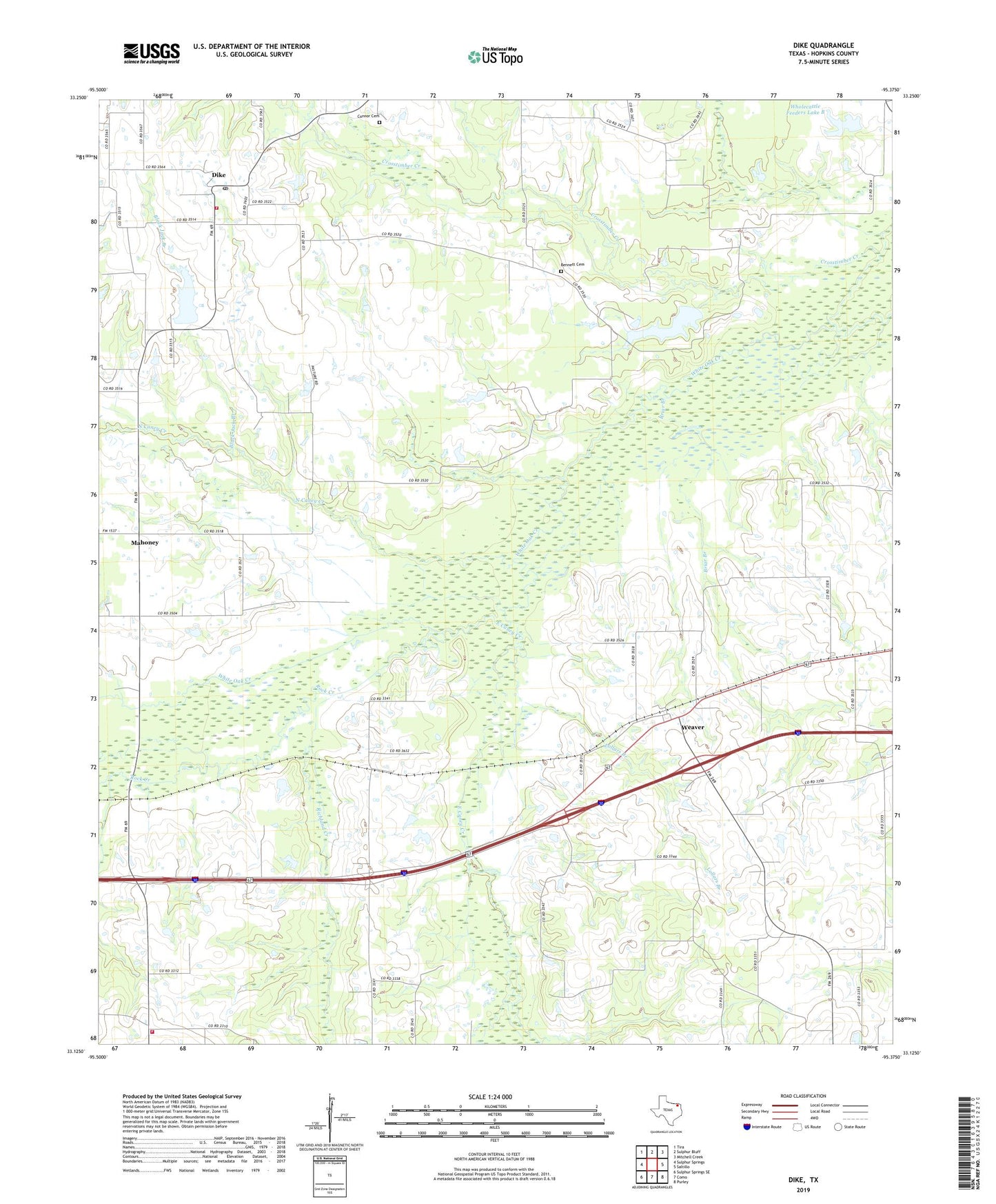
2019 topographic map quadrangle Dike in the state of Texas. Scale: 1:24000. Based on the newly updated USGS 7.5' US Topo map series, this map is in the following counties: Hopkins. The map contains contour data, water features, and other items you are used to seeing on USGS maps, but also has updated roads and other features. This is the next generation of topographic maps. Printed on high-quality waterproof paper with UV fade-resistant inks.
Quads adjacent to this one:
West: Sulphur Springs
Northwest: Tira
North: Sulphur Bluff
Northeast: Mitchell Creek
East: Saltillo
Southeast: Purley
South: Como
Southwest: Sulphur Springs SE
Contains the following named places: Bennett Cemetery, Black Jack Branch, Briar Branch, Brinker, Brinker Volunteer Fire and Rescue Department Station 12, Center Point Church, Connor Cemetery, Dike, Dike Post Office, Dike Volunteer Fire Department - First Responders, East Caney, East Caney Creek, Landers Creek, Lollars Branch, Mahoney, North Caney Creek, Patterson Lake, Patterson Lake Dam, Richland Church, Richland Creek, Rock Creek, Weaver, White Oak Junction, Wholecattle Feeders Dam B, Wholecattle Feeders Lake B