MyTopo
Driftwood Texas US Topo Map
Couldn't load pickup availability
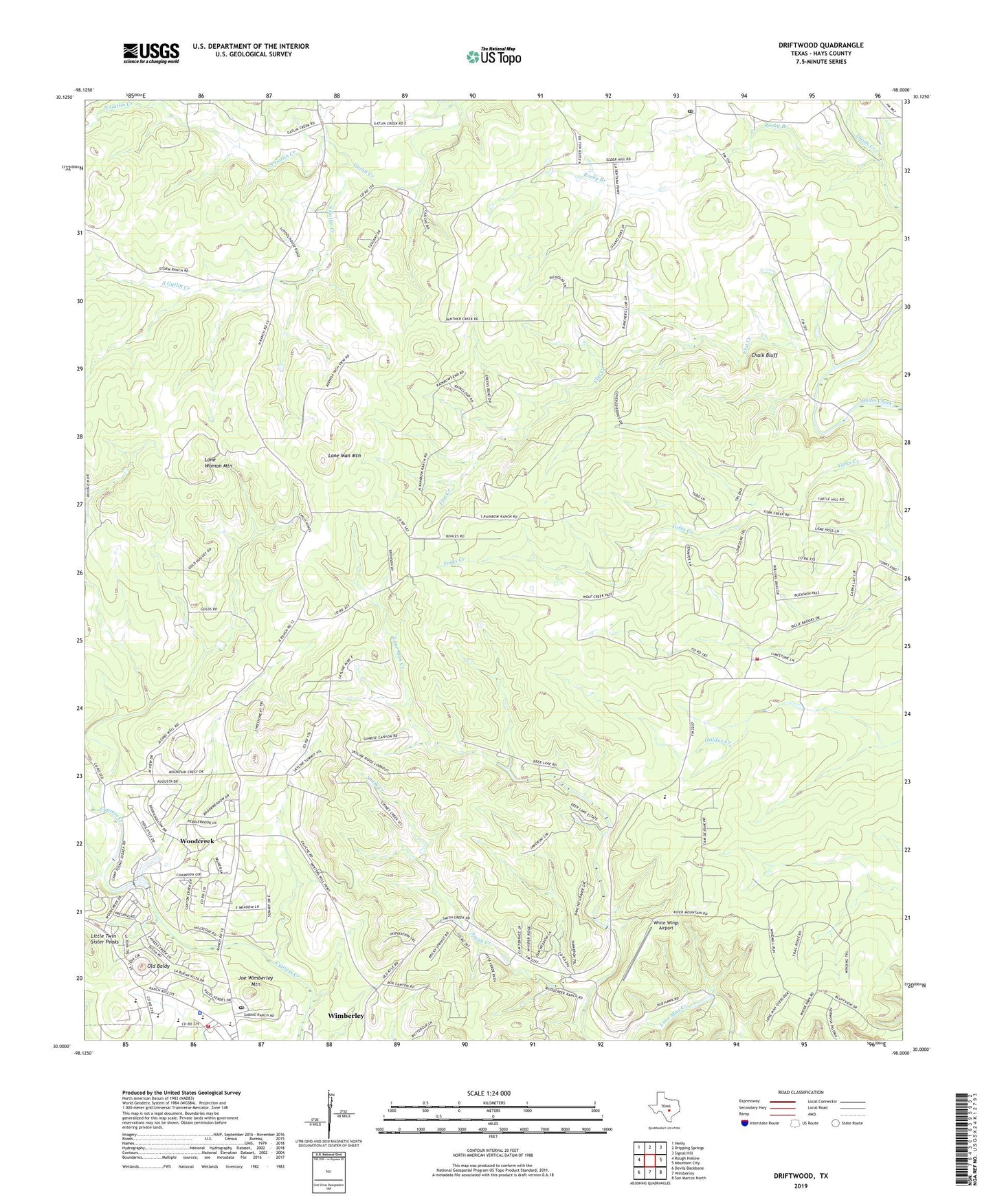
2019 topographic map quadrangle Driftwood in the state of Texas. Scale: 1:24000. Based on the newly updated USGS 7.5' US Topo map series, this map is in the following counties: Hays. The map contains contour data, water features, and other items you are used to seeing on USGS maps, but also has updated roads and other features. This is the next generation of topographic maps. Printed on high-quality waterproof paper with UV fade-resistant inks.
Quads adjacent to this one:
West: Rough Hollow
Northwest: Henly
North: Dripping Springs
Northeast: Signal Hill
East: Mountain City
Southeast: San Marcos North
South: Wimberley
Southwest: Devils Backbone
Contains the following named places: Blue Hole Campground, Bowen Intermediate School, Chalk Bluff, City of Woodcreek, Driftwood, Driftwood Post Office, Eagle Rock Ranch, Flat Creek, Hays County, Hays County Sheriff's Office - Wimberley Substation, Joe Wimberley Mountain, Little Twin Sister Peaks, Lone Man Mountain, Lone Woman Mountain, Nagel Brothers Ranch, Newberry Ranch, North Gatlin Creek, Old Baldy, Rainbow Ranch, Rocky Branch, Scudder Primary School, Smith Creek, South Gatlin Creek, Storm Ranch, The Chapel in the Hills Community Church, White Wings Airport, Wimberley Church of Christ, Wimberley High School, Wimberley Post Office, Wimberley Volunteer Fire Department Central Station, Wimberley Volunteer Fire Department Rolling Oaks Station, Woodcreek, Woodcreek City Hall, Woodcreek Resort Airport, ZIP Code: 78619