MyTopo
Dripping Springs Texas US Topo Map
Couldn't load pickup availability
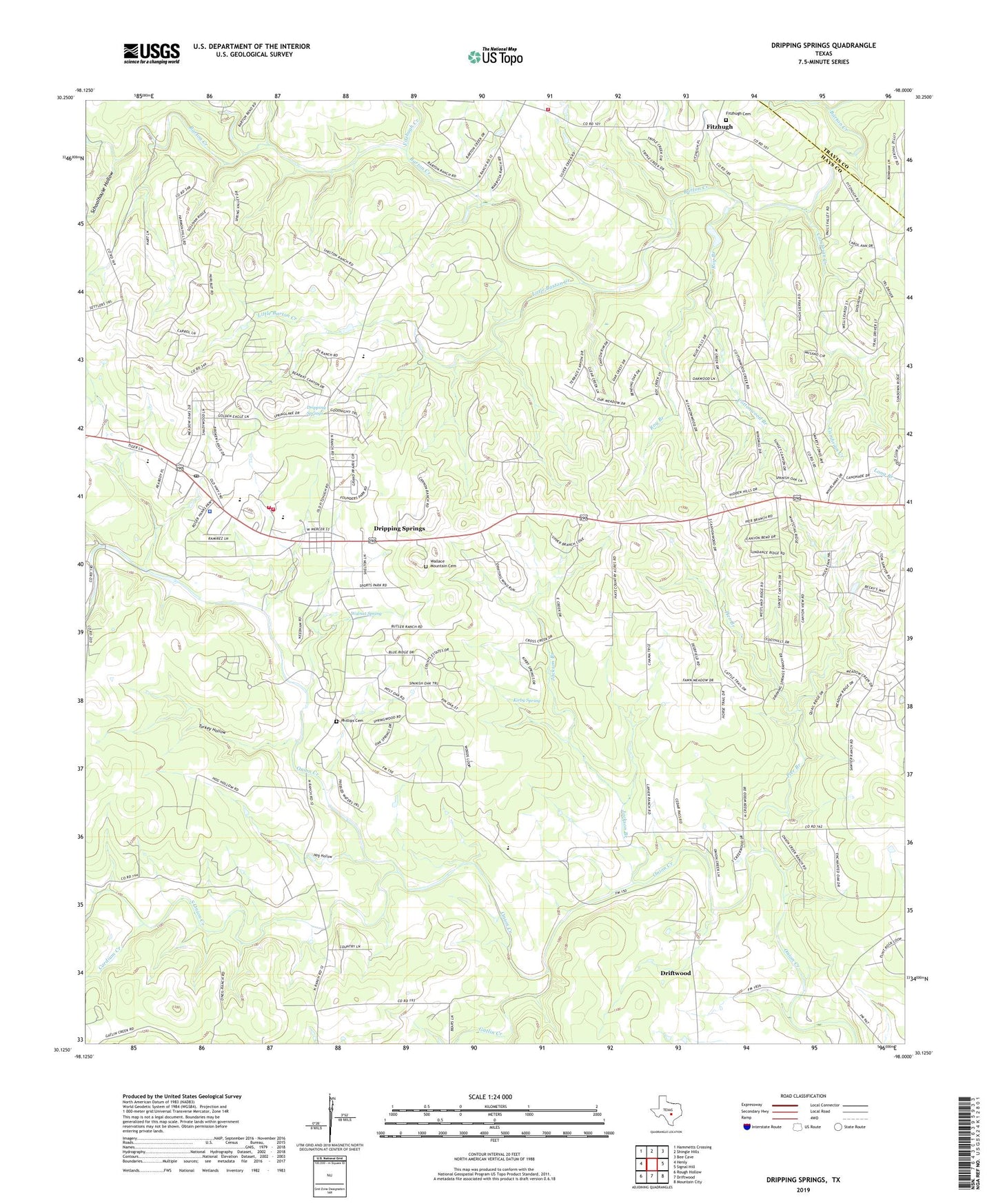
2022 topographic map quadrangle Dripping Springs in the state of Texas. Scale: 1:24000. Based on the newly updated USGS 7.5' US Topo map series, this map is in the following counties: Hays, Travis. The map contains contour data, water features, and other items you are used to seeing on USGS maps, but also has updated roads and other features. This is the next generation of topographic maps. Printed on high-quality waterproof paper with UV fade-resistant inks.
Quads adjacent to this one:
West: Henly
Northwest: Hammetts Crossing
North: Shingle Hills
Northeast: Bee Cave
East: Signal Hill
Southeast: Mountain City
South: Driftwood
Southwest: Rough Hollow
This map covers the same area as the classic USGS quad with code o30098b1.
Contains the following named places: Cambrian Creek, Camp Ben McCulloch, Cardium Creek, City of Dripping Springs, Cottonwood Branch, Doctor Joseph M and Sarah Pound Farmstead, Driftwood Census Designated Place, Dripping Springs, Dripping Springs City Hall, Dripping Springs Intermediate School, Dripping Springs Post Office, Dripping Springs Primary School, Fitzhugh, Fitzhugh Cemetery, Fitzhugh Creek, Gatlin Creek, Hays County Constable's Office Precinct 4, Hays County Sheriff's Office Dripping Springs Substation, Hog Hollow, Holy Spirit Episcopal Church, Jackson Branch, Kirby Spring, Little Barton Creek, North Hays County Emergency Services District 6, North Hays County Fire and Rescue, North Hays County Volunteer Fire Department North Station, North Hays County Volunteer Fire Department Station 71, Phillips Cemetery, Pier Branch, Roy Branch, Schoolhouse Hollow, South Onion Creek, Turkey Hollow, Wallace Mountain Cemetery, Walnut Spring, Womens Aglow Fellowship of South Austin Church