MyTopo
Signal Hill Texas US Topo Map
Couldn't load pickup availability
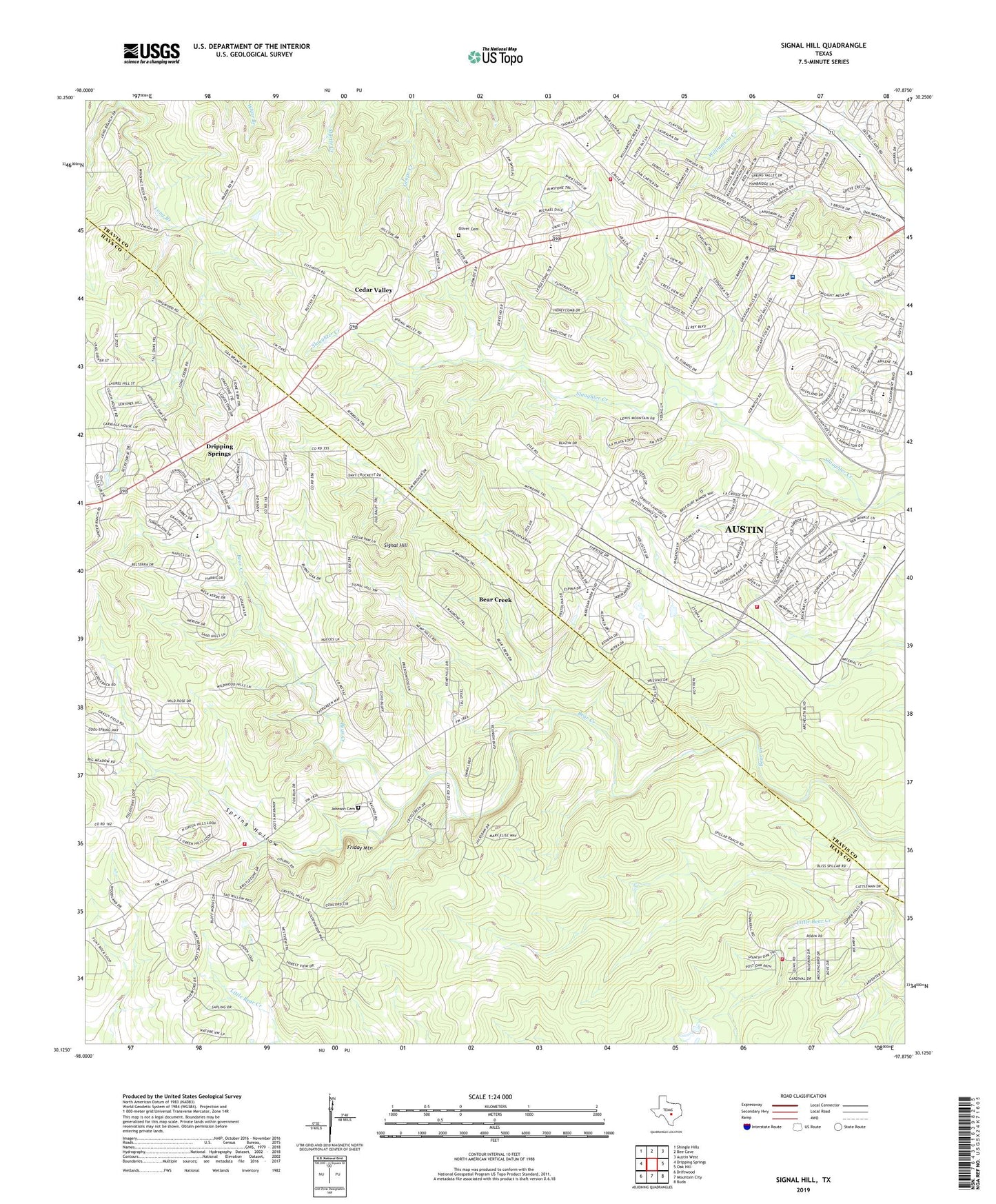
2022 topographic map quadrangle Signal Hill in the state of Texas. Scale: 1:24000. Based on the newly updated USGS 7.5' US Topo map series, this map is in the following counties: Travis, Hays. The map contains contour data, water features, and other items you are used to seeing on USGS maps, but also has updated roads and other features. This is the next generation of topographic maps. Printed on high-quality waterproof paper with UV fade-resistant inks.
Quads adjacent to this one:
West: Dripping Springs
Northwest: Shingle Hills
North: Bee Cave
Northeast: Austin West
East: Oak Hill
Southeast: Buda
South: Mountain City
Southwest: Driftwood
This map covers the same area as the classic USGS quad with code o30097b8.
Contains the following named places: Austin / Travis County Emergency Medical Service - Medic 31, Austin Fire Department Station 43, Bear Creek, Belterra, Belterra Census Designated Place, Cedar Valley, Circle C Slaughter Creek Trail, Driftwood Volunteer Fire Department, Fellowship of the Hills Church, First Baptist Church of Oak Hill, Fitzhugh Baptist Church, Friday Mountain, Friendship Church, Gorzycki Middle School, Heissner Ranch, Hill Country Baptist Church of Oakhill, Joe Dan Mills Elementary School, Johnny Voudouris Heliport, Johnson Cemetery, Kiker Elementary School, Koenig Ranch, Majestic Mountain Ministries, Manchaca Volunteer Fire Department Station 6, Mills Elementary School, Mount Olive Lutheran Church Preschool, Oak Hill Assembly of God Church, Oliver Cemetery, Rim Rock Trail, Sawyer Ranch, Scenic Hills Baptist Church, Seton Southwest Hospital, Signal Hill, Signal Hill Ranch, Spillar Ranch, Spring Hollow, Travis County ESD 3 Oak Hill Fire Department Station 1, Village of Bear Creek, ZIP Codes: 78737, 78739