MyTopo
Henly Texas US Topo Map
Couldn't load pickup availability
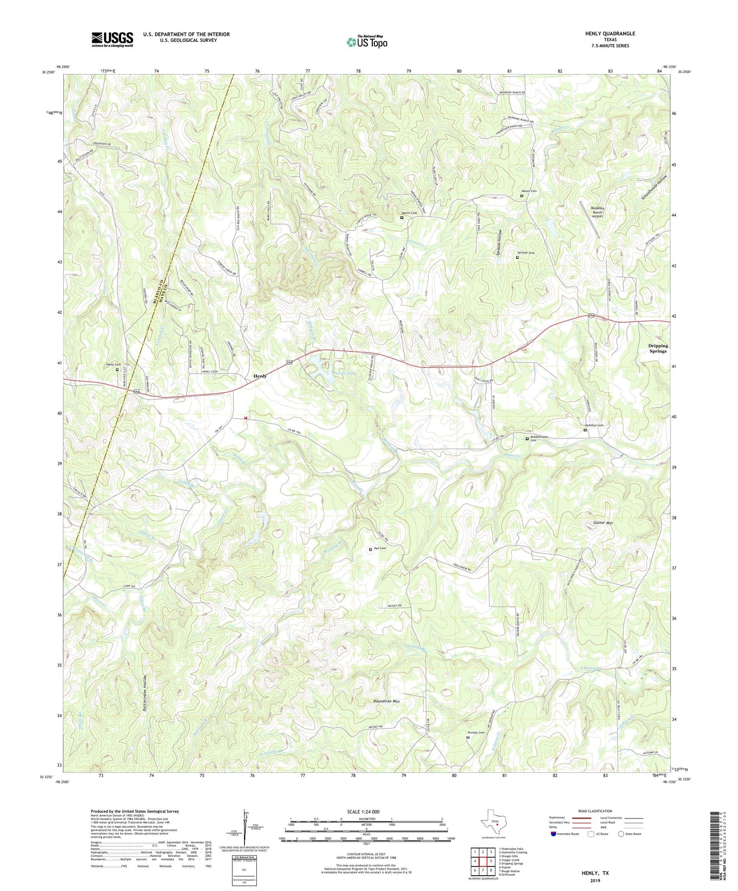
2022 topographic map quadrangle Henly in the state of Texas. Scale: 1:24000. Based on the newly updated USGS 7.5' US Topo map series, this map is in the following counties: Hays, Blanco. The map contains contour data, water features, and other items you are used to seeing on USGS maps, but also has updated roads and other features. This is the next generation of topographic maps. Printed on high-quality waterproof paper with UV fade-resistant inks.
Quads adjacent to this one:
West: Yeager Creek
Northwest: Pedernales Falls
North: Hammetts Crossing
Northeast: Shingle Hills
East: Dripping Springs
Southeast: Driftwood
South: Rough Hollow
Southwest: Payton
This map covers the same area as the classic USGS quad with code o30098b2.
Contains the following named places: Bleakley Ranch Airport, Cadell Branch, Cottonwood Branch, Dripping Springs Community Church, Dripping Sprins Middle School, Dye Cemetery, Eskew Branch, Gainor Mountain, Grooms Branch, Halm Ranch Airport, Henly, Henly Branch, Henly Cemetery, Henly Volunteer Fire Department Station 3, Martin Cemetery, McKellar Cemetery, Middlebrooks Cemetery, Millseat Branch, Moore Cemetery, Mount Gainor, Mustang Branch, Pursley Cemetery, Rattlesnake Hollow, Reeves Lake, Reeves Lake Dam, Roundtree Mountain, Sprouse Cemetery, Sprouse Hollow, Sunset Canyon Baptist Church, White Branch, ZIP Code: 78620