MyTopo
Ebers Camp Texas US Topo Map
Couldn't load pickup availability
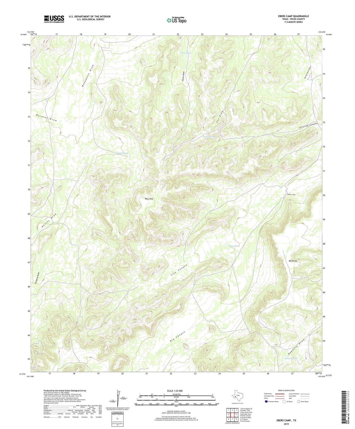
2022 topographic map quadrangle Ebers Camp in the state of Texas. Scale: 1:24000. Based on the newly updated USGS 7.5' US Topo map series, this map is in the following counties: Pecos. The map contains contour data, water features, and other items you are used to seeing on USGS maps, but also has updated roads and other features. This is the next generation of topographic maps. Printed on high-quality waterproof paper with UV fade-resistant inks.
Quads adjacent to this one:
West: Reininger Draw
Northwest: Sierra Madera SE
North: Panther Tank
Northeast: Rock House Draw
East: Busher Canyon
Southeast: Toms Canyon
South: F C Ranch
Southwest: Cap Rock Butte
This map covers the same area as the classic USGS quad with code o30102d6.
Contains the following named places: Boat Hills, Burnen Tower Windmill, Carlos Tank, Cinco de Mayo Windmill, Cox Windmill, Crawford Windmills, Divide Windmill, Ebers Camp, Ebers Tank, Fife Canyon, Fortyone Draw, Fortyone Windmill, Hess Windmill, Javalina Tank, Javalina Well, Middle Windmill, Morales Draw, Nevins Draw, North Camp, Rebecca Tank, Shelton Tank, White Windmills