MyTopo
Edge Texas US Topo Map
Couldn't load pickup availability
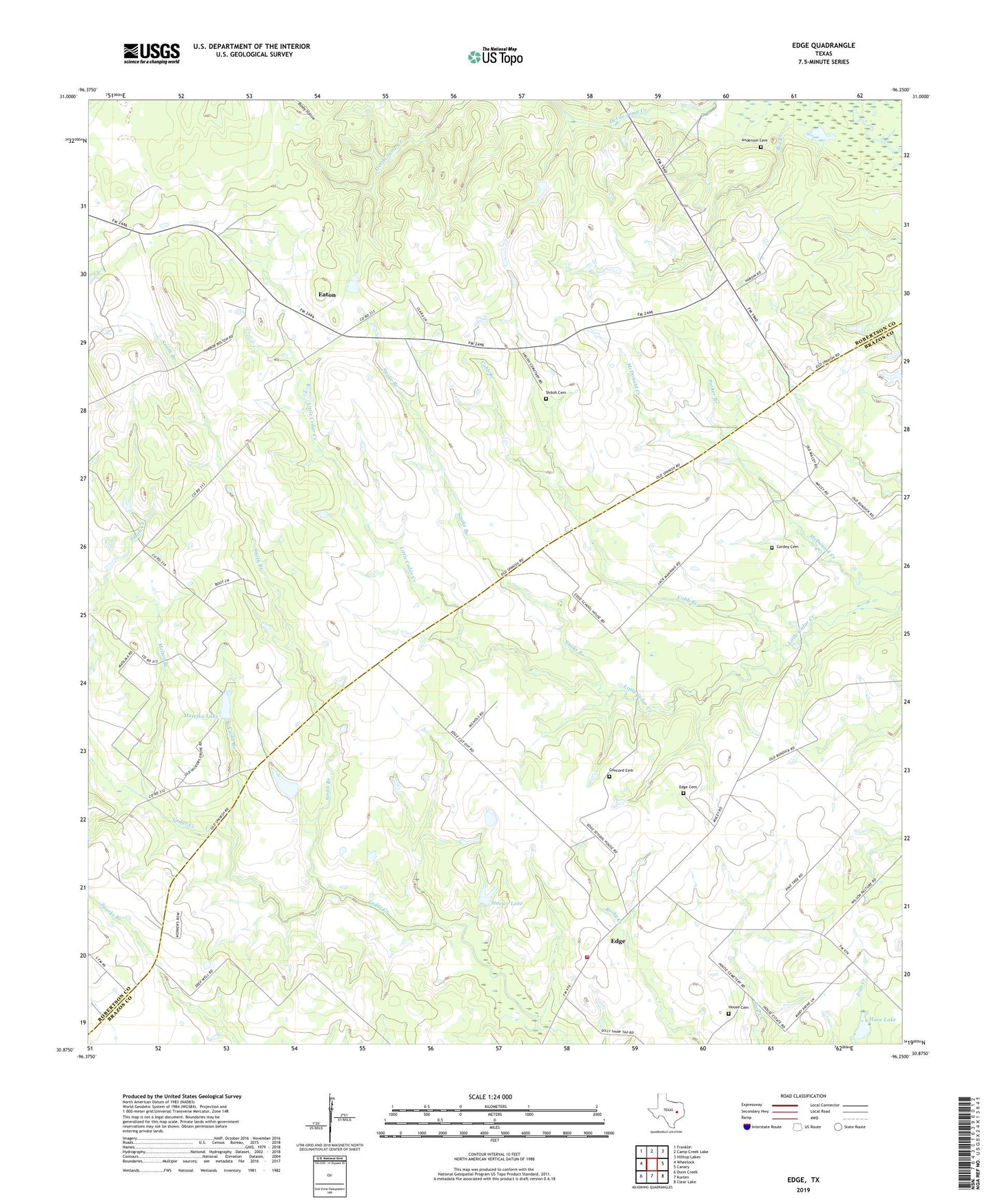
2019 topographic map quadrangle Edge in the state of Texas. Scale: 1:24000. Based on the newly updated USGS 7.5' US Topo map series, this map is in the following counties: Robertson, Brazos. The map contains contour data, water features, and other items you are used to seeing on USGS maps, but also has updated roads and other features. This is the next generation of topographic maps. Printed on high-quality waterproof paper with UV fade-resistant inks.
Quads adjacent to this one:
West: Wheelock
Northwest: Franklin
North: Camp Creek Lake
Northeast: Hilltop Lakes
East: Canary
Southeast: Clear Lake
South: Kurten
Southwest: Dunn Creek
Contains the following named places: Anderson Cemetery, Bee Branch, Brazos County Fire Department District 2 Station 2, Buckhorn Branch, Cajka Branch, Cavitt Ranch, Cobb Branch, Concord Cemetery, Cordey Cemetery, Eaton, Edge, Edge Cemetery, Hare Lake, Hare Lake Dam, House Cemetery, Kings Highway, Macey, Matejka Lake, Matejka Lake Dam, Melton Branch, Parker Branch, Shiloh Cemetery, Shiloh Church, Smith Branch, Snake Branch, Stuewe Lake, Stuewe Lake Dam