MyTopo
Dunn Creek Texas US Topo Map
Couldn't load pickup availability
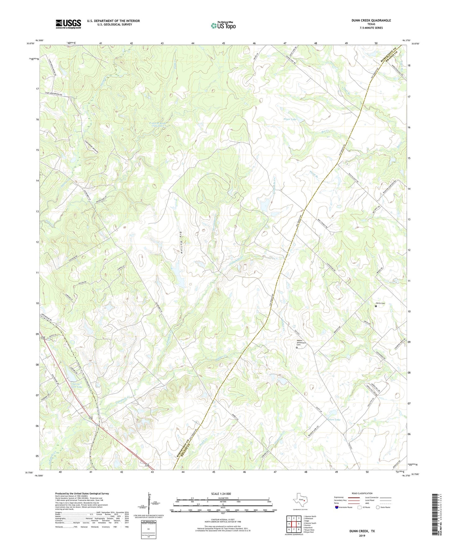
2022 topographic map quadrangle Dunn Creek in the state of Texas. Scale: 1:24000. Based on the newly updated USGS 7.5' US Topo map series, this map is in the following counties: Robertson, Brazos. The map contains contour data, water features, and other items you are used to seeing on USGS maps, but also has updated roads and other features. This is the next generation of topographic maps. Printed on high-quality waterproof paper with UV fade-resistant inks.
Quads adjacent to this one:
West: Hearne South
Northwest: Hearne North
North: Wheelock
Northeast: Edge
East: Kurten
Southeast: Bryan East
South: Bryan West
Southwest: Mumford
This map covers the same area as the classic USGS quad with code o30096g4.
Contains the following named places: Alexander Cemetery, Alexander Church, Dry Hollow, Dunns Fort, Friendship Church, Henry Cemetery, Mount Zion Church, P and M Bank Club Lake, P and M Bank Club Lake Dam, Pecan Branch, Persimmon Creek, Peters Lake, Peters Lake Dam, Pryor Lake, Pryor Lake Dam, Savoy-Gant Lake, Savoy-Gant Lake Dam, Seale Lake, Seale Lake Dam, Walker Creek, Walker Settlement Cemetery