MyTopo
Port Ingleside Texas US Topo Map
Couldn't load pickup availability
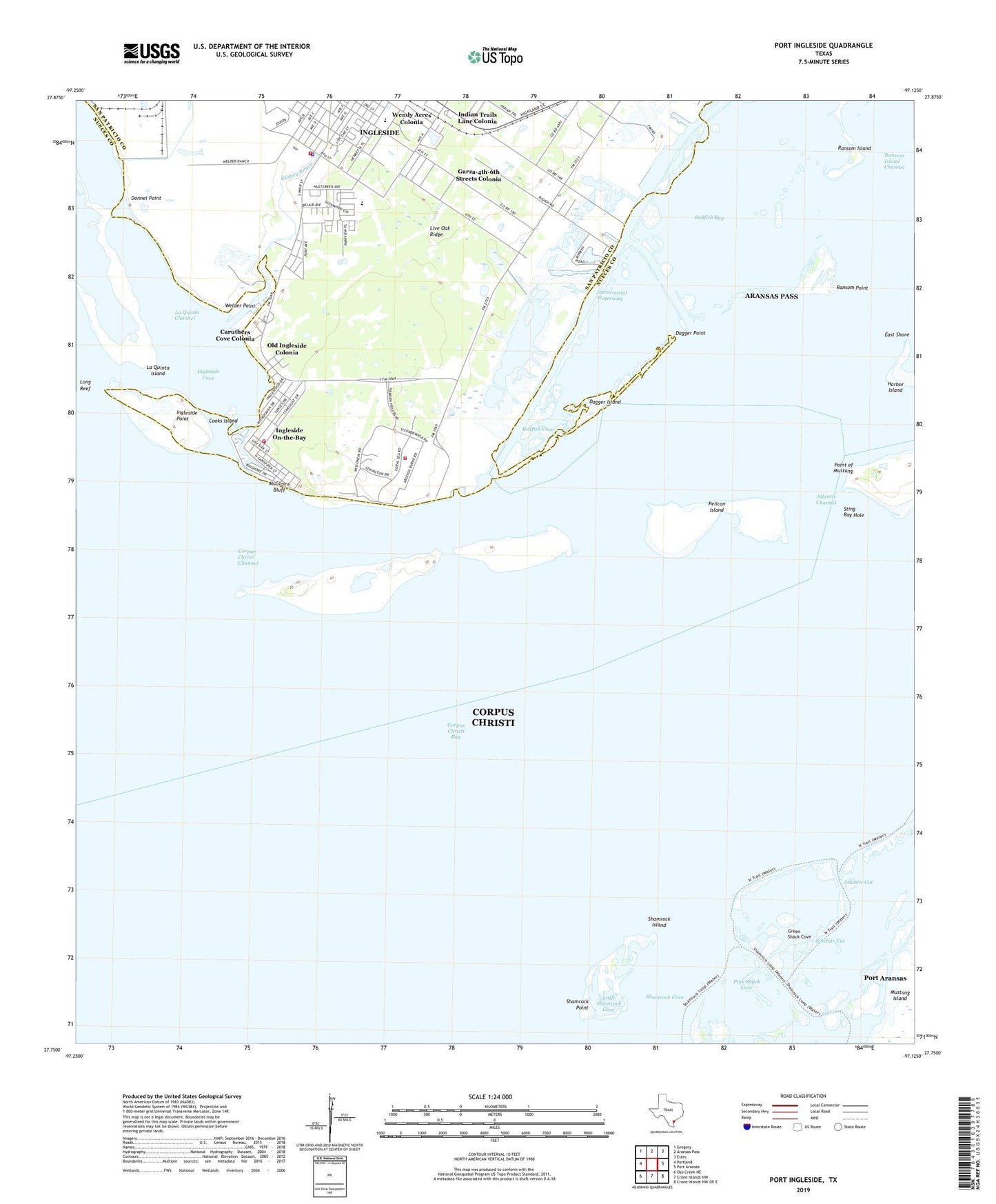
2022 topographic map quadrangle Port Ingleside in the state of Texas. Scale: 1:24000. Based on the newly updated USGS 7.5' US Topo map series, this map is in the following counties: Nueces, San Patricio. The map contains contour data, water features, and other items you are used to seeing on USGS maps, but also has updated roads and other features. This is the next generation of topographic maps. Printed on high-quality waterproof paper with UV fade-resistant inks.
Quads adjacent to this one:
West: Portland
Northwest: Gregory
North: Aransas Pass
Northeast: Estes
East: Port Aransas
Southeast: Crane Islands NW OE E
South: Crane Islands NW
Southwest: Oso Creek NE
This map covers the same area as the classic USGS quad with code o27097g2.
Contains the following named places: Arco Ingleside Shorebase Heliport, Atlantic Channel, Atlantic Cut, Bahia Marina, Caruthers Cove Colonia, City of Ingleside, City of Ingleside on the Bay, Cooks Island, Corpus Christi Channel, Cut B East Lead Light, Cut B East Range Light, Dagger Island, Dagger Point, Donnel Point, Elizabeth Cook Primary School, Garza-4th-6th Streets Colonia, Gilbert J Mircovich Elementary School, Green Shack Cove, Harbor City, Indian Trails Lane Colonia, Ingleside Cove, Ingleside Offshore Services Heliport, Ingleside on the Bay City Hall, Ingleside on the Bay Historical Society Museum, Ingleside on the Bay Volunteer Fire Department, Ingleside On-the-Bay, Ingleside Point, Ingleside Police Department, Ingleside Volunteer Fire Department, Jewell Fulton Canal, Kinney Bayou, La Quinta Channel, Little Shamrock Cove, McGloins Bluff, Naval Station Ingleside, Naval Station Ingleside Fire Department, Navsta Ingleside Heliport, Oak Ridge Heliport, Old Ingleside Colonia, Pelican Island, Pink Shack Cove, Point of Mustang, Port Aransas Division, Port Ingleside, Ransom Island, Ransom Island Channel, Ransom Point, Redfish Cove, Shamrock Cove, Shamrock Island, Shamrock Point, Shamrock Point Light, Sinclair Cut, Sting Ray Hole, Welder Point, Wendy Acres Colonia, ZIP Code: 78362


