MyTopo
Port Aransas Texas US Topo Map
Couldn't load pickup availability
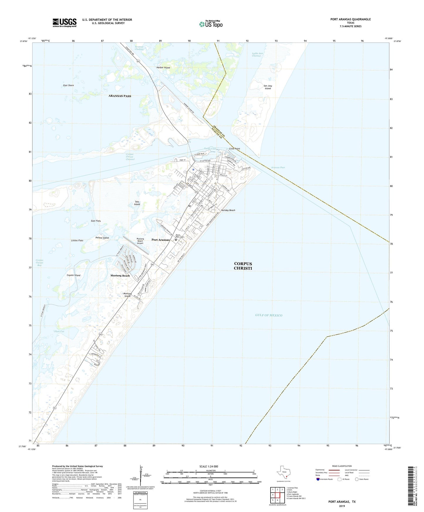
2025 topographic map quadrangle Port Aransas in the state of Texas. Scale: 1:24000. Based on the newly updated USGS 7.5' US Topo map series, this map is in the following counties: Nueces, Aransas. The map contains contour data, water features, and other items you are used to seeing on USGS maps, but also has updated roads and other features. This is the next generation of topographic maps. Printed on high-quality waterproof paper with UV fade-resistant inks.
Quads adjacent to this one:
West: Port Ingleside
Northwest: Aransas Pass
North: Estes
Northeast: Allyns Bight
South: Crane Islands NW OE E
Southwest: Crane Islands NW
This map covers the same area as the classic USGS quad with code o27097g1.
Contains the following named places: Aransas Channel, Aransas Pass, Aransas Pass Light Station, Aransas Pass Lighthouse, Brundrett Middle School, City of Port Aransas, Cline Point, Coyote Island, Deep Sea Headquarters Marina, East Flats, East Shore, Flato Cut, Harbor Island, Holiday Beach, Horace Caldwell Pier, Humble Basin, Inner Basin, Island Moorings Marina, Littles Flats, Lydia Ann Channel, Mustang Beach, Mustang Beach Airport, Mustang Island State Park Trail, North Jetty, Nueces County Constable's Office Precinct 4, Nueces County Park, Olsen Elementary School, Pelone Island, Port Aransas, Port Aransas City Hall, Port Aransas City Marina, Port Aransas EMS, Port Aransas High School, Port Aransas Park, Port Aransas Police Department, Port Aransas Post Office, Royal Palm Cemetery, Salt Island, South Jetty, Sportsplex Marina, Tarpon Inn, Trinity by the Sea Episcopal Church, Turtle Cove, University of Texas Marina, University of Texas Marine Science Institute, ZIP Codes: 78335, 78373