MyTopo
Evant Texas US Topo Map
Couldn't load pickup availability
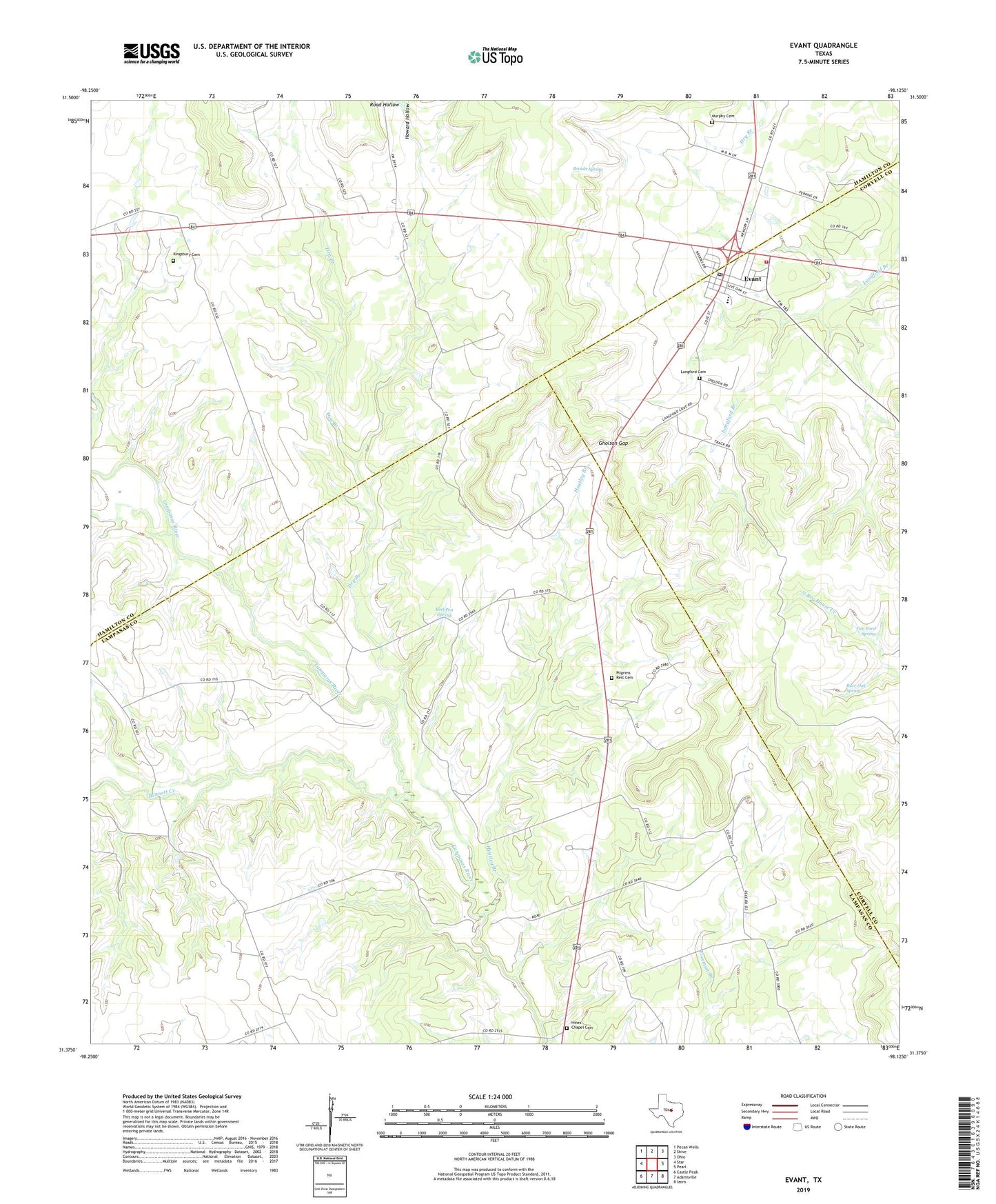
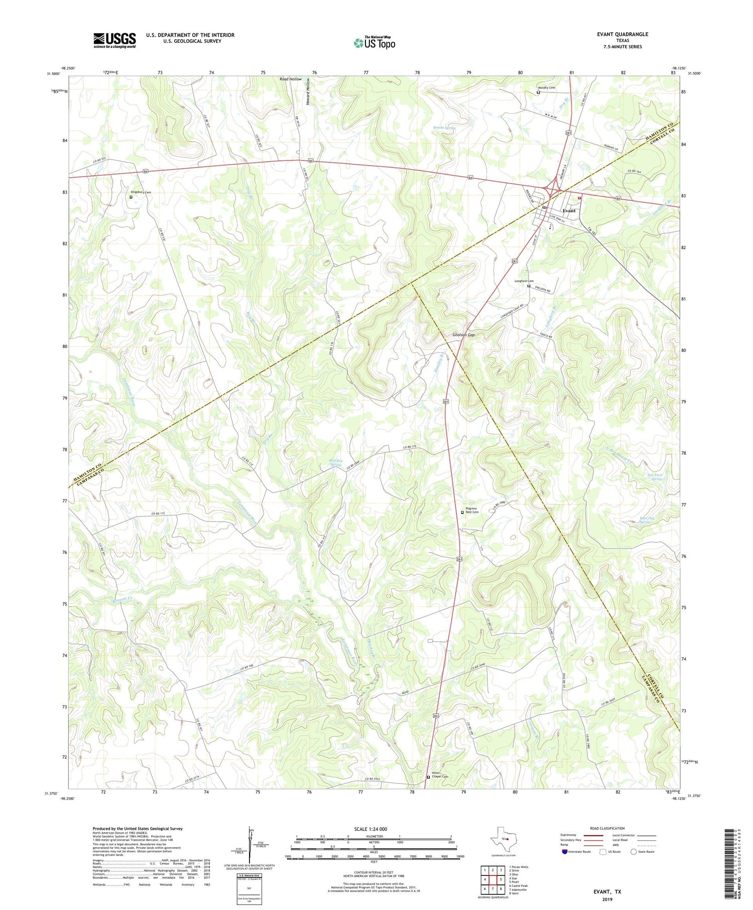
2019 topographic map quadrangle Evant in the state of Texas. Scale: 1:24000. Based on the newly updated USGS 7.5' US Topo map series, this map is in the following counties: Lampasas, Hamilton, Coryell. The map contains contour data, water features, and other items you are used to seeing on USGS maps, but also has updated roads and other features. This is the next generation of topographic maps. Printed on high-quality waterproof paper with UV fade-resistant inks.
Quads adjacent to this one:
West: Star
Northwest: Pecan Wells
North: Shive
Northeast: Ohio
East: Pearl
Southeast: Izoro
South: Adamsville
Southwest: Castle Peak
Contains the following named places: Beef Pen Spring, Bennett Creek, Brooks Spring, Burr Oak Spring, Dry Branch, Evant, Evant City Hall, Evant Post Office, Evant Pumping Station, Evant Volunteer Fire Department, Fairview, Faubion Crossing, Gholson Gap, Heatley Branch, Hines Chapel, Hines Chapel Cemetery, Howard Hollow, Kingsbury Cemetery, Langford Cemetery, Murphy Cemetery, Pilgrims Rest Cemetery, Road Hollow, Tan Yard Spring, Town of Evant, ZIP Code: 76525