MyTopo
Ferris Texas US Topo Map
Couldn't load pickup availability
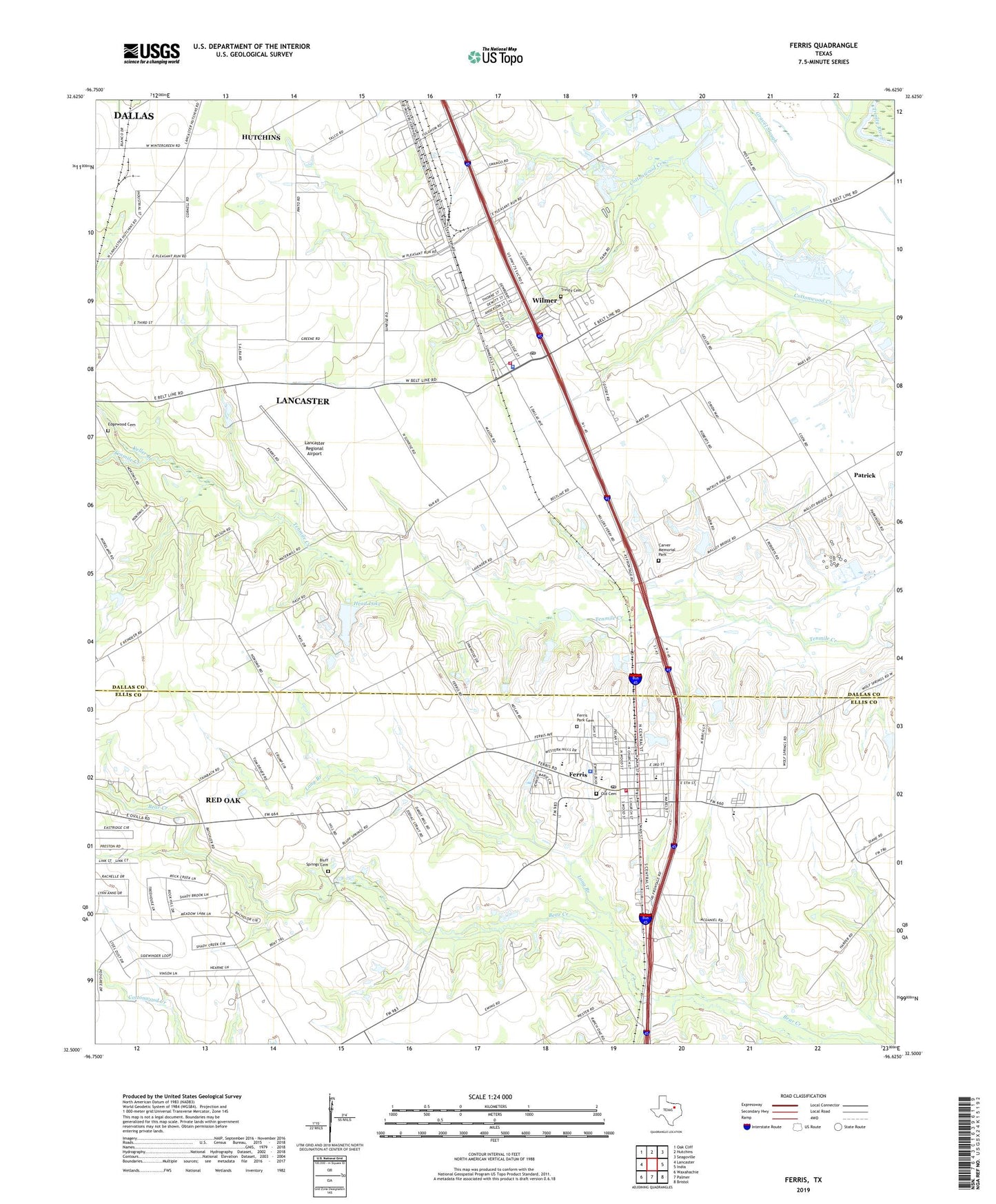
2022 topographic map quadrangle Ferris in the state of Texas. Scale: 1:24000. Based on the newly updated USGS 7.5' US Topo map series, this map is in the following counties: Dallas, Ellis. The map contains contour data, water features, and other items you are used to seeing on USGS maps, but also has updated roads and other features. This is the next generation of topographic maps. Printed on high-quality waterproof paper with UV fade-resistant inks.
Quads adjacent to this one:
West: Lancaster
Northwest: Oak Cliff
North: Hutchins
Northeast: Seagoville
East: India
Southeast: Bristol
South: Palmer
Southwest: Waxahachie
This map covers the same area as the classic USGS quad with code o32096e6.
Contains the following named places: Adams Street Park, Bluff Springs Cemetery, Carver Memorial Park, City of Ferris, City of Wilmer, Cottonwood Park, Dunbar High School, Edgewood Cemetery, Ferris, Ferris City Hall, Ferris Elementary School, Ferris Fire Department, Ferris High School, Ferris Intermediate School, Ferris Junior High School, Ferris Memorial Park, Ferris Park Cemetery, Ferris Police Department, Ferris Post Office, Ferris Street Church of Christ, Head Lake, Head Lake Dam, Keller Branch, Lancaster Intermediate School, Lancaster Regional Airport, Long Branch, Mount Hored Baptist Church, New Friendship Baptist Church, New Mount Zion Baptist Church, Old Cemetery, Patrick, Rocky Crest School, Temple of Truth Church of God in Christ, Trinity Cemetery, W A Strain House, Wilmer, Wilmer City Hall, Wilmer Elementary School, Wilmer Fire Department, Wilmer Police Department, Wilmer Post Office, Yellow Jacket Stadium, ZIP Code: 75172