MyTopo
India Texas US Topo Map
Couldn't load pickup availability
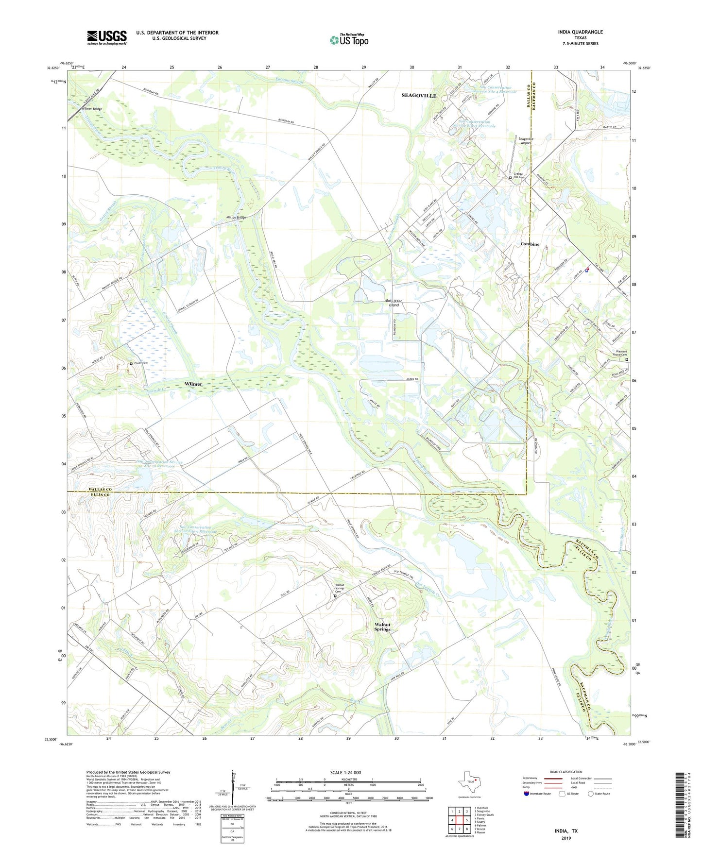
2022 topographic map quadrangle India in the state of Texas. Scale: 1:24000. Based on the newly updated USGS 7.5' US Topo map series, this map is in the following counties: Dallas, Ellis, Kaufman. The map contains contour data, water features, and other items you are used to seeing on USGS maps, but also has updated roads and other features. This is the next generation of topographic maps. Printed on high-quality waterproof paper with UV fade-resistant inks.
Quads adjacent to this one:
West: Ferris
Northwest: Hutchins
North: Seagoville
Northeast: Forney South
East: Scurry
Southeast: Rosser
South: Bristol
Southwest: Palmer
This map covers the same area as the classic USGS quad with code o32096e5.
Contains the following named places: Bois D'Arc Island, City of Combine, Combine, Combine City Hall, Combine Fire Department, Combine Police Department, Cottonwood Creek, Grange Hill Cemetery, Gravel Slough, India, India Branch, KDFT-AM (Ferris), Malloy Bridge, Parsons Slough, Pleasant Grove Cemetery, Point View Church, Pruitt Cemetery, Seagoville Airport, Soil Conservation Service Site 10 Dam, Soil Conservation Service Site 10 Reservoir, Soil Conservation Service Site 3 Dam, Soil Conservation Service Site 3 Reservoir, Soil Conservation Service Site 4 Dam, Soil Conservation Service Site 4 Reservoir, Soil Conservation Service Site 9 Dam, Soil Conservation Service Site 9 Reservoir, Tenmile Creek, Walnut Springs, Walnut Springs Cemetery, Wilmer Bridge, ZIP Codes: 75125, 75159