MyTopo
Palmer Texas US Topo Map
Couldn't load pickup availability
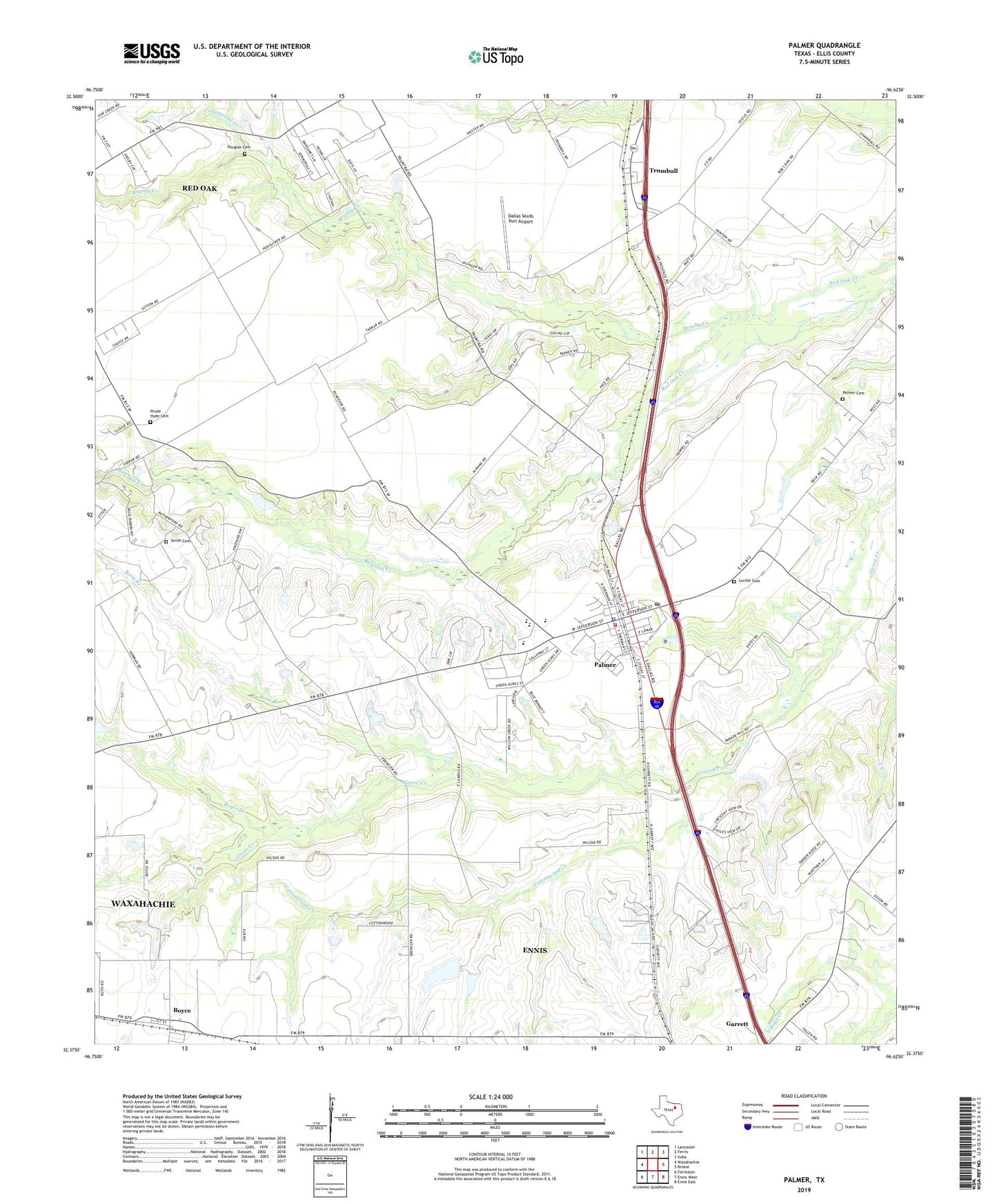
2022 topographic map quadrangle Palmer in the state of Texas. Scale: 1:24000. Based on the newly updated USGS 7.5' US Topo map series, this map is in the following counties: Ellis. The map contains contour data, water features, and other items you are used to seeing on USGS maps, but also has updated roads and other features. This is the next generation of topographic maps. Printed on high-quality waterproof paper with UV fade-resistant inks.
Quads adjacent to this one:
West: Waxahachie
Northwest: Lancaster
North: Ferris
Northeast: India
East: Bristol
Southeast: Ennis East
South: Ennis West
Southwest: Forreston
This map covers the same area as the classic USGS quad with code o32096d6.
Contains the following named places: Bone Branch, Boyce, Boyce Creek, Brushy Creek, Cedar Grove Church, Cottonwood Creek, Dallas South Port Airport, Douglas Cemetery, Ferris Division, Fundamental Baptist Church, Griffith Dam, Griffith Reservoir, Harper Airport, Lucille Cemetery, Palmer, Palmer Cemetery, Palmer City Hall, Palmer Elementary School, Palmer Police Department, Palmer Post Office, Palmer Volunteer Fire Department, Prude Hyde Cemetery, Smith Cemetery, Town of Palmer, Trumbull, ZIP Code: 75152