MyTopo
Flomot Texas US Topo Map
Couldn't load pickup availability
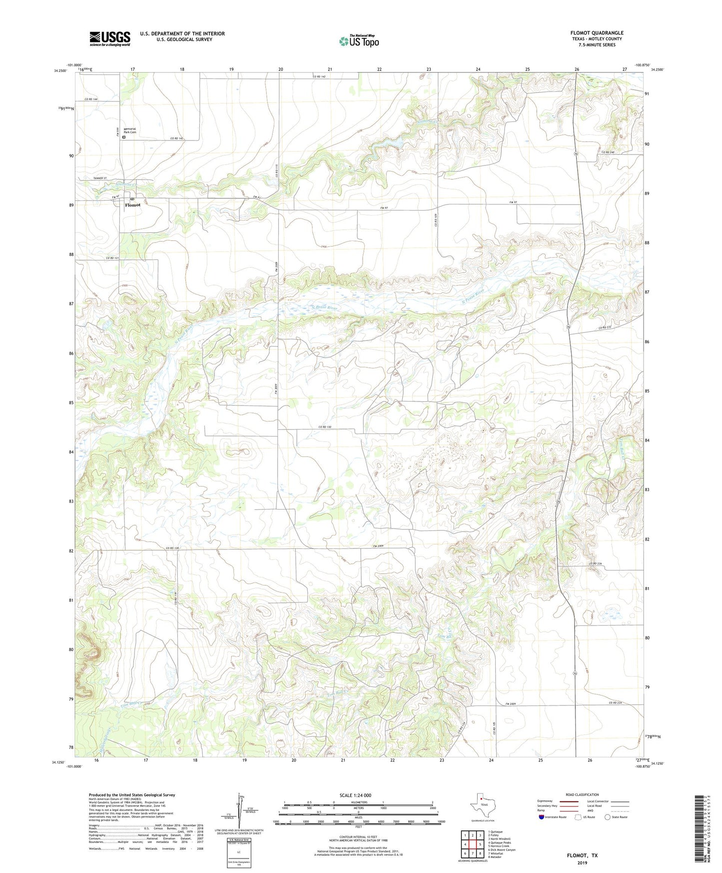
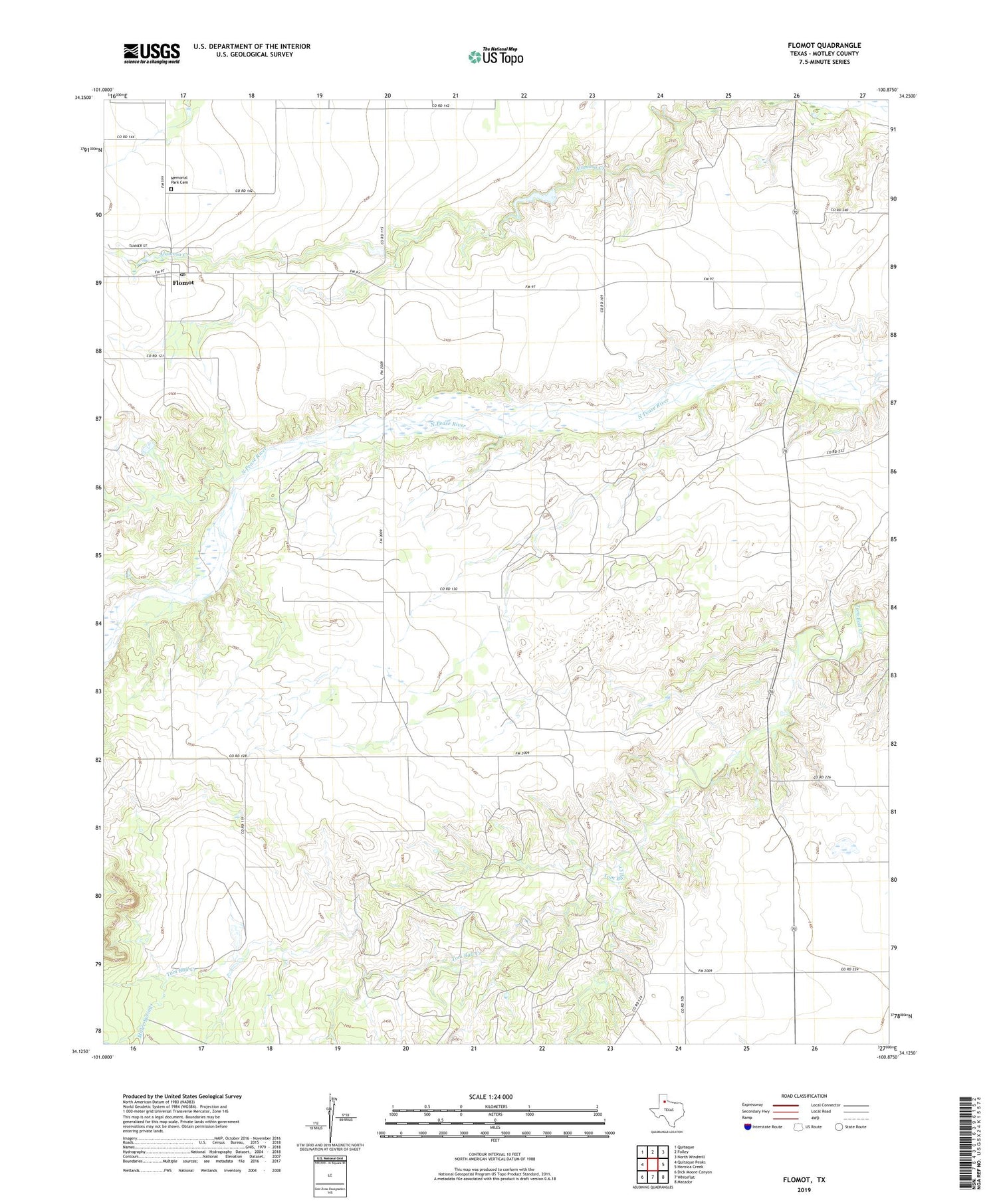
2019 topographic map quadrangle Flomot in the state of Texas. Scale: 1:24000. Based on the newly updated USGS 7.5' US Topo map series, this map is in the following counties: Motley. The map contains contour data, water features, and other items you are used to seeing on USGS maps, but also has updated roads and other features. This is the next generation of topographic maps. Printed on high-quality waterproof paper with UV fade-resistant inks.
Quads adjacent to this one:
West: Quitaque Peaks
Northwest: Quitaque
North: Folley
Northeast: North Windmill
East: Hornica Creek
Southeast: Matador
South: Whiteflat
Southwest: Dick Moore Canyon
Contains the following named places: Flomot, Flomot Post Office, Memorial Park Cemetery, Miller Springs, Twin Windmill, West Windmill, Whitestar, ZIP Code: 79234