MyTopo
Quitaque Peaks Texas US Topo Map
Couldn't load pickup availability
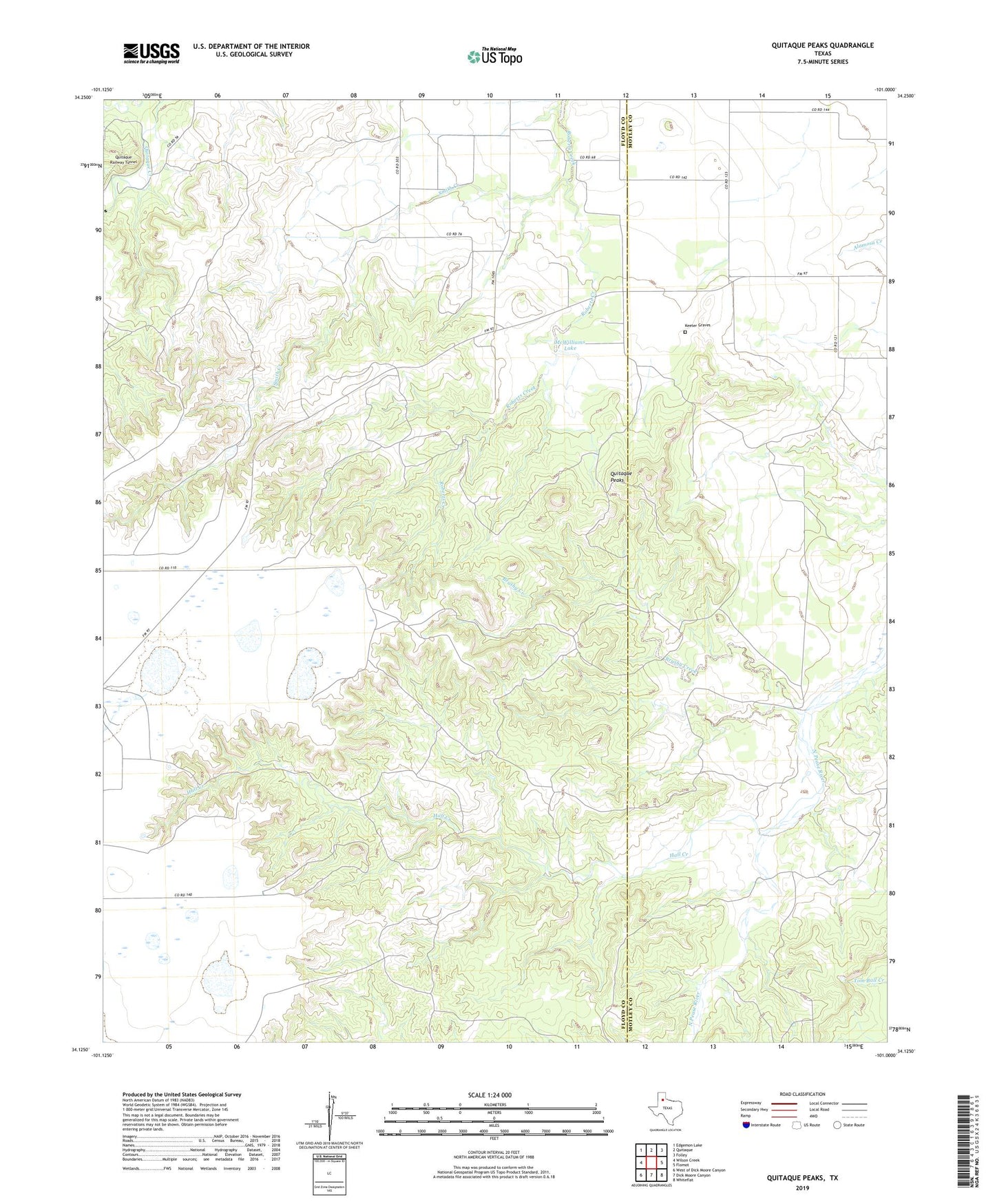
2022 topographic map quadrangle Quitaque Peaks in the state of Texas. Scale: 1:24000. Based on the newly updated USGS 7.5' US Topo map series, this map is in the following counties: Floyd, Motley. The map contains contour data, water features, and other items you are used to seeing on USGS maps, but also has updated roads and other features. This is the next generation of topographic maps. Printed on high-quality waterproof paper with UV fade-resistant inks.
Quads adjacent to this one:
West: Wilson Creek
Northwest: Edgemon Lake
North: Quitaque
Northeast: Folley
Southeast: Whiteflat
South: Dick Moore Canyon
Southwest: West of Dick Moore Canyon
This map covers the same area as the classic USGS quad with code o34101b1.
Contains the following named places: Brushy Creek, Hall Creek, Keeter Graves, McWilliams Lake, McWilliams Lake Dam, Quitaque Peaks, Quitaque Railway Tunnel, Smith Creek, Turkey Creek