MyTopo
Matador Texas US Topo Map
Couldn't load pickup availability
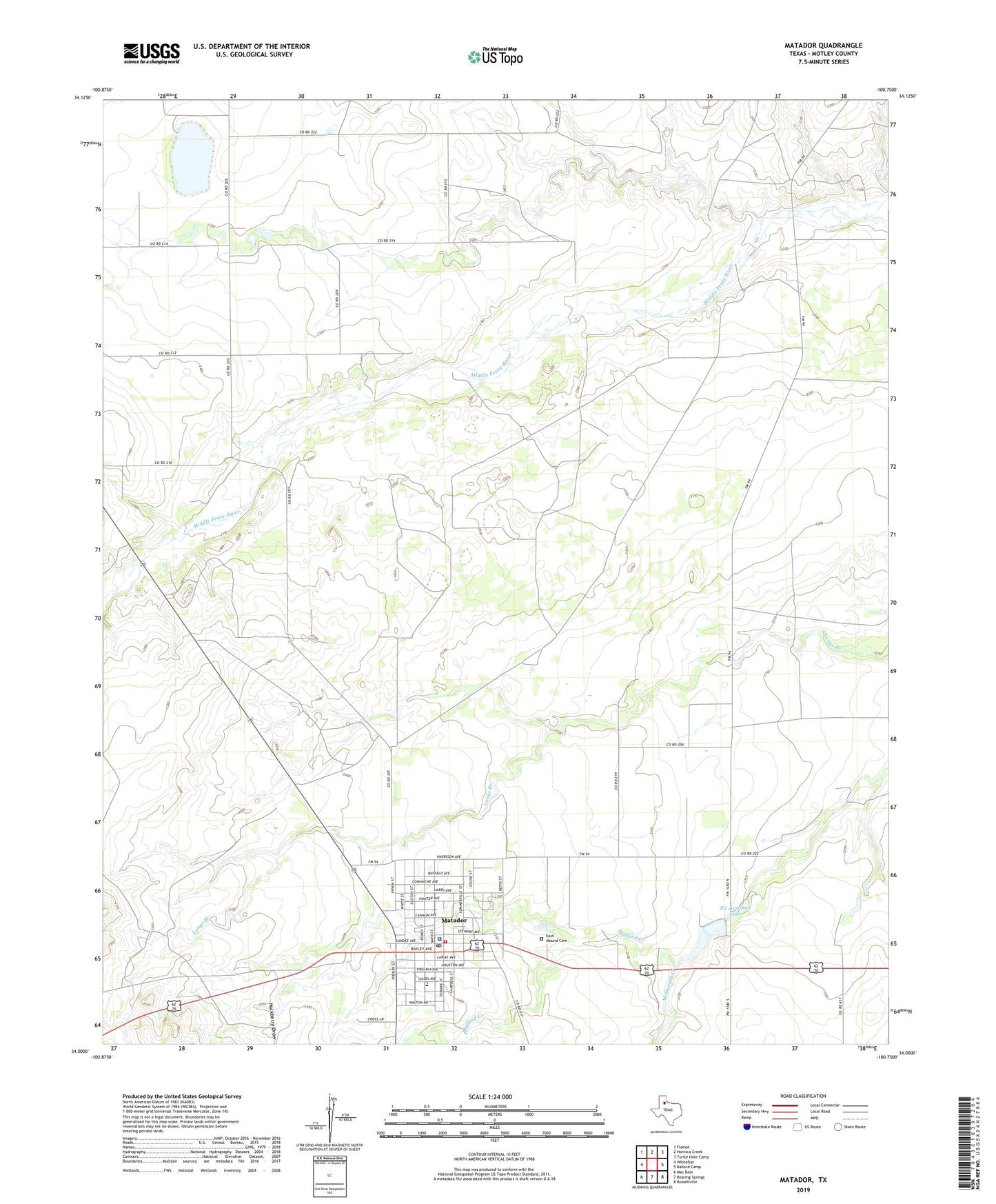
2022 topographic map quadrangle Matador in the state of Texas. Scale: 1:24000. Based on the newly updated USGS 7.5' US Topo map series, this map is in the following counties: Motley. The map contains contour data, water features, and other items you are used to seeing on USGS maps, but also has updated roads and other features. This is the next generation of topographic maps. Printed on high-quality waterproof paper with UV fade-resistant inks.
Quads adjacent to this one:
West: Whiteflat
Northwest: Flomot
North: Hornica Creek
Northeast: Turtle Hole Camp
East: Ballard Camp
Southeast: Russellville
South: Roaring Springs
Southwest: Mac Bain
This map covers the same area as the classic USGS quad with code o34100a7.
Contains the following named places: East Mound Cemetery, Ed Jameson Lake, Ed Jameson Lake Dam, Hackberry Draw, Matador, Matador City Hall, Matador Post Office, Matador Volunteer Fire Department, McDonald Creek, Motley County, Motley County Ambulance Service, Motley County Historical Museum, Motley County Jail, Motley County Jail Museum, Motley County Sheriff's Office, Town of Matador, Traweek House, ZIP Code: 79244