MyTopo
Whiteflat Texas US Topo Map
Couldn't load pickup availability
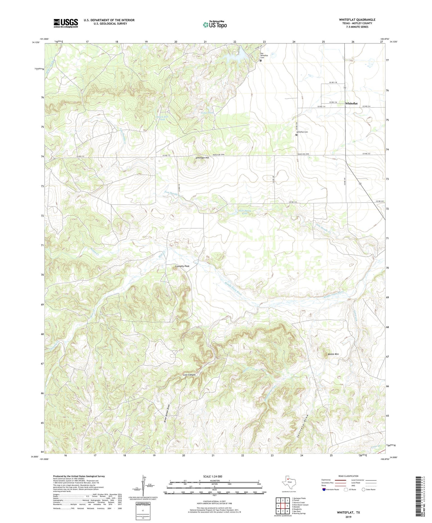
2022 topographic map quadrangle Whiteflat in the state of Texas. Scale: 1:24000. Based on the newly updated USGS 7.5' US Topo map series, this map is in the following counties: Motley. The map contains contour data, water features, and other items you are used to seeing on USGS maps, but also has updated roads and other features. This is the next generation of topographic maps. Printed on high-quality waterproof paper with UV fade-resistant inks.
Quads adjacent to this one:
West: Dick Moore Canyon
Northwest: Quitaque Peaks
North: Flomot
Northeast: Hornica Creek
East: Matador
Southeast: Roaring Springs
South: Mac Bain
Southwest: Dougherty
This map covers the same area as the classic USGS quad with code o34100a8.
Contains the following named places: Antelope Hill, Boggy Creek, Boone Mountain, Bull Cod Windmill, Cedar Tank, Cedar Windmill, Chimney Creek, Connally Peak, Dripping Springs, Hackberry Windmill, Hawk Hill Tank, Horner Lake, Horner Lake Dam, Jack Spray Lake, Jack Spray Lake Dam, Jesse James Draw, Lost Canyon, Miller Springs Windmill, Mott Creek, Old Whiteflat Cemetery, Rincon Windmill, Salt Creek, Shinnery Draw, Stokes Windmill, Tom Handle Creek, Whiteflat, Whiteflat Cemetery