MyTopo
Gatesville West Texas US Topo Map
Couldn't load pickup availability
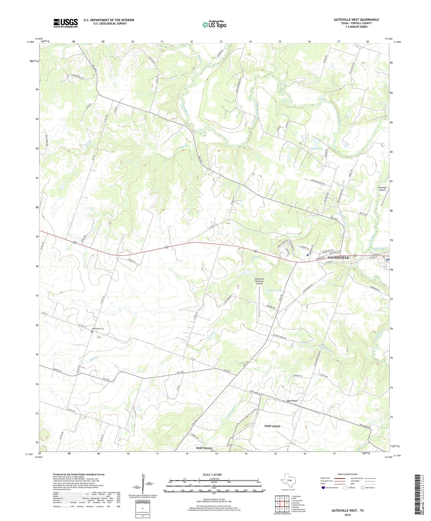
2022 topographic map quadrangle Gatesville West in the state of Texas. Scale: 1:24000. Based on the newly updated USGS 7.5' US Topo map series, this map is in the following counties: Coryell. The map contains contour data, water features, and other items you are used to seeing on USGS maps, but also has updated roads and other features. This is the next generation of topographic maps. Printed on high-quality waterproof paper with UV fade-resistant inks.
Quads adjacent to this one:
West: Purmela
Northwest: Jonesboro
North: Ater
Northeast: Turnersville
East: Gatesville East
Southeast: North Fort Hood
South: Shell Mountains
Southwest: Pidcoke
This map covers the same area as the classic USGS quad with code o31097d7.
Contains the following named places: Anchor Lake, Anchor Lake Dam, Angelina National Forest Trail, Bald Knob, Blue Branch, Calvary Church, Coryell County, Coryell County Constable's Office Precincts 3 and 4, Coryell County Jail, Coryell County Sheriff's Office, Coryell Memorial Hospital, Cottonwood Creek, Dodd Branch, First Lutheran Church, Gatesville Municipal Airport, Hay Valley Church, Hemelline Cemetery, Keener Chapel, Plum Creek, Standlee Chapel, Stillhouse Branch, Walker Lake, Walker Lake Dam, ZIP Code: 76528