MyTopo
German Valley Texas US Topo Map
Couldn't load pickup availability
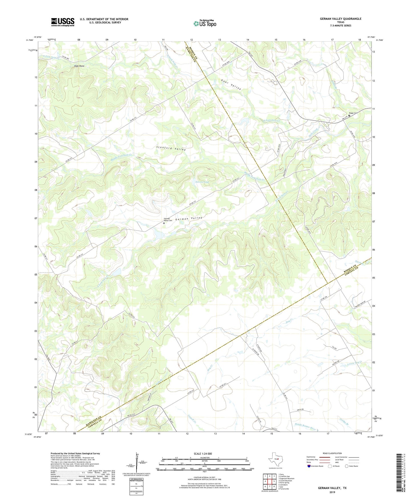
2022 topographic map quadrangle German Valley in the state of Texas. Scale: 1:24000. Based on the newly updated USGS 7.5' US Topo map series, this map is in the following counties: Hamilton, Bosque, Coryell. The map contains contour data, water features, and other items you are used to seeing on USGS maps, but also has updated roads and other features. This is the next generation of topographic maps. Printed on high-quality waterproof paper with UV fade-resistant inks.
Quads adjacent to this one:
West: Cutoff Mountain
Northwest: Fairy
North: Cranfills Gap
Northeast: Sugarloaf Mountain
East: Hurst Spring
Southeast: Turnersville
South: Ater
Southwest: Jonesboro
This map covers the same area as the classic USGS quad with code o31097f7.
Contains the following named places: Boggy Cemetery, German Valley, German Valley Cemetery, Goar Valley, Goar Valley Polling Booth, High Point, Martin Larson House, Middle Fork Neils Creek, North Fork Neils Creek, South Fork Neils Creek, Stanford Valley, Stevens Lake, Stevens Lake Dam