MyTopo
Gettysburg Peak Texas US Topo Map
Couldn't load pickup availability
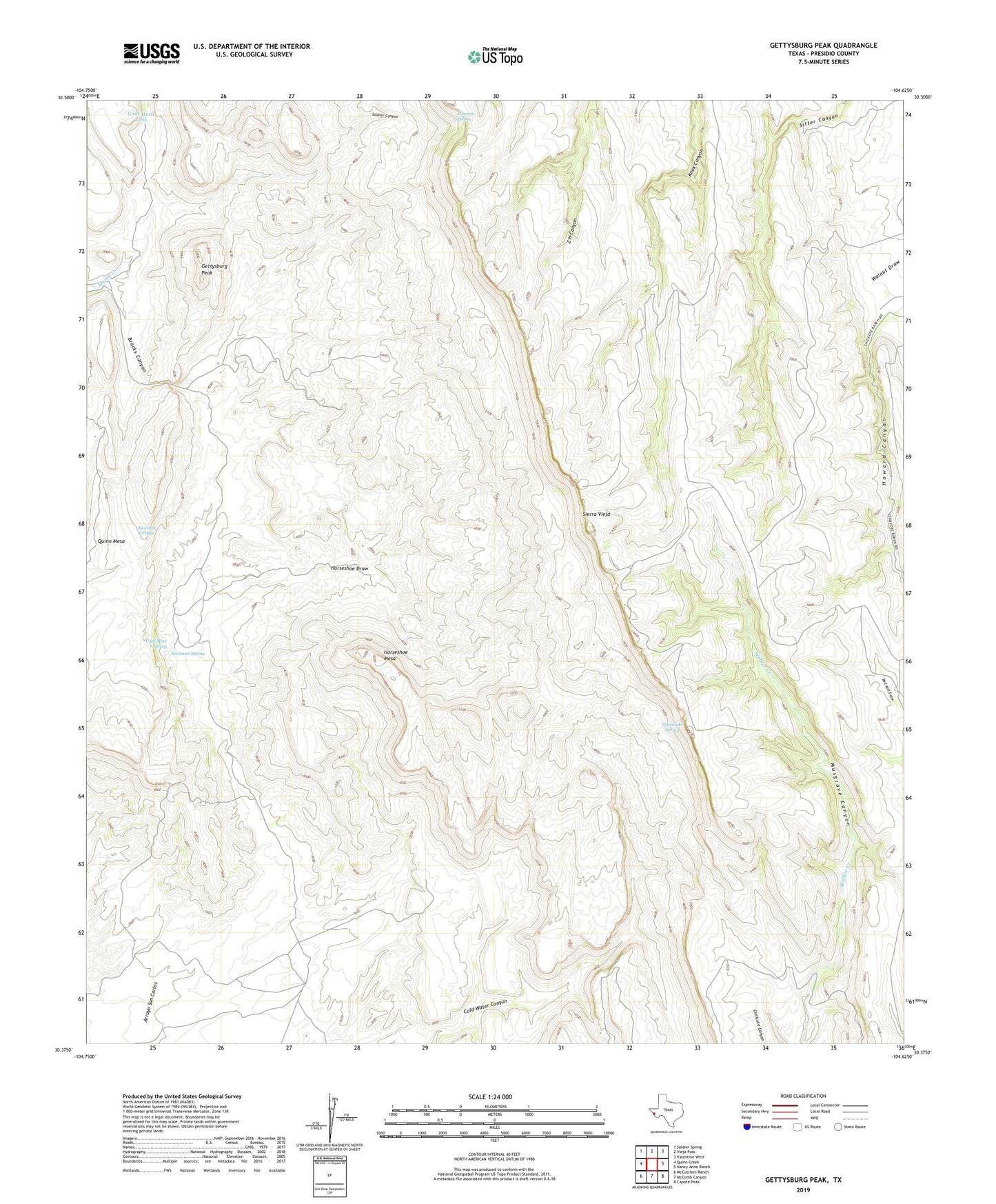
2022 topographic map quadrangle Gettysburg Peak in the state of Texas. Scale: 1:24000. Based on the newly updated USGS 7.5' US Topo map series, this map is in the following counties: Presidio. The map contains contour data, water features, and other items you are used to seeing on USGS maps, but also has updated roads and other features. This is the next generation of topographic maps. Printed on high-quality waterproof paper with UV fade-resistant inks.
Quads adjacent to this one:
West: Quinn Creek
Northwest: Soldier Spring
North: Vieja Pass
Northeast: Valentine West
East: Nancy Anne Ranch
Southeast: Capote Peak
South: McComb Canyon
Southwest: McCutchen Ranch
This map covers the same area as the classic USGS quad with code o30104d6.
Contains the following named places: Bracks Canyon, Chiticote Ranch, Coal Mine Ranch, Coal Mine Spring, Gettysburg Peak, Goat Herd Tank, Horseshoe Draw, Horseshoe Mesa, Maurita Spring, Newman Spring, Newman Springs, Quemado Spring, San Carlos Mine, Sierra Vieja, Toro Windmill, Tunnel Windmill