MyTopo
Vieja Pass Texas US Topo Map
Couldn't load pickup availability
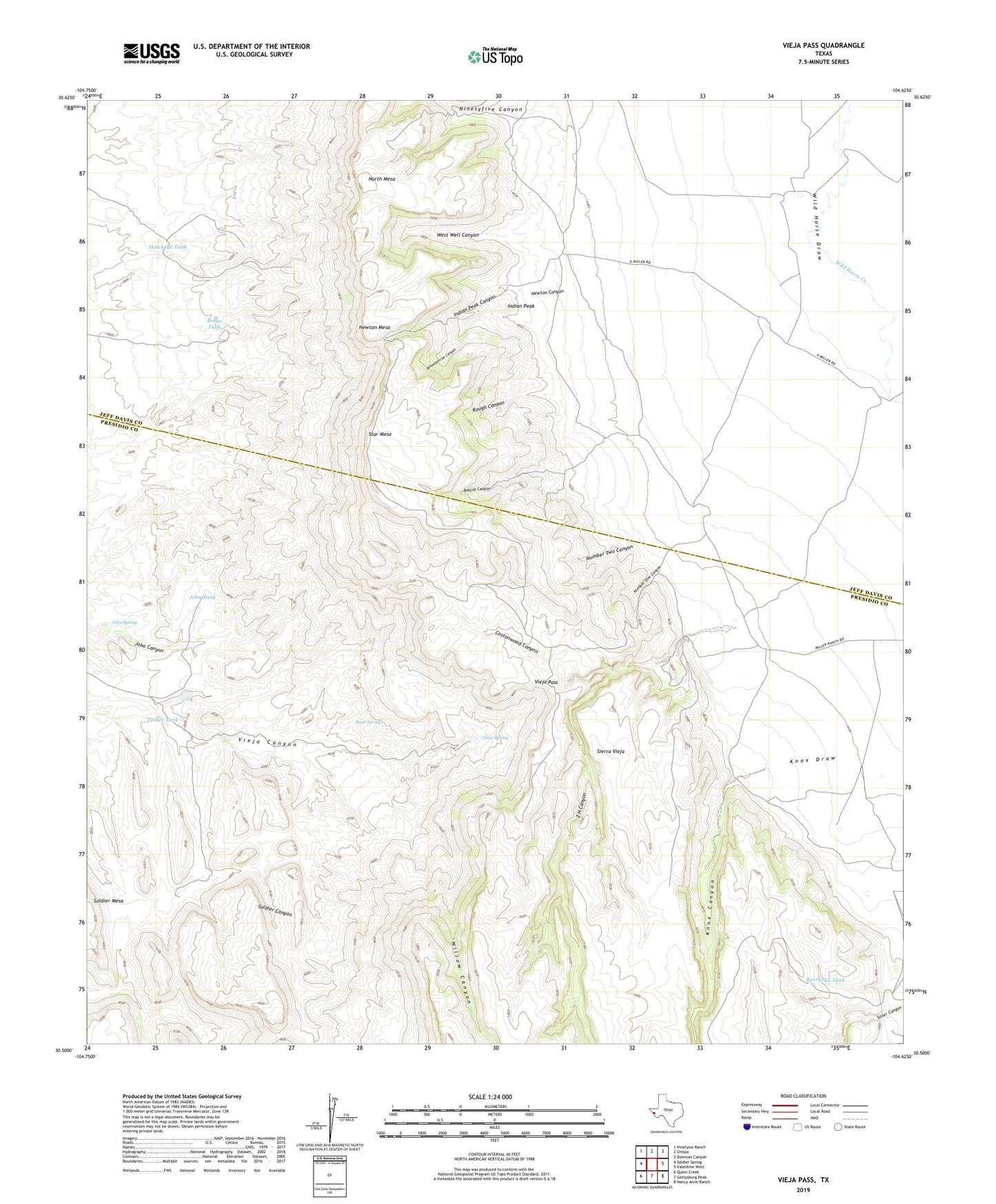
2022 topographic map quadrangle Vieja Pass in the state of Texas. Scale: 1:24000. Based on the newly updated USGS 7.5' US Topo map series, this map is in the following counties: Presidio, Jeff Davis. The map contains contour data, water features, and other items you are used to seeing on USGS maps, but also has updated roads and other features. This is the next generation of topographic maps. Printed on high-quality waterproof paper with UV fade-resistant inks.
Quads adjacent to this one:
West: Soldier Spring
Northwest: Ninetysix Ranch
North: Chispa
Northeast: Dowman Canyon
East: Valentine West
Southeast: Nancy Anne Ranch
South: Gettysburg Peak
Southwest: Quinn Creek
This map covers the same area as the classic USGS quad with code o30104e6.
Contains the following named places: Bear Springs, Bobcat Canyon, Bobcat Canyon Windmill, Borracha Tank, Broke Tank, Cottonwood Canyon, Hawkeye Tank, Hidden Windmill, Indian Peak, Indian Peak Canyon, Joho Spring, Joho Tank, Knox Canyon, Miller Ranch, Newton Canyon, Newton Mesa, Ninetyfive Canyon, North Mesa, Number One Canyon, Number Two Canyon, Rough Canyon, Star Mesa, Tinker Tank, Vieja Pass, Vieja Spring, West Well Canyon, Wheelbarrow Canyon, Willow Canyon, Z H Canyon, ZIP Code: 79854