MyTopo
Gorman Texas US Topo Map
Couldn't load pickup availability
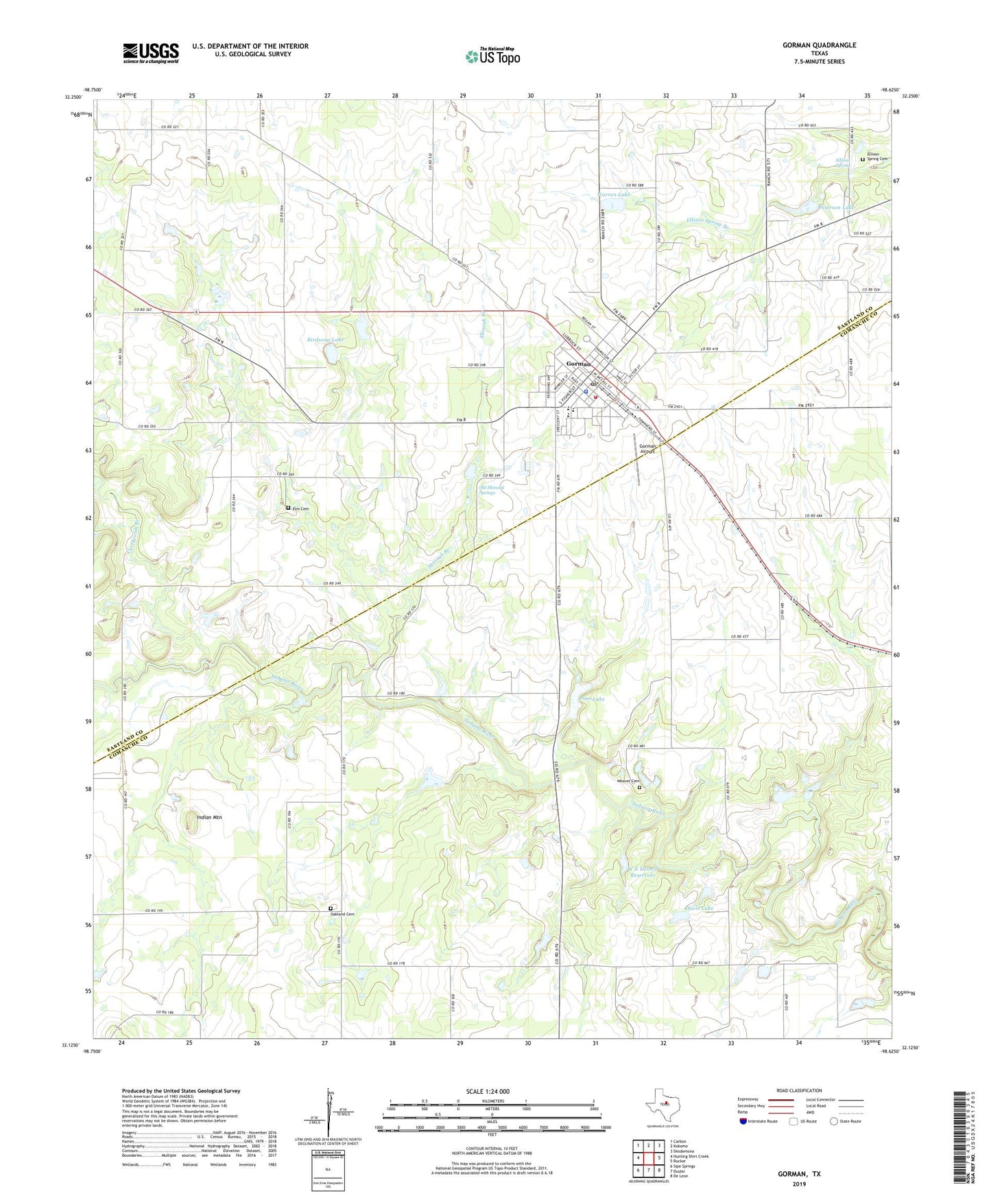
2019 topographic map quadrangle Gorman in the state of Texas. Scale: 1:24000. Based on the newly updated USGS 7.5' US Topo map series, this map is in the following counties: Comanche, Eastland. The map contains contour data, water features, and other items you are used to seeing on USGS maps, but also has updated roads and other features. This is the next generation of topographic maps. Printed on high-quality waterproof paper with UV fade-resistant inks.
Quads adjacent to this one:
West: Hunting Shirt Creek
Northwest: Carbon
North: Kokomo
Northeast: Desdemona
East: Rucker
Southeast: De Leon
South: Duster
Southwest: Sipe Springs
Contains the following named places: Birdsong Dam, Birdsong Lake, City of Gorman, Currycomb Branch, Davis Lake, Davis Lake Dam, Ellison Spring, Ellison Spring Cemetery, Ellison Springs, Elm Cemetery, Gorman, Gorman Airport, Gorman High School, Gorman Police Department, Gorman Post Office, Gorman Volunteer Fire Department, Indian Mountain, Maxfield Elementary School, New Hope Baptist Church, New Hope Church, Oakland Cemetery, Old Shinoak Springs, Peterson Dam, Peterson Lake, Pino Lake, Pino Lake Dam, Rock Bluff Church, Shinoak Branch, W E Dennis Dam, W E Dennis Reservoir, Warren Dam, Warren Lake, Weaver Cemetery, ZIP Code: 76454