MyTopo
Granger Texas US Topo Map
Couldn't load pickup availability
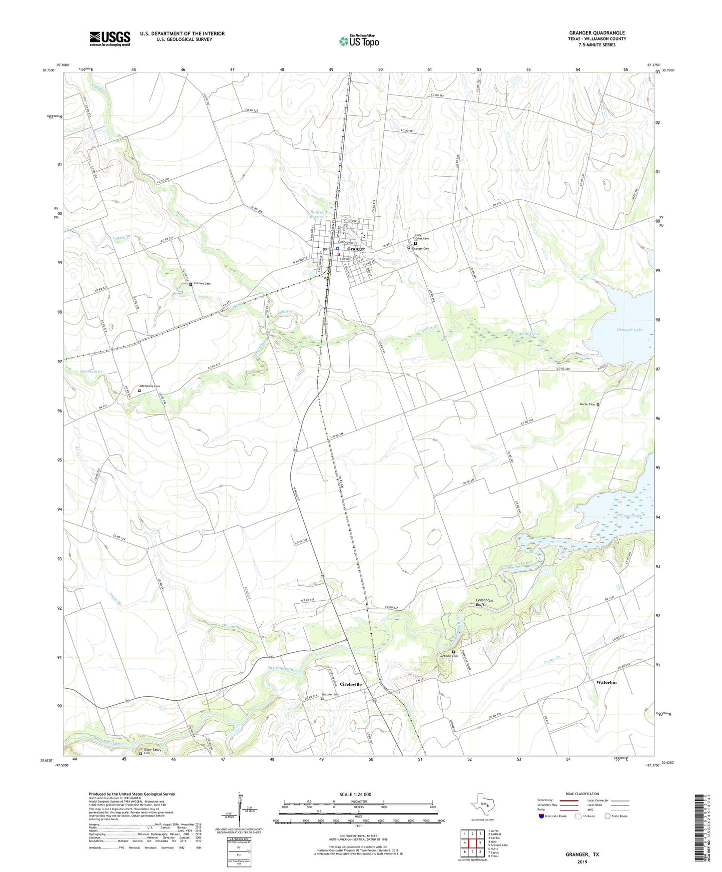
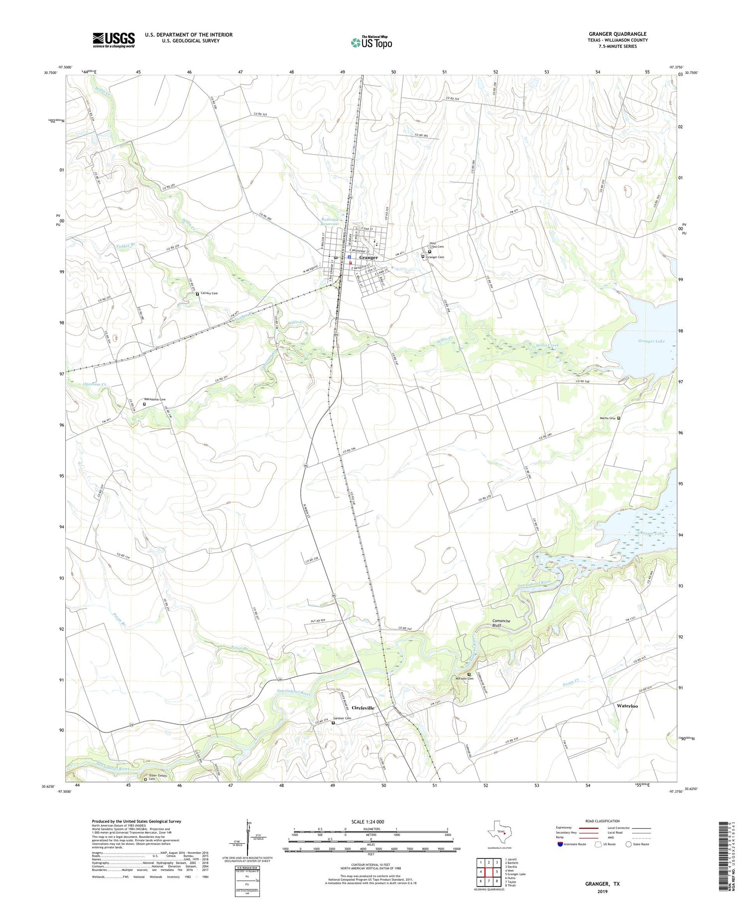
2019 topographic map quadrangle Granger in the state of Texas. Scale: 1:24000. Based on the newly updated USGS 7.5' US Topo map series, this map is in the following counties: Williamson. The map contains contour data, water features, and other items you are used to seeing on USGS maps, but also has updated roads and other features. This is the next generation of topographic maps. Printed on high-quality waterproof paper with UV fade-resistant inks.
Quads adjacent to this one:
West: Weir
Northwest: Jarrell
North: Bartlett
Northeast: Davilla
East: Granger Lake
Southeast: Thrall
South: Taylor
Southwest: Hutto
Contains the following named places: Calvary Cemetery, Circleville, City of Granger, Comanche Bluff, Crispus Attucks School, Gardner Cemetery, Granger, Granger Cemetery, Granger City Hall, Granger Division, Granger Police Department, Granger Post Office, Granger Volunteer Fire Department, Holy Cross Cemetery, Hoxie Bridge, Macedonia Cemetery, Machu Cemetery, McFadin Cemetery, McFadin House, Opossum Creek, Pecan Branch, Railroad Reservoir, Railroad Reservoir Dam, San Gabriel Wildlife Area, Sloan- Easley Cemetery, Vitek Field Airport, Waterloo, Willis Creek Park, Willis Creek Wildlife Area, Yankee Branch, ZIP Code: 76530