MyTopo
Davilla Texas US Topo Map
Couldn't load pickup availability
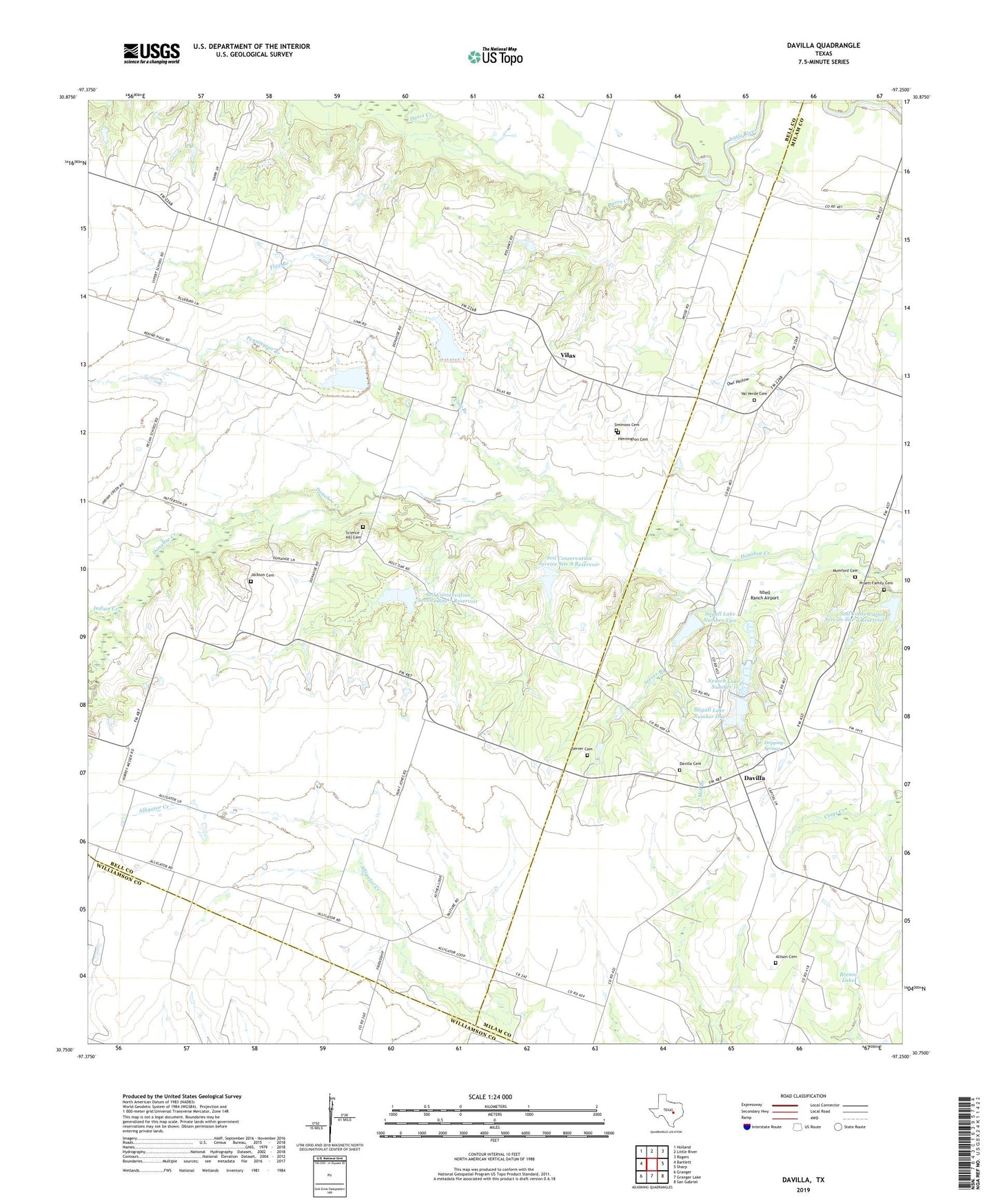
2022 topographic map quadrangle Davilla in the state of Texas. Scale: 1:24000. Based on the newly updated USGS 7.5' US Topo map series, this map is in the following counties: Bell, Milam, Williamson. The map contains contour data, water features, and other items you are used to seeing on USGS maps, but also has updated roads and other features. This is the next generation of topographic maps. Printed on high-quality waterproof paper with UV fade-resistant inks.
Quads adjacent to this one:
West: Bartlett
Northwest: Holland
North: Little River
Northeast: Rogers
East: Sharp
Southeast: San Gabriel
South: Granger Lake
Southwest: Granger
This map covers the same area as the classic USGS quad with code o30097g3.
Contains the following named places: Allison Cemetery, Brenni Lake, Darrs Creek, Davilla, Davilla Cemetery, Davilla Post Office, Donahoe, Dripping Springs, Flag Branch, Hennington Cemetery, Indian Creek, Isbell Ranch Airport, Jackson Cemetery, Mill Branch, Mumford Cemetery, Neusch Lake Number 1, Neusch Lake Number 1 Dam, Pennington Branch, Pruett Family Cemetery, Science Hill Cemetery, Server Branch, Server Cemetery, Simmons Cemetery, Soil Conservation Service Site 5 Dam, Soil Conservation Service Site 5 Reservoir, Soil Conservation Service Site 6 Dam, Soil Conservation Service Site 6 Reservoir, Soil Conservation Service Site 7 Dam, Soil Conservation Service Site 7 Reservoir, Soil Conservation Service Site 8 Dam, Soil Conservation Service Site 8 Reservoir, Soil Conservation Service Site 9 Dam, Soil Conservation Service Site 9 Reservoir, Stigall Lake Number 2 Dam, Stigall Lake Number One, Stigall Lake Number Two, Val Verde Cemetery, Val Verde Church, Vilas, ZIP Code: 76523