MyTopo
Boggy Creek Texas US Topo Map
Couldn't load pickup availability
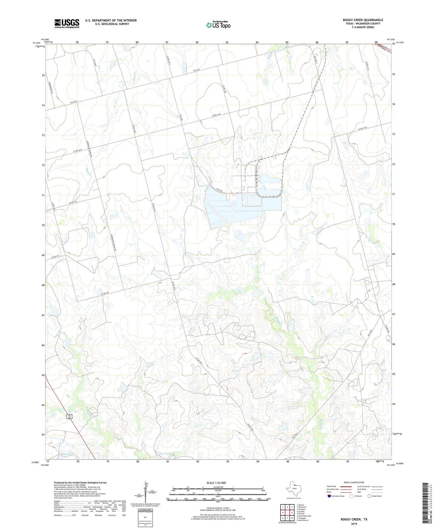
2022 topographic map quadrangle Boggy Creek in the state of Texas. Scale: 1:24000. Based on the newly updated USGS 7.5' US Topo map series, this map is in the following counties: Wilbarger. The map contains contour data, water features, and other items you are used to seeing on USGS maps, but also has updated roads and other features. This is the next generation of topographic maps. Printed on high-quality waterproof paper with UV fade-resistant inks.
Quads adjacent to this one:
West: Lockett
Northwest: Vernon
North: Oklaunion
Northeast: Davidson
East: Harrold
Southeast: Lake Electra
South: Grayback
Southwest: Santa Rosa Lake
This map covers the same area as the classic USGS quad with code o34099a2.
Contains the following named places: Flax Tank, Stone Tank, Wilbarger County