MyTopo
Kamey Texas US Topo Map
Couldn't load pickup availability
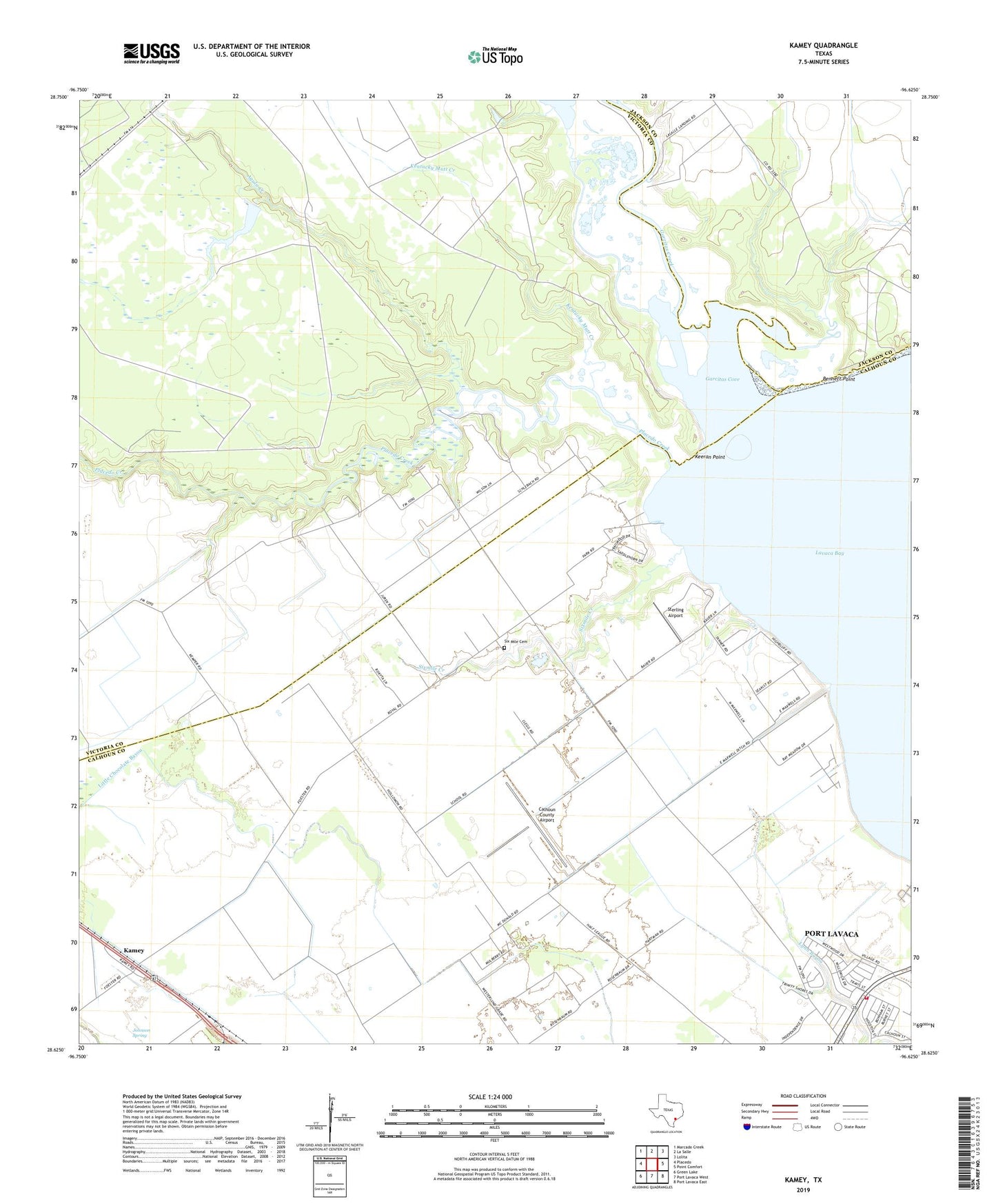
2022 topographic map quadrangle Kamey in the state of Texas. Scale: 1:24000. Based on the newly updated USGS 7.5' US Topo map series, this map is in the following counties: Calhoun, Victoria, Jackson. The map contains contour data, water features, and other items you are used to seeing on USGS maps, but also has updated roads and other features. This is the next generation of topographic maps. Printed on high-quality waterproof paper with UV fade-resistant inks.
Quads adjacent to this one:
West: Placedo
Northwest: Marcado Creek
North: La Salle
Northeast: Lolita
East: Point Comfort
Southeast: Port Lavaca East
South: Port Lavaca West
Southwest: Green Lake
This map covers the same area as the classic USGS quad with code o28096f6.
Contains the following named places: Agula Creek, Bennett Point, Calhoun County Airport, First Baptist Church, Garcitas Cove, Garcitas Creek, Johnson Spring, Kamey, Keeran Point, Kentucky Mutt Creek, Placedo Creek, Port Lavaca Fire Department Station 2, Six Mile A / G Christian School, Six Mile Cemetery, Sixmile, Sixmile Church, Sixmile Creek, Sterling Airport, Texas No Name Number 44 Dam