MyTopo
Hackberry Lake Texas US Topo Map
Couldn't load pickup availability
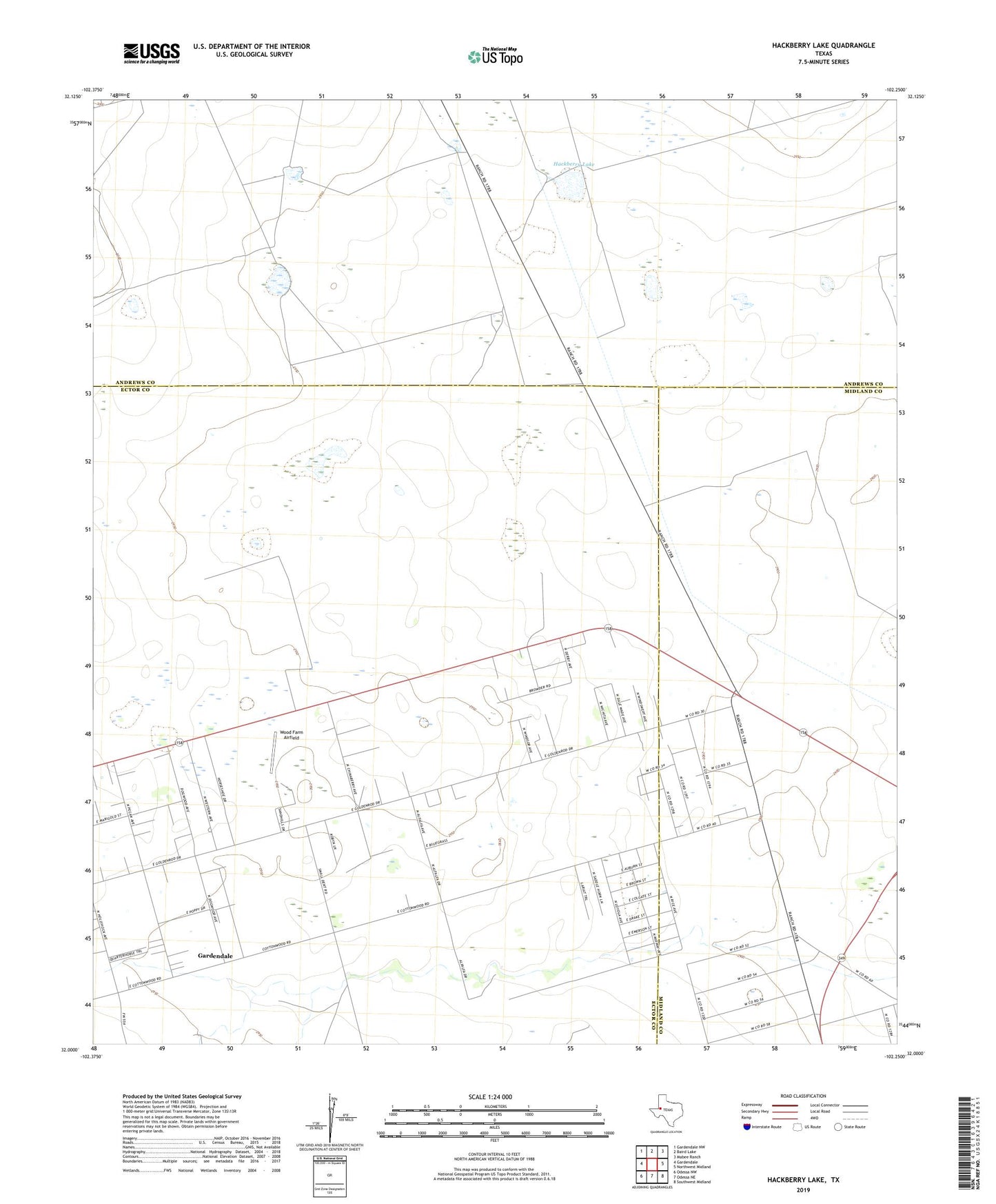
2022 topographic map quadrangle Hackberry Lake in the state of Texas. Scale: 1:24000. Based on the newly updated USGS 7.5' US Topo map series, this map is in the following counties: Ector, Andrews, Midland. The map contains contour data, water features, and other items you are used to seeing on USGS maps, but also has updated roads and other features. This is the next generation of topographic maps. Printed on high-quality waterproof paper with UV fade-resistant inks.
Quads adjacent to this one:
West: Gardendale
Northwest: Gardendale NW
North: Baird Lake
Northeast: Mabee Ranch
East: Northwest Midland
Southeast: Southwest Midland
South: Odessa NE
Southwest: Odessa NW
This map covers the same area as the classic USGS quad with code o32102a3.
Contains the following named places: Country Chapel Church, Gardendale Census Designated Place, Hackberry Lake, Hackberry Windmill, Horse Well, Hunter Well, KCRS-FM (Midland), KMID-TV (Midland), KMLM-TV (Odessa), KNFM-FM (Midland), KPEJ-TV (Odessa), KQIP-FM (Odessa), New Windmill, North Well, North Windmill, South Camp Windmill, South Windmill, Thomas Windmill, Tower Windmill, West Windmill, Willow Well, Windmill Number Eight, Windmill Number Seven, Windmill Number Six, Windmill Number Sixtyeight, Windmill Number Twentyfour, Windmill Number Twentyseven, Windmill Number Twentytwo, Wood Farm Airfield