MyTopo
Hagansport Texas US Topo Map
Couldn't load pickup availability
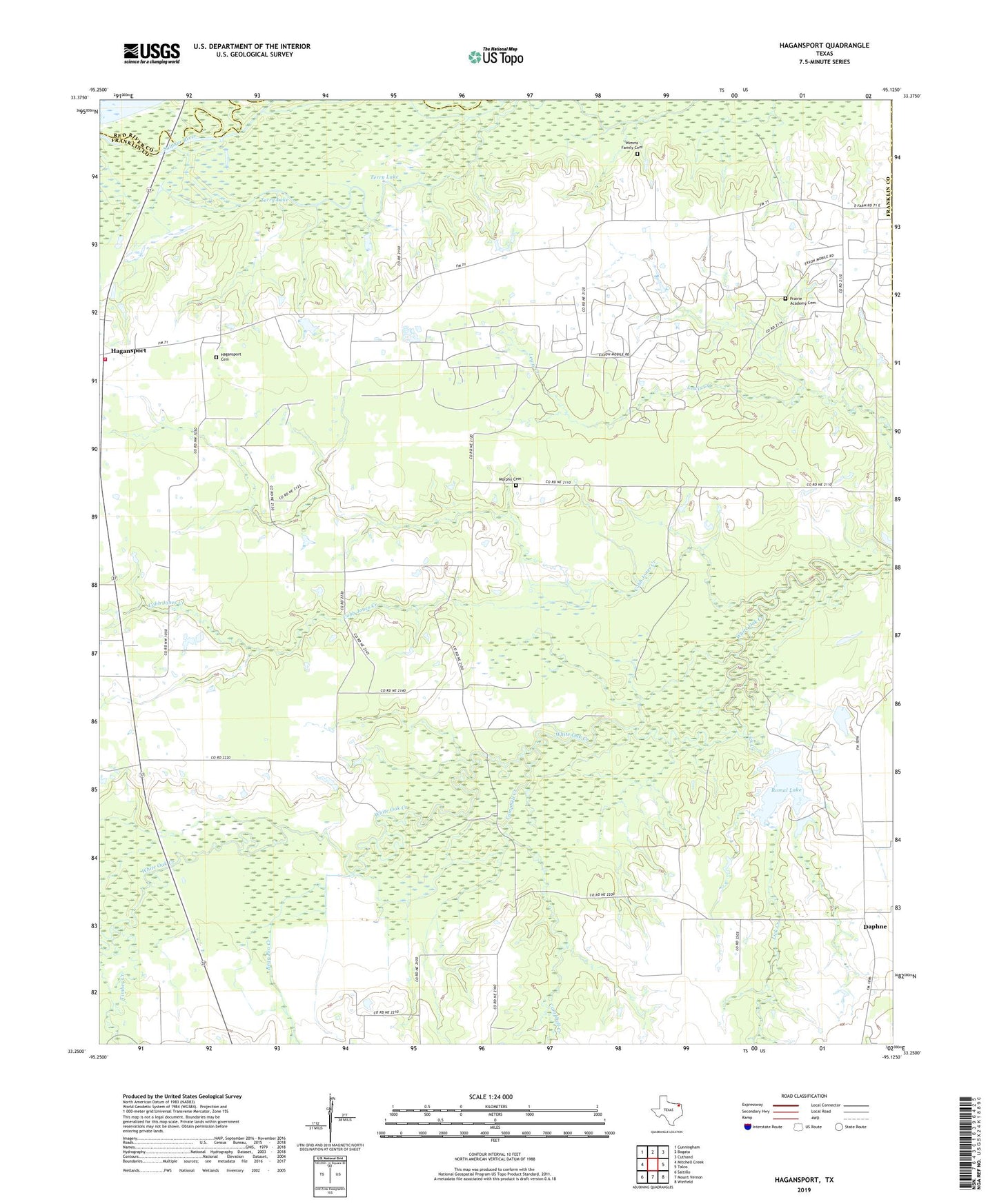
2019 topographic map quadrangle Hagansport in the state of Texas. Scale: 1:24000. Based on the newly updated USGS 7.5' US Topo map series, this map is in the following counties: Franklin, Red River, Titus. The map contains contour data, water features, and other items you are used to seeing on USGS maps, but also has updated roads and other features. This is the next generation of topographic maps. Printed on high-quality waterproof paper with UV fade-resistant inks.
Quads adjacent to this one:
West: Mitchell Creek
Northwest: Cunningham
North: Bogata
Northeast: Cuthand
East: Talco
Southeast: Winfield
South: Mount Vernon
Southwest: Saltillo
Contains the following named places: Bear Pen Creek, Campbell Creek, Chapel Lake, Cobb Jones Creek, Daphne, Hagansport, Hagansport Cemetery, KALK-FM (Winfield), Lakeview, Lick Creek, Midway Church, Mount Olive Church, Murphy Cemetery, North Franklin Volunteer Fire Department, Prairie Academy Cemetery, Romal Lake, Romal Lake Dam, Terry Lake, Texas No Name Number 34 Dam, Timber Creek, Wims Cemetery, ZIP Code: 75487