MyTopo
Hamby Texas US Topo Map
Couldn't load pickup availability
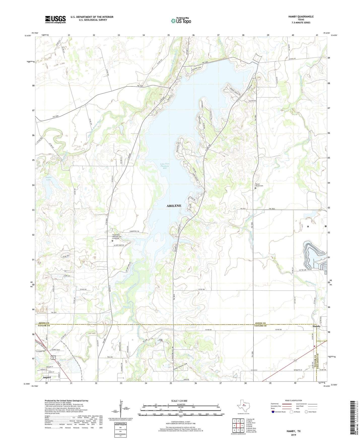
2022 topographic map quadrangle Hamby in the state of Texas. Scale: 1:24000. Based on the newly updated USGS 7.5' US Topo map series, this map is in the following counties: Jones, Taylor, Callahan. The map contains contour data, water features, and other items you are used to seeing on USGS maps, but also has updated roads and other features. This is the next generation of topographic maps. Printed on high-quality waterproof paper with UV fade-resistant inks.
Quads adjacent to this one:
West: Hawley
Northwest: Hawley NE
North: Nugent
Northeast: Smoky Draw
East: Flattop
Southeast: Kirby Lake NE
South: Abilene East
Southwest: Abilene West
This map covers the same area as the classic USGS quad with code o32099e6.
Contains the following named places: Buck Creek, Cedar Creek, Clear Fork Brazos River Diversion Dam, Clear Fork Diversion Dam, Fort Phantom Hill Dam, Fort Phantom Hill Lake, Hamby, Hamby Baptist Church, Hamby Elementary School, Hamby Volunteer Fire Department, KWVG-AM (Hamby), Lake Fort Phantom Hill, Lanius, Mulberry Creek, Rainy Creek, Round Mound Cemetery, Sayles Lake, Sayles Lake Dam, Texas Department of Criminal Justice French Robertson Unit, Texas Department of Criminal Justice John Middleton Transfer Facility, Texas State Veterans Cemetery at Abilene, Town of Impact, Warren Dodson Abilene Police Training Complex, ZIP Code: 79601