MyTopo
Hartburg Texas US Topo Map
Couldn't load pickup availability
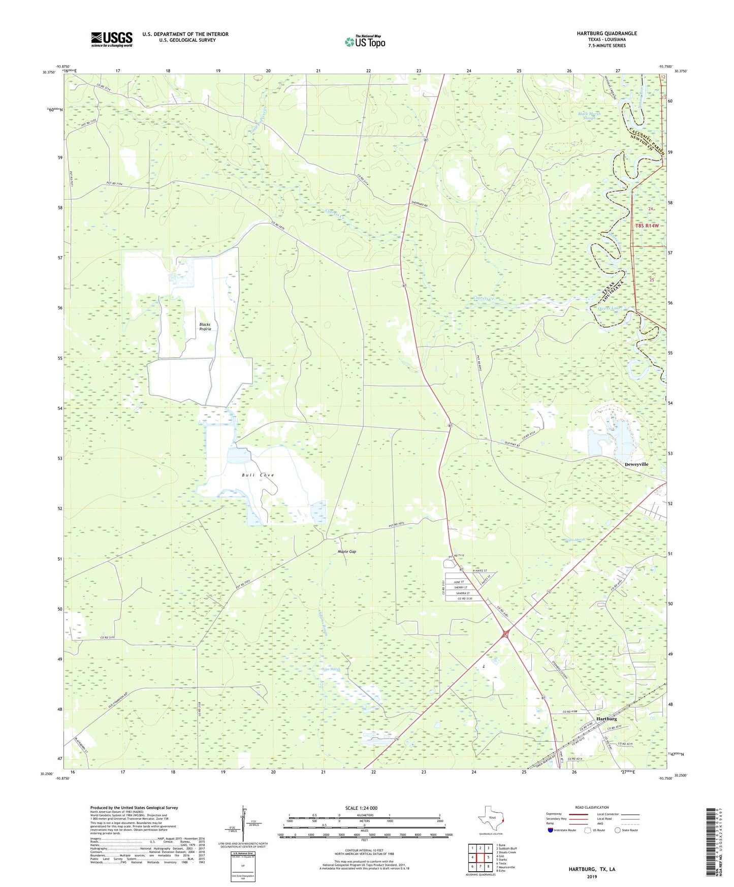
2019 topographic map quadrangle Hartburg in the states of Texas, Louisiana. Scale: 1:24000. Based on the newly updated USGS 7.5' US Topo map series, this map is in the following counties: Newton, Calcasieu. The map contains contour data, water features, and other items you are used to seeing on USGS maps, but also has updated roads and other features. This is the next generation of topographic maps. Printed on high-quality waterproof paper with UV fade-resistant inks.
Quads adjacent to this one:
West: Gist
Northwest: Buna
North: Sudduth Bluff
Northeast: Shoats Creek
East: Starks
Southeast: Echo
South: Mauriceville
Southwest: Texla
Contains the following named places: Blacks Prairie, Bull Cove, Cypress Creek, Deweyville Census Designated Place, Deweyville Division, Hartburg, Hollis Marsh, Little Cypress Creek, Maple Gap, Negro Marsh, Nips Marsh, Owens Lake, South Newton Emergency Services District 1 Station 2, The Peoples Ambulance Service, ZIP Code: 77614